Alpl (Waldschulle Alpl) - Teufelsteinalm
Starting point: Alpl (Waldschulle Alpl) (967 m)
Starting point Lat/Lon: 47.50157°N 15.63323°E 
Time of walking: 2 h 10 min
Difficulty: easy marked way
Difficulty of skiing: no data
Altitude difference: 423 m
Altitude difference (by path): 455 m
Map:
Access to starting point:
Highway A2 Graz - Vienna we leave at the exit for Gleisdorf west, then follow the signs for Hartberg and Weiz, and later only Weiz. At the beginning of the town Weiz, we exit the roundabout in the direction of the settlement Birkfeld, then follow the road to the mentioned settlement and from there follow the signs for Alpl. When we arrive at Alpl, we turn left before the bridge near the Alpl ski slope in the direction of the Waldschulle Peter Rosegger forest school. Next follows a slight descent, and we park in a parking lot slightly below the school, which is now a museum.
From the border crossing Šentilj, we continue driving on the highway towards Graz and further towards Linz and Salzburg. We soon leave highway A9 and continue driving slightly right in the direction of Vienna, proceeding along the expressway S35. Near the settlement Bruck an der Mur, we reach highway S16 and follow it in the direction of Vienna. We leave the mentioned highway at the exit for Mitterdorf, and upon reaching the roundabout with the old road, we take the first exit in the direction of Vienna. After the settlement Krieglach, we turn right towards the settlements Birkfeld and Alpl. When we arrive at Alpl, we turn right in the direction of the Waldschulle Peter Rosegger forest school. Next follows a slight descent, and we park in a parking lot slightly below the school, which is now a museum.
Path description:
From the parking lot, we continue on the road which runs through the valley, and the path first leads past an open public toilet, then past the inn Waldesruh. Further on, we ascend slightly for some time, and at a few crossings, we continue straight, following the path along the stream Freßnitzbach. Later, the asphalt road turns slightly to the right, while we continue slightly left on a macadam road, marked with signs for Teufelstein, Schanz, and Fischbach. The path ahead leads us past the cross Lendkreuz, where there is also a rest area. After the cross, the road turns left, crosses the gate, then we leave it and continue right over an almost dilapidated small bridge onto a slope, ascending along a slightly overgrown path. Only a little further, we cross a macadam road diagonally to the right, then ascend through the forest on a mountain path. Further on, we cross a few cart tracks and forest roads; after crossing a wider macadam road, we continue the ascent along a broader cart track. Higher up, we return to the macadam road and continue along it all the way to the mountain hut Untere Holdahütte.
From the crossing near the mountain hut, we continue right toward the mountain Teufelstein, where the path first leads along the edge of the forest and then enters the forest. In a strip of younger forest, a view briefly opens up towards the eastern mountain groups of the Northern Limestone Alps. A few minutes later, the path leads us to a cart track, along which we continue to a macadam road. We follow the road to the left, and at the nearby crossroad, we go straight (to the right leads an unmarked path to Teufelstein). Further on, we descend gently, and the path leads us through a scenic area, from which a beautiful view opens up, extending far towards the south. A little lower, we reach a marked crossing, from which we continue right on a cart track (to the left leads downward to Fischbach), quickly ascending to the hut Teufelsteinhütte on the mountain pasture Teufelsteinalm.
Alpl - Untere Holdahütte 1:35, Untere Holdahütte - Teufelsteinalm 0:35.
The description and pictures refer to the conditions in October 2023 and September 2024.
Pictures:
 1
1 2
2 3
3 4
4 5
5 6
6 7
7 8
8 9
9 10
10 11
11 12
12 13
13 14
14 15
15 16
16 17
17 18
18 19
19 20
20 21
21 22
22 23
23 24
24 25
25 26
26 27
27 28
28 29
29 30
30 31
31 32
32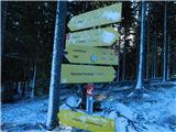 33
33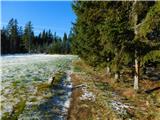 34
34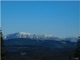 35
35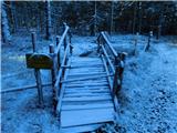 36
36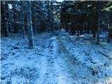 37
37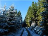 38
38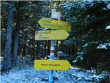 39
39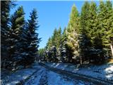 40
40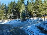 41
41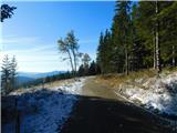 42
42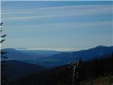 43
43 44
44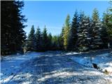 45
45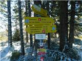 46
46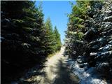 47
47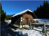 48
48