Podnar / Bodenbauer - Klagenfurter Hutte/Celovška koča (via Karweg)
Starting point: Podnar / Bodenbauer (1052 m)
| Latitude/Longitude: | 46,4678°N 14,2152°E |
| |
Route name: via Karweg
Walking time: 2 h
Difficulty: easy unmarked way
Elevation gain: 612 m
Elevation difference along the route: 675 m
Map: Karavanke - osrednji del 1:50.000
Recommended equipment (summer):
Recommended equipment (winter): ice axe, crampons
Views: 5.054
 | 1 person like this post |
Access to starting point:
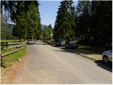
From the Ljubljana - Jesenice highway we take the Ljubelj (Tržič) exit, and then we continue driving in the direction of Celovec / Klagenfurt. After the Ljubelj tunnel the road starts descending, and we follow it to a crossroad, where the road into the Poden / Bodental valley branches off to the left. We go on the mentioned road, which further leads through Slovenji Plajberk / Windisch Bleiberg and higher Žabnica / Bodental. We follow the mentioned road to the end of the asphalt by the inn Podnar / Bodenbauer, where on an appropriate place by the road we also park.
Route description:
From Podnar near which we park on the extended road we head onto the macadam and for public traffic closed forest road in the direction of Mlaka / Märchenwiese and Celovška koča / Klagenfurter Hütte. The road, which starts gently ascending, soon brings us to the first junction, where the path towards the farm Vgriz / Ogrisbauer branches off to the right, and we continue straight in the direction of Celovška koča. The road goes a little further into the forest and splits into two parts. We choose the left marked road, which after approximately 30 minutes of walking from the starting point brings us to Mlaka (flat, ample and panoramic meadow).
Here the road turns slightly to the right, and we continue straight on the parallel but somewhat less visible marked path, which continues across the meadow. On the other side of the meadow the path returns to the forest and gradually starts moderately ascending. After a short ascent we arrive at a smaller junction, where the ski touring path branches off to the left, and we continue straight through the smaller torrent ditch. Some 10 steps higher we leave the ditch, as the blazes direct us to the right (straight at first on and along the ditch, higher a worse partly pathless track leads across ample scree towards the saddle Belščica) onto the path, which a few meters higher joins the forest road. When we step onto the road we follow it to the left, but we walk on it only to the first right bend. At the end of the bend we leave the marked path, which initially continues along the road, and we continue sharply left onto an unmarked but easy-to-follow track. The track already after a few meters turns slightly to the right and starts first traversing upwards through the forest. Higher the track starts steeply ascending through the forest, which after some time starts to thin out. A little further ahead the forest is gradually replaced by a belt of dwarf pines and scrub, and the increasingly panoramic path, from which we get beautiful views of the walls of Palec, Zelenjak, Vrtača and nearby Svačica, brings us to the place where we return to the marked path (the marked path is somewhat longer and technically more demanding, but well secured). When we reach the marked path we first ascend along it to a small spring, and from there to the nearby junction at the pass Vrata / Matschatcher Sattel.
On the mentioned pass a less trodden unmarked track branches off to the left, which leads "directly" to the saddle Belščica, and we continue straight and start descending towards Celovška koča. On the section of the path where the track widens into a cart track, the marked path to Ovčji vrh (Kozjak) / Geissberg branches off to the right, and we continue further on the path which gently descends. A little further the cart track splits into two parts, and we choose the right one, along which we reach Celovška koča in a few minutes, from which a nice view opens towards Stol and Vajnež.

Along the route: Vrata / Matschatcher Sattel (1714m)
Photos:
 1
1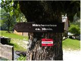 2
2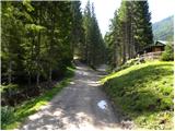 3
3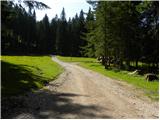 4
4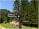 5
5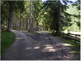 6
6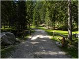 7
7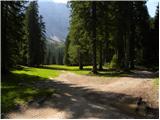 8
8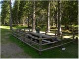 9
9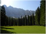 10
10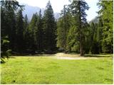 11
11 12
12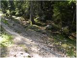 13
13 14
14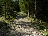 15
15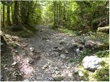 16
16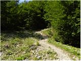 17
17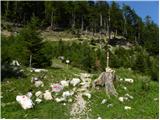 18
18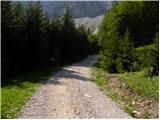 19
19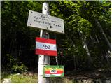 20
20 21
21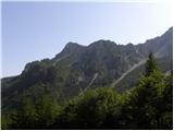 22
22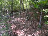 23
23 24
24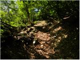 25
25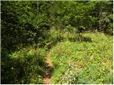 26
26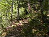 27
27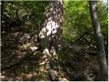 28
28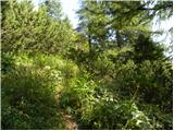 29
29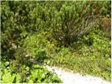 30
30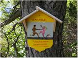 31
31 32
32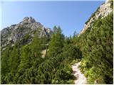 33
33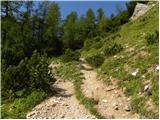 34
34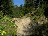 35
35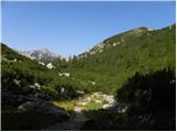 36
36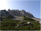 37
37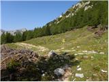 38
38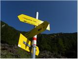 39
39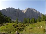 40
40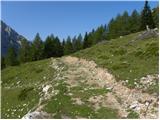 41
41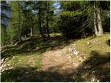 42
42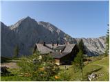 43
43
Discussion about the trip Podnar / Bodenbauer - Klagenfurter Hutte/Celovška koča (via Karweg)
|
| JORDAN22. 09. 2013 |
Today we returned from Celovška koča along the described path. First, I must mention that the path is very steep and I advise against descending it when wet, as it runs through deciduous forest and there is a lot of leaves on the path. The path becomes very demanding when wet. For all those planning to ascend this path, I warn that it is very steep and after the new arrangement of roadside slopes, the entry to the unmarked trail is now 10m before the signpost in photo no. 20, where we leave the road and head left into the forest.
|
|
|
To post a comment you must log in:
If you do not yet have a username, you must first
register.