Boreča - Križarka (via Sveta Ana)
Starting point: Boreča (321 m)
| Latitude/Longitude: | 46,83540°N 16,15396°E |
| |
Route name: via Sveta Ana
Walking time: 1 h
Difficulty: easy unmarked way
Elevation gain: 92 m
Elevation difference along the route: 120 m
Map: Pomurje 1:40.000
Recommended equipment (summer):
Recommended equipment (winter):
Views: 164
 | 1 person like this post |
Access to starting point:
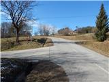
A) We drive to Murska Sobota, then continue driving towards the border crossing Hodoš. In Gornji Petrovci from a somewhat larger crossroads we continue left towards the settlements Kuzma and Martinje. When we arrive in Šulinci, at the village fire station we leave the main road which turns right and continue straight on the side road which bypasses the fire station on the left side. When Šulinci end we soon arrive at the Balon memorial, and we drive on to the neighbouring village Boreča, where at the smaller crossroads a road branches off to the left towards St. Ana (at the crossroads there are signs for the church of St. Ana and signs for the Catholic and evangelical cemetery). At the crossroads there are no designated parking spaces, so we park in a suitable place somewhere nearby. B) We drive to Kuzma, then follow the road towards Petrovci. Somewhat after the settlement Dolič the road towards Mačkovci branches off to the right. Here we continue straight, turning right at the next crossroads where the signs direct us to Boreča. A descent through Boreča follows, lower we notice signs for the church of St. Ana which direct us sharply right onto the road (at the crossroads there are signs for the church of St. Ana and signs for the Catholic and evangelical cemetery). At the crossroads there are no designated parking spaces, so we park in a suitable place somewhere nearby.
Route description:
From the crossroads we head onto the side road towards St. Ana and the evangelical and Catholic cemetery. The asphalt ends after the crossroads, and on the macadam road we descend easily and continue along the stream Merak. A little further the road enters the forest, we go slightly left and begin to ascend. We soon leave the forest and from the path a nice view opens towards Boreča.
The path ahead leads past the evangelical cemetery, and the gentle road brings us to the church of St. Ana in a few minutes, where the Catholic cemetery is also located.
We bypass the church on the right, and from the crossroads behind the church we continue straight (sharply left Ženavlje). A few minutes of walking through the forest follow and we join the road leading from Stanjevci. Here we go right and continue the path on the wider macadam road, which continues with some shorter ascents and descents, at the crossroads continuing straight.
About ten steps before reaching the asphalt road we notice on the right a poorer path which then parallel to the nearby asphalt road ascends easily to the indistinct summit Križarka.
Starting point - St. Ana 0:25, St. Ana - Križarka 0:35.
Description and pictures refer to the condition in February 2021 and May 2022.

Photos:
 1
1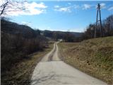 2
2 3
3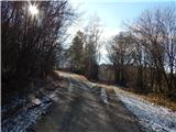 4
4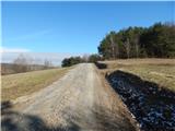 5
5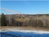 6
6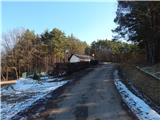 7
7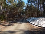 8
8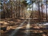 9
9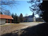 10
10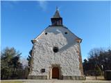 11
11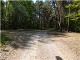 12
12 13
13 14
14 15
15 16
16 17
17 18
18 19
19 20
20 21
21
Discussion about the trip Boreča - Križarka (via Sveta Ana)
To post a comment you must log in:
If you do not yet have a username, you must first
register.