Brancljeva senožet - Mišnice
Starting point: Brancljeva senožet (930 m)
Starting point Lat/Lon: 45.9084°N 14.4573°E 
Time of walking: 20 min
Difficulty: easy unmarked way
Difficulty of skiing: no data
Altitude difference: 31 m
Altitude difference (by path): 50 m
Map: Ljubljana - okolica 1:50.000
Access to starting point:
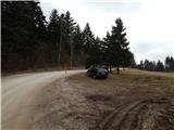
A) First, we drive to Ig, and from there we continue driving in the direction of Iška vas and Iški Vintgar. Immediately after Iška vas we will arrive in the village Iška, where the road towards Gornji Ig and Rakitna branches off sharply to the right. We head onto the mentioned ascending road, on which we drive past Gornji Ig and higher also past the turn-off of the road to Krim. A few 100 m ahead from the turn-off for Krim we arrive at a larger hay meadow, where the road flattens, and on the other side of the hay meadow turns left and returns into the forest. Only a few meters before the road enters the forest, we will notice on the left side the NOB monument and next to it an appropriate space for parking.
B) From the highway Ljubljana - Koper we take the exit Brezovica, and then we continue driving in the direction of Podpeči (to Podpeči we can also come from Črna vas or Ig). In Podpeči we continue in the direction of Borovnica, Krim and Rakitna, and we continue driving for a short time along the edge of the Ljubljana Moor, and then the signs for Rakitna direct us left onto a steep ascending road. The road then leads us through Preserje, where it also starts to descend. After a short descent we continue left in the direction of Krim and Rakitna, and we follow the mostly ascending road to the intersection, where the road towards Krim branches off to the left. From the mentioned intersection we continue left, and then we continue driving on a macadam road. When after a few kilometers the road comes out of the forest onto a larger hay meadow, we will immediately at the start spot the NOB monument and next to it a suitable place where we can park.
C) First, we drive to Cerknica, and then we continue driving in the direction of Begunje; when we arrive in Begunje we follow the signs for Rakitna. From Rakitna we continue driving on the main road towards the settlement Preserje, and we drive along it to the intersection, where the road towards Krim branches off to the right. From the mentioned intersection we continue right, and then we continue driving on a macadam road. When after a few kilometers the road comes out of the forest onto a larger hay meadow, we will immediately at the start spot the NOB monument and next to it a suitable place where we can park.
Path description:
From the starting point near the NOB monument a cart track begins which continues towards the southeast. The cart track goes immediately into the forest and after some 10 steps splits, and we continue on the slightly left one. A slight ascent follows, and then on the right a large clearing appears, and just before it we notice a few benches, a little to the right also a hunting stand.
We do not enter the mentioned clearing and continue the path on the cart track which runs left of it. After the nearby wild garlic patch a few junctions follow, and we choose those cart tracks which continue along the indistinct forested valley. When somewhat further we reach the path marked with white triangles which have a red border, we continue left (if we continue right we can reach the farm Ustje).
Further on we follow the mentioned markers, and on the left we soon notice a smaller clearing. On the section where the clearing is on our left, the peak of Mišnice is located to the right of the marked path, to which we ascend after some 10 steps of steep ascent on pathless terrain. In wintertime a little view opens up from the peak, otherwise the forest obstructs the view.
Description and pictures refer to the condition in the year 2016 (March).
Pictures:
 1
1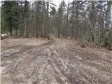 2
2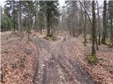 3
3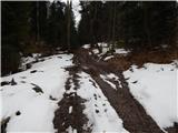 4
4 5
5 6
6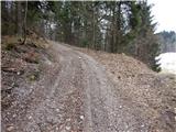 7
7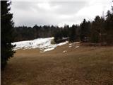 8
8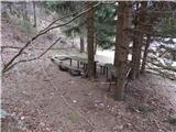 9
9 10
10 11
11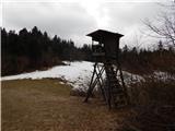 12
12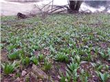 13
13 14
14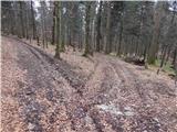 15
15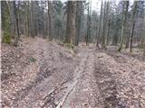 16
16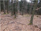 17
17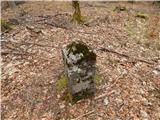 18
18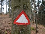 19
19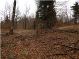 20
20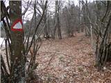 21
21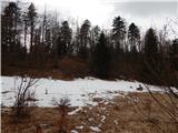 22
22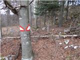 23
23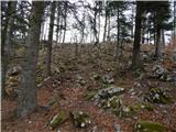 24
24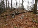 25
25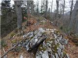 26
26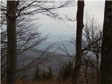 27
27