Konec ceste pod Struško (Strmela) - Planina Seča (hunting and mining educational trail)
Starting point: Konec ceste pod Struško (Strmela) (1270 m)
| Latitude/Longitude: | 46,465°N 14,1071°E |
| |
Route name: hunting and mining educational trail
Walking time: 1 h 15 min
Difficulty: partly demanding unmarked way
Elevation gain: 428 m
Elevation difference along the route: 428 m
Map: Karavanke 1:50.000
Recommended equipment (summer): helmet
Recommended equipment (winter): helmet, ice axe, crampons
Views: 7.084
 | 3 people like this post |
Access to starting point:
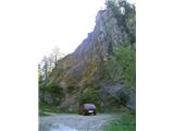
From the highway Ljubljana - Jesenice we go to the exit Lipce, and in the direction to the right we drive towards Jesenice. In the settlement Javornik at the first traffic-light intersection we drive right (direction Lj.) towards Koroška Bela. At the next intersection with traffic lights we turn left, and soon once again left towards Javorniški Rovt. After a few kilometers of driving uphill (when we have already got to the mentioned village), the road ahead runs past the mountain hut Dom Pristava (last bus stop), and behind the mountain hut we come to the next smaller intersection, where we turn slightly right. Ahead we drive for approximately 3 km on a winding macadam road, whereupon at a sharp left turn (near Križovec) we encounter a road turn-off to the right, where we go and after 5 min of additional driving we get to the end of the forest road, where there is a parking lot.
Route description:
The footpath continues in the same direction in which we were driving a little before. When we step on it, it first ascends a little, whereupon we notice a junction, where it isn't important how we decide. If we go e.g. right, immediately on the left we run into a trench, where they used to dig ore, and when we continue, we join the left, cart-track-like path, on which we continue through the forest, still in the direction of east. After some time, we run into a less noticeable junction, which we recognize by a dry, transversely lying trunk, over (past) which we go on the upper-left path, which there past the nearby mangers (between two spruces), soon brings us out of the forest below the nice and interesting cliffs. The path further crosses a shorter scree, on whose other side we meet a stand on which there is attached a metal information board with descriptions of mountains and destinations on the horizon. When we continue, the path becomes slightly exposed, and on the left twice we get help from a few meters of steel cable. Again follows a shorter scree, after which we again step for a short time into the forest. Soon at a smaller descent we join the marked path, which is coming from the mountain hut Dom Trilobit.
We continue left on the path through partly sparser mixed woodland towards the mountain pasture Seča. Soon, when the path starts passing into a belt of dwarf pines, on the right we observe the amphitheater Rida, and the path in a few additional zigzags reaches the mountain pasture Seča, the beginning of which we recognize by signposts on the trees. We turn left, where past the ruins of the former guardhouse we reach the destination - border saddle with a hunting cottage.

Photos:
 1
1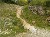 2
2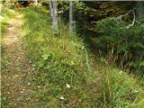 3
3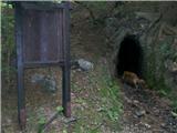 4
4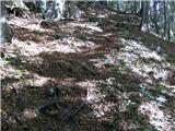 5
5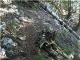 6
6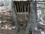 7
7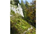 8
8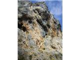 9
9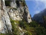 10
10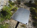 11
11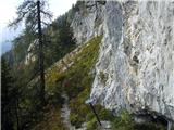 12
12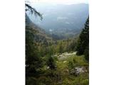 13
13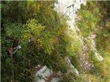 14
14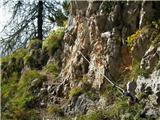 15
15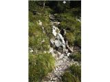 16
16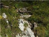 17
17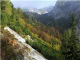 18
18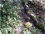 19
19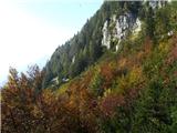 20
20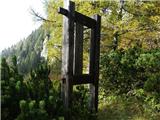 21
21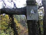 22
22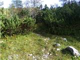 23
23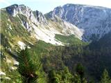 24
24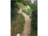 25
25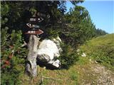 26
26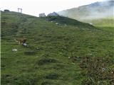 27
27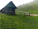 28
28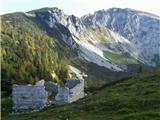 29
29
Discussion about the trip Konec ceste pod Struško (Strmela) - Planina Seča (hunting and mining educational trail)
|
| marezt1. 06. 2012 |
Just got home from this trip. Very nice path, which I extended to Belska planina and then descended from there back to the starting point.
One question - On picture no.6 there is a junction, does the lower path lead to Dom Trilobit or somewhere else?
|
|
|
|
| heinz1. 06. 2012 |
The lower path on picture 6 descends to the one coming from the mentioned Dom.
|
|
|
|
| mili9. 08. 2018 |
I'm interested if anyone has walked this trail recently. Are there any fallen trees on the path?
|
|
|
|
| nina49. 08. 2018 |
I was there in June. The path is normally passable.
|
|
|
|
| tango12. 04. 2025 10:26:06 |
Yesterday we made a really wonderful circular tour. We left the car at the bend where the turnoff to Križovec is, then along the described path to Seča. The path is unremarkable, a bit of snow starts at the turnoff to Konjske peči, but it doesn't cause problems. Seča is still all snow-covered, the views towards Julijci and Vajnež, Stol, the Rida amphitheater are breathtaking. Towards Belska planina the path is continuously snow-covered, a bit of caution is needed right after the planina, where avalanches usually cross the path. Belska and the views are postcard-worthy, then on the way to Pustem rovtu up to the first ramp nicely on snow. Great trip and despite wonderful weather, a bit of wind, we met no one.
|
|
|
To post a comment you must log in:
If you do not yet have a username, you must first
register.