Starting point: Famlje (390 m)
Starting point Lat/Lon: 45.6628°N 14.0211°E 
Time of walking: 2 h 30 min
Difficulty: easy marked way
Difficulty of skiing: no data
Altitude difference: 637 m
Altitude difference (by path): 637 m
Map:
Access to starting point:
From the highway Ljubljana - Koper, we take the exit Divača, and then we continue driving towards Divača. Still before Divača, we turn right towards the settlement Dolnje Ležeče and Famlje. We park before the beginning of the settlement Famlje, on a suitable place by the road.
Path description:
From the starting point, we continue on the main road through the village, and then signs for Vremščica point us to the left on a macadam road, on which we walk to a nearby orchard. Before the orchard, signs for Vremščica point us slightly to the right on a cart track which continues between the orchard and fields. On the other side of the fields, the path goes into a low forest, through which it starts moderately ascending. A little higher, we cross an old cart track, and the path brings us below the power line, where it turns to the right. Next follows a crossing to the right, and the path leads directly by the railway tracks. After a few minutes of crossing, we get to the railway station Vreme.
From the station, first we carefully cross the double-track railway line, and then we start moderately ascending over a partly grassy slope. Higher, we reach a cart track, which we follow to the right to the nearby asphalt road. We follow the road to the right as well, and we walk along it approximately 20 minutes, or more precisely to a smaller crossroad, where a marked path (at first a road) branches off to the left towards Vremščica (to here possible also with a car - starting point Loščica).
The road after some 10 m brings us to an old wagon converted into a bivouac, where it changes into a cart track. We continue on the marked cart track, which moderately ascends through the low forest. Higher, there are a few smaller junctions, but if we carefully follow the blazes, there are no bigger problems with orientation. After a while the forest thins out and a more panoramic path brings us to a junction, where we join the path from Matavun (Škocjan Caves).
Here we continue straight or slightly right on a less distinct cart track, which gradually enters the forest and changes into a nice easy-to-follow footpath. A little higher, the path from Senožeče also joins us, and we continue straight and ascend through one more strip of forest. Higher the forest thins out, and an increasingly panoramic path quickly brings us to the summit of Vremščica.
On the way: Loščica (660m)
Pictures:
 1
1 2
2 3
3 4
4 5
5 6
6 7
7 8
8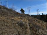 9
9 10
10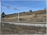 11
11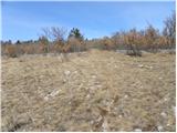 12
12 13
13 14
14 15
15 16
16 17
17 18
18 19
19 20
20 21
21 22
22 23
23 24
24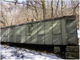 25
25 26
26 27
27 28
28 29
29 30
30 31
31 32
32 33
33 34
34 35
35 36
36 37
37 38
38 39
39 40
40 41
41 42
42 43
43 44
44 45
45 46
46 47
47 48
48 49
49