Starting point: Hudajužna (381 m)
| Latitude/Longitude: | 46,17400°N 13,91490°E |
| |
Walking time: 3 h
Difficulty: easy unmarked way, easy marked way
Elevation gain: 922 m
Elevation difference along the route: 940 m
Map: Škofjeloško in Cerkljansko hribovje 1:50.000
Recommended equipment (summer):
Recommended equipment (winter): ice axe, crampons
Views: 2.600
 | 2 people like this post |
Access to starting point:
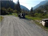
A) We drive to Podbrdo, and then we continue driving towards Tolmin. In the settlement Hudajužna we leave the main road and before the small church of St. Barbara we turn left in the direction of Zakojce. We continue over the river Bača, and then we park at a suitable place by the road.
B) From the road Idrija - Most na Soči, at the settlement Bača pri Modreju we turn in the direction of Podbrdo, and then we drive on the main road to the settlement Hudajužna, where after the small church of St. Barbara we turn right in the direction of Zakojce. We continue over the river Bača, and then we park at a suitable place by the road.
Route description:
From the starting point, we continue on the macadam road which leads us through the underpass under the railway track, and immediately after the underpass slightly to the left a footpath to Porezen branches off. Here we can continue left in the direction of Porezen and to the homestead Rore we ascend on a usually quite overgrown path, or we continue on a gently sloping road, from which we go a little ahead left on the road, by which there is a sign for dead-end street (straight driving road towards Zakojci) and we ascend there to the homestead Rore.
At the homestead there is a marked crossing, and we continue right in the direction of Zakojce (left Porezen) and on a somewhat worse road we descend to the stream Porezen, over a small stone bridge we cross it, and then we return to the driving road towards Zakojci. We continue the ascent on a quite nice macadam road, from which occasional views open up on part of the Spodnjih Bohinjskih gora. Higher, the path leads us among pastures and hayfields, and then past the road sign which marks the beginning of the settlement Zakojca. After the sign, the path leads also past a wayside shrine and some houses, and then on the left we already notice Bevkova domačija, which we can visit every day, and the keys can be obtained in Zakojca at the tourist farm Pri Flandru.
We bypass the homestead on the right side, and then we go left on a footpath in the direction of Zakojce. Further, we are accompanied by signs and rare blazes, which were absent from the homestead Rore onwards, and through pastures we arrive at the previously mentioned tourist farm, where we also reach an asphalt road.
We follow the road to the left, and it leads us past the NOB monument, and we leave it at the transformer, where we go right on a cart track (the turn-off is not marked). When after a few steps the cart track becomes grassy and passes onto grazing meadows, we notice a blaze which confirms that we are on the right path. Next follows an ascent to the upper edge of the pasture, from where upon looking back a nice view opens up on Zakojca and the chain of Spodnjih Bohinjskih gora, and blazes still before the hunting observatory direct us left onto a cart track which ascends diagonally towards the left. Higher, the trail, which partly still runs on cart tracks, occasionally disappears, and we follow the blazes which after a while lead us into a dense forest, where we finally leave the cart track. Next follows a steep ascent through the forest, where along the poorly beaten path we follow quite frequent blazes. Higher from the right almost unnoticeably a worse pathlet joins, which at an altitude of around 1100 meters entirely circles Kojca, and here our path turns left and becomes completely level.
Next follows a few minutes of traversing, and then we arrive at a junction, where we join a better beaten path from Jesenica and Orehka. Next follows some moderate ascent, and then the path from Reka and the second path from Orehka also join us, and in the same direction the path which circles Kojca also continues.
The path ahead again starts to ascend more steeply and with occasional views continues along the eastern ridge of Kojca. We ascend for a few more minutes through the forest, then the forest ends, the path levels out and only a few minutes of walking separate us from the summit with the famous haystack.
Hudajužna - Bevkova domačija 1:00, Bevkova domačija - tourist farm Pri Flandru 0:15, tourist farm Pri Flandru - Kojca 1:45.
Description and pictures refer to the condition in 2018 (October).

Along the route: Bevkova domačija v Zakojci (635m), Turistična kmetija pri Flandru (706m), Zakojca (706m)
Photos:
 1
1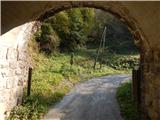 2
2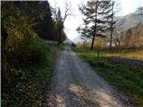 3
3 4
4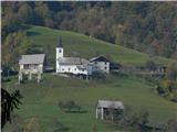 5
5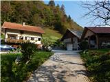 6
6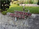 7
7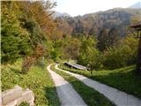 8
8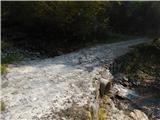 9
9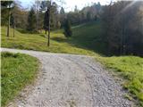 10
10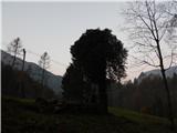 11
11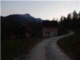 12
12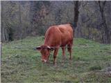 13
13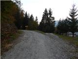 14
14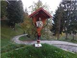 15
15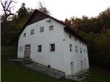 16
16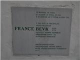 17
17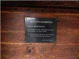 18
18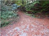 19
19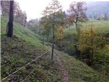 20
20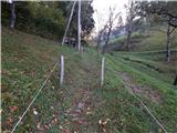 21
21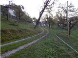 22
22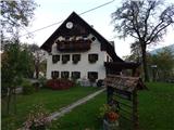 23
23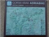 24
24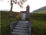 25
25 26
26 27
27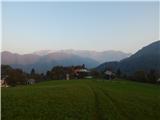 28
28 29
29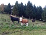 30
30 31
31 32
32 33
33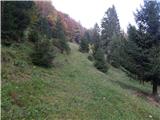 34
34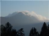 35
35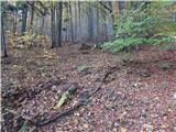 36
36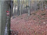 37
37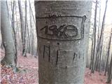 38
38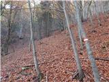 39
39 40
40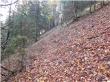 41
41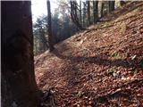 42
42 43
43 44
44 45
45 46
46 47
47 48
48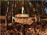 49
49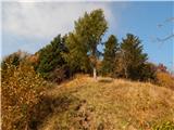 50
50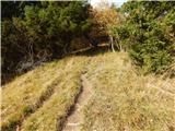 51
51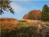 52
52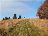 53
53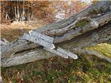 54
54 55
55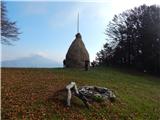 56
56 57
57
Discussion about the trip Hudajužna - Kojca
To post a comment you must log in:
If you do not yet have a username, you must first
register.