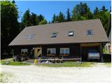
Koča na Klopnem vrhu - Posestvo Šumik
Starting point: Koča na Klopnem vrhu (1260 m)
| Latitude/Longitude: | 46,5018°N 15,3991°E |
| |
Walking time: 1 h 30 min
Difficulty: easy marked way
Elevation gain: -160 m
Elevation difference along the route: 75 m
Map: Pohorje 1:50.000
Recommended equipment (summer):
Recommended equipment (winter):
Views: 5.875
 | 1 person like this post |
Access to starting point:
A) First, we drive to Dravograd, and then we continue driving towards Maribor. Soon after the settlement Ožbalt we leave the main road and continue driving right over the bridge across the river Drava in the direction of the settlement Lovrenc na Pohorju. On the other side of the river the road starts to ascend slightly and soon brings us to the next crossroad, where we continue left in the direction of the village Činžat (right Lovrenc na Pohorju). In Činžat, where the road from Ruše also joins, we continue right in the direction of the mountain hut Koča na Klopnem vrhu. Above the village, the road becomes macadam, and it first ascends along the stream Lamprehtov potok. Higher, the road leads past the farm Lampreht, and at the crossroads we follow the road in the direction of the mountain hut Koča na Klopnem vrhu. When we arrive at the mentioned mountain hut, we park in an appropriate place near it.
B) We drive to Ruše (to here from Maribor or Selnica ob Dravi) and then we continue driving towards Lovrenc na Pohorju. When we arrive at the village Činžat, we leave the road that leads towards Lovrenc na Pohorju and continue driving left on the initially still asphalt road in the direction of the mountain hut Koča na Klopnem vrhu. Above the village, the road becomes macadam, and it first ascends along the stream Lamprehtov potok. Higher, the road leads past the farm Lampreht, and at the crossroads we follow the road in the direction of the mountain hut Koča na Klopnem vrhu. When we arrive at the mentioned mountain hut, we park in an appropriate place near it.
C) From the highway Ljubljana - Maribor we take the exit Slovenske Konjice and continue driving towards the mentioned settlement. From Slovenske Konjice we continue towards Zreče, and we follow the road in the direction of Rogla. When we arrive at Rogla we continue driving on the main road, and we descend along it to the mountain hut Koča na Pesku. At the mentioned mountain hut we continue right in the direction of Osankarica and mountain hut Koča na Klopnem vrhu. We then follow the macadam road, and at all subsequent crossroads we follow in the direction of the mountain hut Koča na Klopnem vrhu. We park in an appropriate place near the mentioned mountain hut.
Route description:
From the mountain hut Koča na Klopnem vrhu we continue on the road in the direction of Osankarica and mountain hut Koča na Šumiku. The road soon brings us to the first crossroad, where we continue straight (right Koča na Pesku and Rogla). From the crossroad, we walk on a wide macadam road only some 10 meters, then we turn slightly right onto an initially wide cart track. The cart track first leads past the NOB monument, then brings us to a meadow, where it narrows. On the other side of the meadow, we cross a stream, then we start to ascend somewhat more steeply for a while. Higher, the somewhat wider cart track levels out and after a few minutes of further walking brings us to a marked junction.
We continue on the wider cart track in the direction of the mountain hut Koča na Šumiku (slightly right Osankarica and Falski ribnik). For some time we still continue on the cart track, then it brings us to a macadam road, along which we gradually start to descend moderately. Somewhat lower we leave the road and continue the path on the parallel cart track, which soon returns to the road. For some time we walk on the road, then we continue right again, this time on a nice forest path that continues to the right of the macadam road. Lower the path brings us to a wooden hut, behind which we return to the road. Along the road we descend for a short time, then we arrive at a marked junction, where a marked path towards the waterfall Šumik and mountain hut Ruška koča branches off to the right downwards, and we continue straight on the road in the direction of Smolnik and Ruše. A little further we arrive at a smaller crossroad, where we continue straight, then continue right downwards on a footpath, along which we descend to the parking lot at the mountain hut Koča na Šumiku. From the parking lot only some 10 easy strides separate us from the mountain hut.

Photos:
 1
1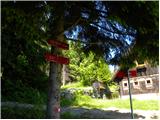 2
2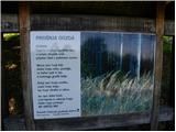 3
3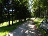 4
4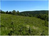 5
5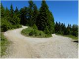 6
6 7
7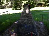 8
8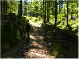 9
9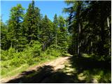 10
10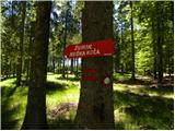 11
11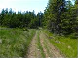 12
12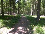 13
13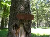 14
14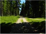 15
15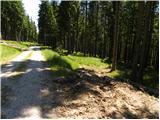 16
16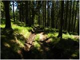 17
17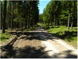 18
18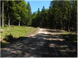 19
19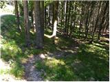 20
20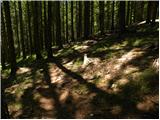 21
21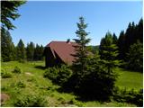 22
22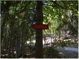 23
23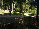 24
24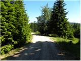 25
25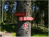 26
26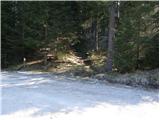 27
27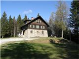 28
28
Discussion about the trip Koča na Klopnem vrhu - Posestvo Šumik
|
| alenkas4. 07. 2016 |
Unfortunately I have nothing good to say about the hut at Šumik. One time they invite you to overnight, but last Saturday they put me and my daughter out the door at 19h into the rain because apparently everyone went down to the valley.... absolutely do not recommend!
|
|
|
To post a comment you must log in:
If you do not yet have a username, you must first
register.