Starting point: Lučine (634 m)
Starting point Lat/Lon: 46.0619°N 14.1982°E 
Time of walking: 50 min
Difficulty: easy unmarked way
Difficulty of skiing: no data
Altitude difference: 300 m
Altitude difference (by path): 300 m
Map: Škofjeloško in Cerkljansko hribovje 1:50.000
Access to starting point:
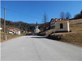
A) We drive to Gorenje vas in the Poljanska dolina, from where, at the roundabout by the Petrol petrol station, we take the exit in the direction of Vrhnika and Horjul. We then drive through Dolenjo and Gorenjo Dobravo and Todraž, after which the road begins to ascend more steeply. When, higher up, the road flattens somewhat, we arrive at a crossroads by the Prelesje bus stop, where the road to Prelesje and Zadobje branches off to the left, but we continue slightly to the right towards Polhov Gradec, and soon after the crossroads we arrive in Lučine. In Lučine, by the primary school and kindergarten Lučine, we turn left towards the Matija refreshment bar, but we drive between the houses to a larger asphalt parking lot in front of the parish church of St. Vid in Lučine, where we park.
B) We drive to Polhov Gradec, then follow the signs for Gorenje vas. Higher up, we arrive at the settlement Suhi Dol, where the road begins to descend towards the Poljanska dolina, but we drive along it to Lučine, where, just a little before the primary school and kindergarten, we turn right towards the Matija refreshment bar, but we drive between the houses to a larger asphalt parking lot in front of the parish church of St. Vid in Lučine, where we park.
C) We drive to Horjul, then follow the signs for Šentjošt nad Horjulom. After Vrzdenec, the road begins to ascend more noticeably and soon brings us to a crossroads, where we continue right on the priority road in the direction of Suhi Dol, Butajnova and Gorenje vas (straight ahead Šentjošt and Žiri). A short descent follows, then we join the road from Polhov Gradec, but we continue towards Gorenje vas. Higher up, we arrive at the settlement Suhi Dol, where the road begins to descend towards the Poljanska dolina, but we drive along it to Lučine, where, just a little before the primary school and kindergarten, we turn right towards the Matija refreshment bar, but we drive between the houses to a larger asphalt parking lot in front of the parish church of St. Vid in Lučine, where we park.
Path description:
From the parking lot, we walk to the church of St. Vid, which we bypass on the left side, and from a smaller crossroads behind the church we continue left upwards. Next follows a steep ascent on a narrower asphalt road, from which a nice view of Lučine opens up, when the road turns left we leave it and continue right on an ascending cart track (we do not continue on the cart track that crosses the grassy slope). Next follows an ascent through the forest; when we reach a smaller break in the slope, the path, which turns slightly right, flattens only temporarily, then quickly ascends to an asphalt road, which we follow uphill, continuing along it to a smaller saddle by the chapel, where we leave it.
From the saddle we continue left on a path in the direction of the hiking trail (straight to the Lomovec homestead, right to Suhi Dol), along which higher up we notice a few signs with the inscription Prijatelji Sivke. After a few minutes of ascent the forest ends and only a short walk remains to the summit along the panoramic summit slope of the mountain.
Right of the summit is the mountaineering logbook box, left of the summit the logbook box of Prijatelji Sivke.
The description and pictures refer to the condition in 2019 (February).
Pictures:
 1
1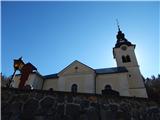 2
2 3
3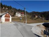 4
4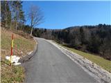 5
5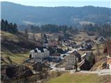 6
6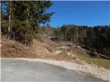 7
7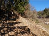 8
8 9
9 10
10 11
11 12
12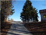 13
13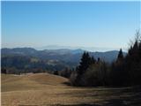 14
14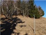 15
15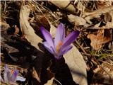 16
16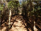 17
17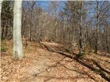 18
18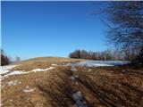 19
19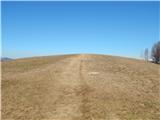 20
20 21
21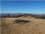 22
22 23
23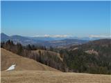 24
24 25
25