Mačkin Kot (Enci) - Lepenatka (over saddle Kunšperk)
Starting point: Mačkin Kot (Enci) (815 m)
Starting point Lat/Lon: 46.2998°N 14.7353°E 
Path name: over saddle Kunšperk
Time of walking: 1 h 40 min
Difficulty: easy unmarked way, easy marked way
Difficulty of skiing: no data
Altitude difference: 610 m
Altitude difference (by path): 610 m
Map: Kamniške in Savinjske Alpe 1:50.000
Access to starting point:
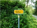
a) First, we drive to Gornji grad, then we continue driving in the direction of the Črnivec pass and Kamnik. When we arrive at the settlement Šmiklavž, opposite the sign (cross), we continue right in the direction of the path over Mačkin Kot, the company Mizarske and tesarske storitve Belaj Janez s.p. and Šmiklavž 16-26, 28-34. Further on, we drive past individual houses, then after crossing the Mačkovec stream, the road starts to ascend more steeply, and we drive along it to the Enci homestead, near which we park in a suitable place. At the starting point, there are no designated parking spaces.
b) We drive to Kamnik, then we continue driving towards the Črnivec pass and further to Gornji Grad. When we descend to the settlement Šmiklavž, a few hundred meters further from the road sign "5 km", we turn left in the direction of the path over Mačkin Kot, the company Mizarske and tesarske storitve Belaj Janez s.p. and Šmiklavž 16-26, 28-34. Further on, we drive past individual houses, then after crossing the Mačkovec stream, the road starts to ascend more steeply, and we drive along it to the Enci homestead, near which we park in a suitable place. At the starting point, there are no designated parking spaces.
Path description:
From the crossroad at the homestead Enci we continue left and walk through the yard of the nearby homestead. Behind the houses we continue across the pasture, then the road enters the forest, where it turns right, and further on it ascends moderately. Higher up there are a few more serpentines, at the junctions we follow the road, not the cart tracks that branch off from the road. Higher the road reaches an indistinct forested ridge, where it turns slightly right, and in the middle of the bend a wider cart track branches off to the right, along which we continue the ascent (it is also possible to continue along the road). After a few minutes of steep ascent along the cart track we reach the end of the forest road, which we follow to the left along it to the place where we reach the ridge or saddle Kunšperk (to here it is also possible if at the previous junction we do not continue along the cart track).
From the saddle we continue right in the direction of Lepenatka, first still along the cart track, then slightly right onto the marked footpath. The path immediately starts to ascend steeply, soon turning a little to the right, where it ascends transversely across the steeper slope. Further on the path ascends steeply, occasionally leading us also across some shorter exposed section, where special caution is needed especially in wet conditions and snow. Higher up the slope gradually flattens, and the path turns right and takes us to the ridge east of Kunšperski vrh (also Brezovec).
When we reach the ridge we continue right (left to Kunšperski vrh, 5 minutes of easier pathless terrain) along the marked path, which continues along the occasionally panoramic ridge. Further on we ascend gently to moderately along or slightly left of the ridge. Higher up the path leads across a grazing fence, behind which we step onto the summit grassy slopes of Lepenatka. A few more minutes of moderate ascent follow along the path, from which beautiful views open up reaching from the nearby Veliki Rogatec, across Raduha and Olševa, to the highest peaks of the Kamniško-Savinjske Alps, and we already reach the grassy summit of Lepenatka.
On the way: Sedlo Kunšperk (1119m)
Pictures:
 1
1 2
2 3
3 4
4 5
5 6
6 7
7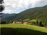 8
8 9
9 10
10 11
11 12
12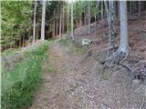 13
13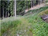 14
14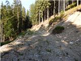 15
15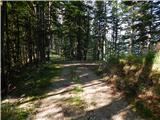 16
16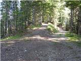 17
17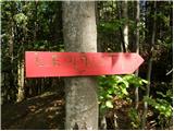 18
18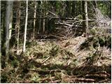 19
19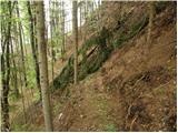 20
20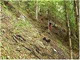 21
21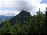 22
22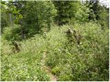 23
23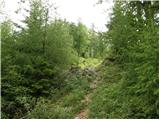 24
24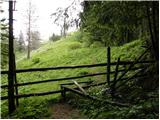 25
25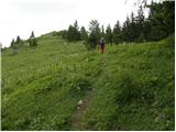 26
26 27
27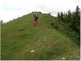 28
28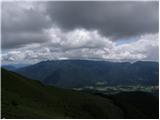 29
29 30
30