Matajur / Montemaggiore - Monte Mataiur/Matajur (over saddle)
Starting point: Matajur / Montemaggiore (950 m)
Path name: over saddle
Time of walking: 2 h 15 min
Difficulty: easy marked way
Difficulty of skiing: no data
Altitude difference: 692 m
Altitude difference (by path): 692 m
Map: Julijske Alpe - zahodni del 1:50.000
Access to starting point:
A) On the Italian side:
From the Gorizia direction, we drive on the regional road towards Videm / Udine to the turn-off for Krmin / Cormons. In the roundabout, on the first exit, we turn towards Krmin / Cormons and Čedad / Cividale and drive under the underpass and then immediately turn left. In the larger and awkward intersection in Krmin, we turn right towards Čedad / Cividale del Friuli. We continue driving through several settlements on the carefully maintained Friulian plain, from where, with good visibility, our destination Matajur next to Krn first appears on our right side, and from Čedad straight ahead. In Čedad, we arrive at the traffic-light intersection next to the building, in which there is first a pharmacy (farmacia) and then a bank. At the intersection, we turn sharply right (straight ahead is the entrance to the old part of the town and a large free parking lot). To the famous Hudičev most, it is only a few minutes' walk.
We continue to a smaller roundabout, in front of which there are several direction signs, among them also a brown sign for Kolovrat. From here onwards, we follow the signs for Kolovrat. Along the river Nadiža, we drive towards the settlement Špeter Slovenov / San Pietro al Natisone. Approximately 1 km before Špeter, we arrive at the intersection in the settlement Ponte San Quirino. Here we turn right (straight to Špeter), left over the bridge to Čedad on the other bank of the river Nadiža, on which a path from Čedad brings us, which you can find on Google Maps. We continue to follow the signs for Kolovrat, but only for approximately 1.5 km, where the road branches off to the right towards Kolovrat and the former border crossing Solarij / Solarie. We continue straight to the larger settlement Sauodnja / Savogna, also the center of the eponymous municipality. Here we turn right over the bridge and continue on the main road. We could also go after the bridge left upwards, but the path is very steep and narrow. On the bridge, we also see red signs for Rifugio Pelizzo. The path soon starts to ascend in zig-zags (approx. 3 km and 6 sharp turns). At the top, we come to the next turn-off, where we turn left towards the village Matajur / Montemaggiore and Rifugio Pelizzo. Straight ahead is the village Čepletišče (Cepletischis) and approximately 6 km to Livk. From the intersection, approximately 5.5 km of moderately ascending two-lane road separates us to the village Matajur, and to Rifugio Pelizzo 9 km.
B) On the Slovenian side:
From the road Tolmin - Kobarid, in the settlement Idrsko to the left (from the direction Kobarid to the right), a steep two-lane road branches off towards the village Livek (approximately 5 km). Here we continue on an increasingly narrow road into Italy. On the other side of the border, the road starts to descend slightly, at the village Polava the road widens again and slightly ascends towards the village Čepletišče / Cepletischis. From here we descend to the intersection (0.5 km), where we continue right in the direction of the village Matajur / Montemaggiore and Rifugio Pelizzo. Straight Sauodnja / Savogna. From Livek to the village Matajur is approximately 10 km, to Rifugio Pelizzo 13 km.
Path description:
We park by the road above the village Matajur. In snow conditions, there is also a road closure here. Mountain signposts direct us right upwards past the holiday cottage towards Matajur and mountain pasture Gosnach. After a very short ascent, we cross the road, where the mountain signpost directs us straight through the forest towards Matajur and Dom na Matajure. After a few steps, we turn left and start to ascend quite steeply, then gently towards mountain pasture Gosnach. The path runs partly through the forest, partly crosses grassy slopes, from which nice views to the sea already appear. Below the larger white homestead, which we spot on our right side, the forest thins out completely. Soon we arrive at the abandoned Rifugio Gosnach, from where in nice weather the first views towards the Dolomites open up. From here, the path starts to ascend more steeply on the southwestern grassy slopes of Matajur. Ahead of us, we constantly see Dom na Matajure and the summit of Matajur. After a good hour of walking, we reach the start of Maršinska planina / Malga di Mersino, on which a beautiful view opens from the Dolomites to the Kanin mountain range. From the right side, at this point, the path from Rifugio Pelizzo joins (30 min).
We continue walking ahead on the cart track leading towards the cottages we see in front of us. The path ascends moderately below the western slopes of Matajur. Above the cottages, the cart track flattens again and brings us in a couple of minutes to the next group of stone cottages at the artificial pond.
At the mountain pasture by the pond, we continue straight on the cart track, which ascends moderately towards the saddle below the northwestern slopes of Matajur. We reach the saddle after a gentle 15-minute ascent. In ideal weather conditions, luxurious views from the Dolomites to the Kanin mountain range and Rombon accompany us the entire way. At the saddle, the horizon expands further to the mighty Krn and the Tolmin and Lower Bohinj Mountains.
The path to the saddle also leads below the northern slopes of Matajur, which we reach via the path from Avsa (instead of directing to the Beneška pot, we continue straight below the northern slopes of Matajur in the direction Sedlo-Meršinska smer).
From the saddle begins a short but relatively steep ascent along the northern ridge to the summit of Matajur, which we reach in approximately 20 minutes. In snow conditions, on this part of the path, great caution and appropriate equipment are needed. The slope is often frozen, but it can also sink deeply. Due to the steepness, the use of crampons is not possible. The path crosses steep slopes, so there is also a great risk of slipping.
In dry conditions, the path is undemanding and very suitable especially on hot days.
Unlike other accesses to Matajur, we spot the little church on the summit only a couple of steps below the summit.
...
Pictures:
 1
1 2
2 3
3 4
4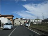 5
5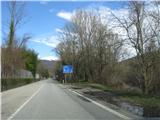 6
6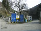 7
7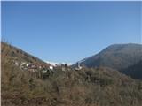 8
8 9
9 10
10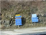 11
11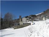 12
12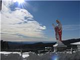 13
13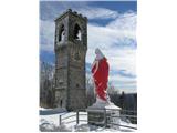 14
14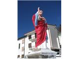 15
15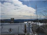 16
16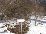 17
17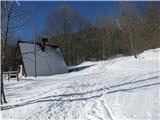 18
18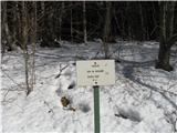 19
19 20
20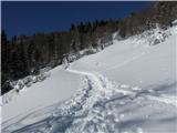 21
21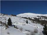 22
22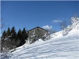 23
23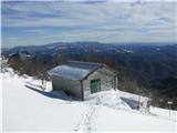 24
24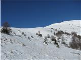 25
25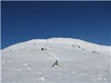 26
26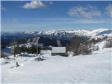 27
27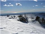 28
28 29
29 30
30 31
31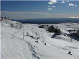 32
32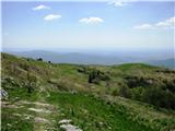 33
33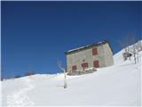 34
34 35
35 36
36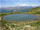 37
37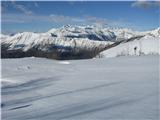 38
38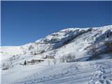 39
39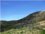 40
40 41
41 42
42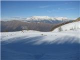 43
43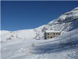 44
44 45
45 46
46 47
47 48
48 49
49 50
50 51
51 52
52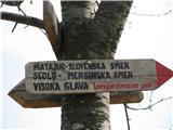 53
53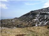 54
54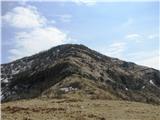 55
55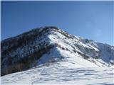 56
56 57
57 58
58 59
59 60
60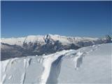 61
61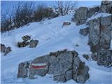 62
62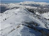 63
63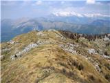 64
64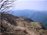 65
65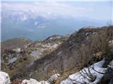 66
66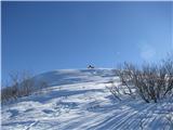 67
67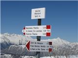 68
68 69
69 70
70 71
71 72
72 73
73 74
74 75
75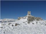 76
76 77
77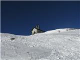 78
78 79
79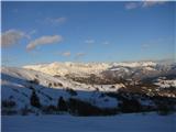 80
80 81
81 82
82 83
83 84
84 85
85 86
86 87
87 88
88 89
89 90
90 91
91 92
92 93
93 94
94