Mlaka - Sveta Ana (Tunjice)
Starting point: Mlaka (340 m)
Starting point Lat/Lon: 46.2108°N 14.5539°E 
Time of walking: 1 h 30 min
Difficulty: easy unmarked way
Difficulty of skiing: no data
Altitude difference: 135 m
Altitude difference (by path): 170 m
Map:
Access to starting point:
A) From the highway Ljubljana - Jesenice, we take the Vodice exit, then continue driving towards Vodice and Kamnik. When we arrive in the settlement Moste, at the main traffic-light crossroads we cross the road Mengeš - Kranj, then immediately after the crossroads we turn left towards Komenda (straight to Kamnik). Further, we drive through Komenda to the roundabout, where to the right (first exit) the road branches off towards Križ and Gmajnica; in the following crossroads and roundabouts we follow the signs for Gmajnice and Mlaka. When the settlement Mlaka ends, a short descent follows to the crossroads by the Knežji potok stream, where the described path begins by the religious symbol. We park in a suitable place nearby.
B) From Trzin or Domžale, we drive to Mengeš, from there we continue driving towards Kranj. At the main traffic-light crossroads in Moste we turn right towards Kamnik, then immediately left towards Komenda. Further, we drive through Komenda to the roundabout, where to the right (first exit) the road branches off towards Križ and Gmajnica; in the following crossroads and roundabouts we follow the signs for Gmajnice and Mlaka. When the settlement Mlaka ends, a short descent follows to the crossroads by the Knežji potok stream, where the described path begins by the religious symbol. We park in a suitable place nearby.
C) First, we drive to Kamnik, then continue driving towards Kranj. When we arrive in Moste, just before the main traffic-light crossroads we turn right towards Komenda. Further, we drive through Komenda to the roundabout, where to the right (first exit) the road branches off towards Križ and Gmajnica; in the following crossroads and roundabouts we follow the signs for Gmajnice and Mlaka. When the settlement Mlaka ends, a short descent follows to the crossroads by the Knežji potok stream, where the described path begins by the religious symbol. We park in a suitable place nearby.
D) We drive to Šenčur, then continue driving on the road towards Mengeš. A few hundred meters before the traffic-light crossroads in Moste, we turn left towards Komenda. Further, we drive through Komenda to the roundabout, from which the road branches off towards Križ and Gmajnica; in the following crossroads and roundabouts we follow the signs for Gmajnice and Mlaka. When the settlement Mlaka ends, a short descent follows to the crossroads by the Knežji potok stream, where the described path begins by the religious symbol. We park in a suitable place nearby.
Path description:
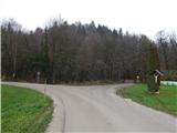
From the religious symbol, we continue on the right road, where first over the bridge we cross the Knežji potok stream, immediately behind the bridge we go left (if we continue right we arrive in the settlement Gora). We walk for a few minutes on the road, then before the fenced land we continue right onto a poorer road, which gradually turns into a cart track. For a short time we still ascend barely noticeably, then the cart track splits, and we choose the somewhat narrower right one, along which we ascend mostly traversely to the right. The path quickly flattens and joins the marked path, which starts near the Komenda hunting lodge.
We follow the marked path to the left, along which we mostly ascend easily, at forks we follow the blazes. The path leads us further along and beside the indistinct ridge of Korinove drče, where it continues with some easy ascents and shorter descents. When after some time we leave the forest, the path widens into a road, along which we begin to ascend past individual houses of the settlement Vinski Vrh, where at crossroads we follow the blazes. Higher up, at the chapel we continue slightly left and past the logbook box we ascend to the hillock, on which stands the church of St. Anne.
Description and pictures refer to the condition in 2019 (November).
On the way: Vinski Vrh (450m)
Pictures:
 1
1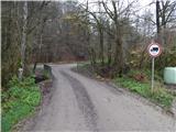 2
2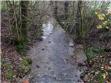 3
3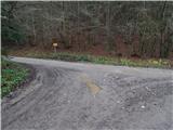 4
4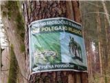 5
5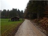 6
6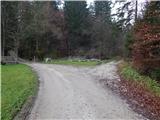 7
7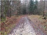 8
8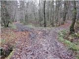 9
9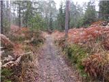 10
10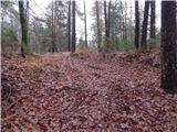 11
11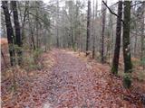 12
12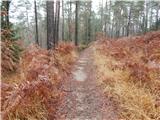 13
13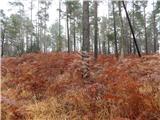 14
14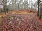 15
15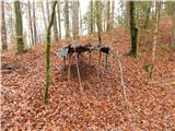 16
16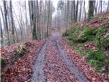 17
17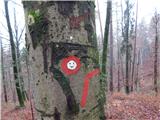 18
18 19
19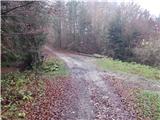 20
20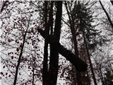 21
21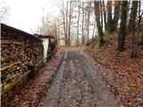 22
22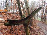 23
23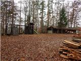 24
24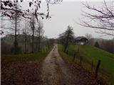 25
25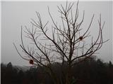 26
26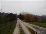 27
27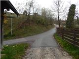 28
28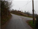 29
29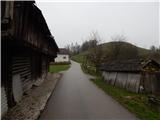 30
30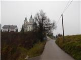 31
31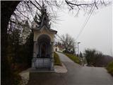 32
32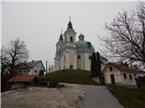 33
33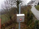 34
34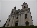 35
35