Planina pod Golico - Koča na Golici (winter way)
Starting point: Planina pod Golico (980 m)
Starting point Lat/Lon: 46.4706°N 14.0599°E 
Path name: winter way
Time of walking: 1 h 30 min
Difficulty: partly demanding marked way
Difficulty of skiing: partly demanding
Altitude difference: 602 m
Altitude difference (by path): 602 m
Map: Karavanke - osrednji del 1:50.000
Access to starting point:
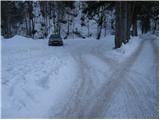
From the Ljubljana–Jesenice motorway, take the Lipce exit (also possible Hrušica) and follow the road ahead towards Jesenice, where signs for Planina pod Golico direct us onto an ascending road (the turn-off is marked and located at the health centre in Jesenice). The relatively steep road soon brings us to the mentioned village, where in May, on the surrounding meadows, we can admire the blooming of narcissi. From Planina pod Golico we drive further to the next junction, where we notice numerous mountaineering signposts. Here we continue right and drive another good 50 m to the parking lot below Savske jame.
Path description:
At the beginning of the parking lot we notice the mountaineering signs, which direct us left up the asphalt road. After a short ascent, the path brings us to the agrotourism Betel and behind it to a junction, where we continue right in the direction of Golica. After a few more minutes of walking along the road, we arrive at the hut Pri Fencu. Here be careful, as just a few steps ahead to the right a wide marked path branches off, which leads to Golica.
The path ahead ascends across a shorter meadow behind which we enter the forest through which it continues. After approximately half an hour of walking we step onto a macadam road, which we follow right, but only to the lower station of the cargo cableway.
At the lower station of the cargo cableway we notice a direction sign with the inscription "zimska pot", which directs us slightly left into the forest (slightly right the usual summer path). The path ahead ascends transversely, then passes into a belt of sparse forest, where it crosses a short slightly avalanche-prone slope. Further the path passes into a gully which we follow only briefly, as the blazes soon direct us left onto a steep vegetated slope. After a few minutes of ascent the steepness eases and the path brings us to a side ridge, where it turns right. Further we ascend along the mentioned ridge, which later even slightly descends and brings us to a steep drop. To the middle of the mentioned drop we ascend straight up the slope, then we have two options for continuing; we can ascend slightly right along an exposed ledge (danger of slipping) or continue straight along the steep partly rocky slope (both paths are exposed to avalanche and slipping).
A little higher the paths merge again and then bring us along the increasingly panoramic slope to the Koča na Golici hut.
Pictures:
 1
1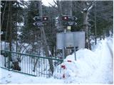 2
2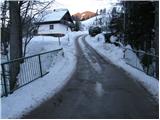 3
3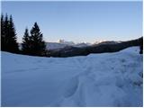 4
4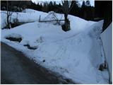 5
5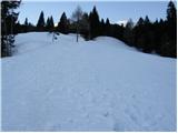 6
6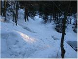 7
7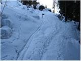 8
8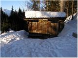 9
9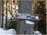 10
10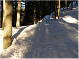 11
11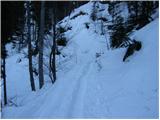 12
12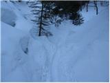 13
13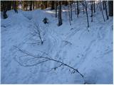 14
14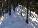 15
15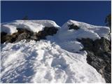 16
16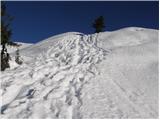 17
17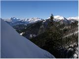 18
18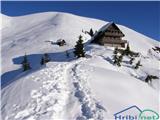 19
19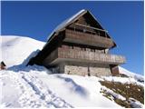 20
20