Planina Spodnji Kozjek - Jerebikovec
Starting point: Planina Spodnji Kozjek (1082 m)
Starting point Lat/Lon: 46.4254°N 14.0023°E 
Time of walking: 2 h 30 min
Difficulty: easy unmarked way
Difficulty of skiing: no data
Altitude difference: 511 m
Altitude difference (by path): 525 m
Map: TNP 1:50.000
Access to starting point:
A) We leave the Gorenjska motorway at the Jesenice east (Lipce) exit, then follow the signs for Spodnje Gorje and Pokljuka. We continue driving through the settlement Kočna, then arrive in Spodnje Gorje, where we first cross the Rečica stream, a little after the stream we go right in the direction of the settlement Zgornje Laze. We continue on a narrower road which leads us through the settlement; when the settlement Zgornje Laze ends, in a smaller valley where the road turns semicircular to the left and where there are several crossroads, we choose the second turn-off to the right. We start ascending towards the Mežakla plateau, when the road flattens we go past the mountain pasture Strmole and mountain pasture Ravne. At the end of the mountain pasture Ravne we continue straight (left University of Ljubljana hut) and we again start more visibly ascending. When we pass onto the northwestern slopes of the peak Oblek, a cart track branches off to the left, which leads to the nearby mountain pasture Spodnji Kozjek, and we continue on a wider macadam road to the next crossroad by which there is a marked parking lot and we park on an appropriate place by the crossroad.
B) We drive to Bled, then continue driving towards Pokljuka. Towards the end of the settlement Krnica we leave the main road towards Pokljuka and continue right downwards in the direction of Radovna, Krma and Mojstrana. There follows some descent, then over the bridge we cross the Radovna river, after the bridge we go right in the direction of Pernikov and Zgornje Laze. We continue driving through Spodnje Laze, when the mentioned settlement ends, in a smaller valley the road turns semicircular to the right and where there are several crossroads, we choose the second turn-off to the left. We start ascending towards the Mežakla plateau, when the road flattens we go past the mountain pasture Strmole and mountain pasture Ravne. At the end of the mountain pasture Ravne we continue straight (left University of Ljubljana hut) and we again start more visibly ascending. When we pass onto the northwestern slopes of the peak Oblek, a cart track branches off to the left, which leads to the nearby mountain pasture Spodnji Kozjek, and we continue on a wider macadam road to the next crossroad by which there is a marked parking lot and we park on an appropriate place by the crossroad.
Path description:
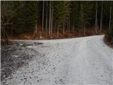
From the starting point, we continue on the left road (slightly right mountain pasture Zgornji Kozjek), which leads us past a green gate and further ascends diagonally towards the left. After a good 10 minutes of walking, we arrive at a smaller crossroad, from which we continue on the upper, slightly right road, which we then follow with occasional views to its end.
From the end of the road, from where a really nice view opens up on the highest peaks of the Julian Alps, we continue right and continue walking on a poorer pathlet, which after a few minutes brings us to a cart track which branches off slightly to the right from the road approximately a minute before its end. The path ahead leads us on an old cart track, over which there are several fallen trees. Higher, the cart track flattens, then above Požarov rovt (Požarov rovt is part of the forest where the cart track flattened) it joins a forest road, which we follow upwards. We continue walking on the forest road, which makes a few hairpins and from which occasional views still open up. When higher at an altitude of approximately 1450 m the road starts descending towards the mountain pasture Mežakla, we leave it and continue left where an arrow on the TNP pole also directs us.
There follows a few minutes of ascent on the cart track, when it ends we continue on a poorer but traceable pathlet, which quickly brings us to the forepeak of Jerebikovec. From the forepeak there follows a light descent, then along the northeastern ridge we reach the summit of Jerebikovec, where there is a stamping box with a logbook and stamp and from where a nice view opens up on the Julian Alps and Karawanks; in good visibility the view reaches all the way to the Carnic and Gailtal Alps and the High Tauern.
Description and pictures refer to the condition in the year 2019 (December).
Pictures:
 1
1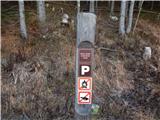 2
2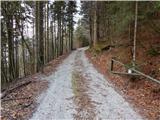 3
3 4
4 5
5 6
6 7
7 8
8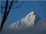 9
9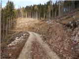 10
10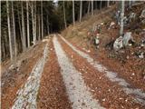 11
11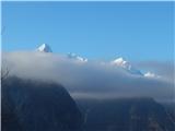 12
12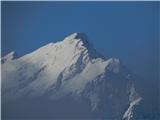 13
13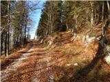 14
14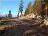 15
15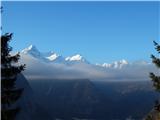 16
16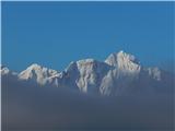 17
17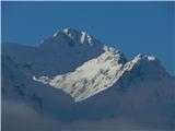 18
18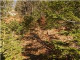 19
19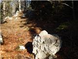 20
20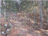 21
21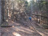 22
22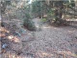 23
23 24
24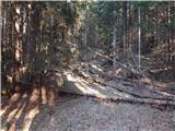 25
25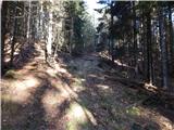 26
26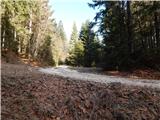 27
27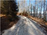 28
28 29
29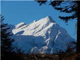 30
30 31
31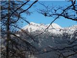 32
32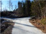 33
33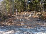 34
34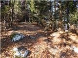 35
35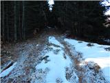 36
36 37
37 38
38 39
39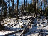 40
40 41
41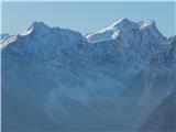 42
42 43
43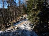 44
44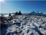 45
45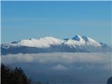 46
46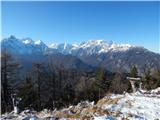 47
47