Pri Mlinču - Mangartska koča (via Gladki rob)
Starting point: Pri Mlinču (1094 m)
Starting point Lat/Lon: 46.4234°N 13.5937°E 
Path name: via Gladki rob
Time of walking: 2 h 30 min
Difficulty: easy unmarked way
Difficulty of skiing: no data
Altitude difference: 812 m
Altitude difference (by path): 845 m
Map: Julijske Alpe - zahodni del 1:50.000
Access to starting point:
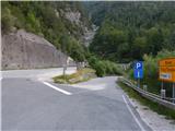
a) Via the Rateče border crossing we drive into Italy, then in Trbiž / Tarvisio we turn left towards Predel / Cave del Predil. After a few hundred m we turn left again in the same direction, then at the intersection by Rabeljsko jezero / Lago del Predil we continue straight on the main road towards Slovenia (right Nevejski preval (Na Žlebeh) / Sella Nevea). This is followed by several serpentines and a drive through a tunnel, then we arrive at the Predel border crossing, after which we drive back into Slovenia. Continuing, we start descending, then before the bridge with the largest arch in the Julian Alps (bridge over Mangartski potok (on the road sign marked as bridge Predel 129 m)) we turn left towards Mangart. Immediately after the intersection a side branch of the road turns off, where the parking lot is marked.
b) From the Primorska region we drive to Log pod Mangartom, from there we continue driving towards Italy. Even before we arrive at the Predel border crossing, after the Predel bridge (bridge over Mangartski potok) we turn right towards Mangart. We park immediately after the bridge at the marked parking lot on the side branch of the road.
Path description:
From the starting point we continue along the asphalt road leading towards Mangartsko sedlo, along which we ascend to the first right bend, or to the place where it crosses Mangartski potok. At the mentioned bend, even before we cross the bridge, we continue straight onto the footpath in the direction of Mangartska planina. We continue along the path with a nice view of Mangart, along the path that ascends parallel to the stream, a little higher we also cross the Stože landslide, which was triggered in November 2000. When we leave the landslide area, we gradually enter the forest, through which we moderately ascend to the western edge of Mangartska planina.
When we step onto the planina we walk to the nearby shepherd's hut, after which we continue along a somewhat overgrown path that leads across the planina. After crossing the planina we arrive in a belt of forest, then quickly reach a narrower belt of meadow, along which the old abandoned road continues (we can also get here if on the planina we continue along the road and then at the first junction left in the direction of Mangartsko sedlo). The poorer road or cart track ascends gently, then, when we cross a torrent, it finally turns into a mountain path. This is followed by a few minutes of moderate ascent, then we cross the asphalt road. On the other side of the road we ascend by gentle steps, then we reach a clearing where the path turns left and begins to ascend relatively steeply. After a few minutes of ascent we reach the road again, along which we continue to the nearby bend, where a path branches off from the road, along which we will continue.
Here the marked path continues along the road, we, however, continue along an unmarked trail that enters the forest. In the continuation we steeply ascend along the path, which at first still runs through the forest, then increasingly beautiful views open up to us that reach towards Rombon, Jerebica... Higher up we return to the road, along which, except for a few shortcuts, we continue to the part where a longer traverse to the right begins. After we cross the rather mighty gorge of the Nakel torrent, we will soon notice on the left side of the road shorter steps, along which we ascend to the nearby grassy slope, where the traceable but still unmarked path continues. The path soon turns left and ascends transversely to the edge of the gorge, where a metal pole with a pink and yellow ribbon stands. Here the path turns back to the right, then ascends transversely across somewhat steeper grassy slopes. The path, from which increasingly better views open up and which runs along the old mule track, higher brings us to the ruins that are located a bit above the next gorge. Along the old mule track we continue across a steeper slope that leads us towards the gorge. Just a little before we reach the gorge, the unmarked path splits into two parts; we continue straight to the gorge (the left path leads directly to Mangartsko sedlo) along which a smaller stream flows, and a water intake is also arranged. On the other side of the gorge we first gently ascend along the wide mule track, which leads us across the steep slope, then after the break in the slope the slope flattens and becomes grassy. The mule track begins to descend moderately, then brings us to a junction where we reach the marked path that leads towards Mangartsko sedlo. Here we go right (left Mangartsko sedlo), then turn left and descend to the nearby hut.
Pri Mlinču - Mangartska planina 0:35, Mangartska planina - Mangartska koča 1:55.
The description and pictures refer to the state in 2016 (July).
Pictures:
 1
1 2
2 3
3 4
4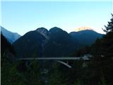 5
5 6
6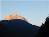 7
7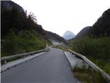 8
8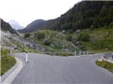 9
9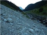 10
10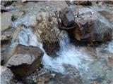 11
11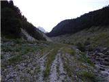 12
12 13
13 14
14 15
15 16
16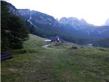 17
17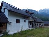 18
18 19
19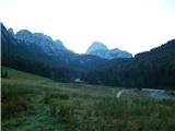 20
20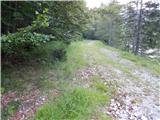 21
21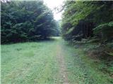 22
22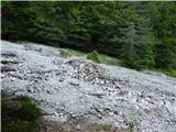 23
23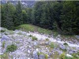 24
24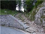 25
25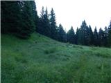 26
26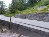 27
27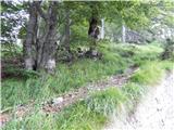 28
28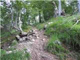 29
29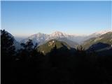 30
30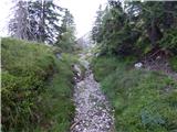 31
31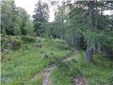 32
32 33
33 34
34 35
35 36
36 37
37 38
38 39
39 40
40 41
41 42
42 43
43 44
44 45
45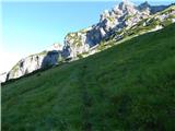 46
46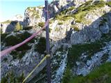 47
47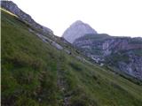 48
48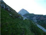 49
49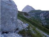 50
50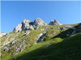 51
51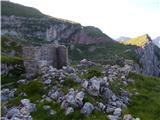 52
52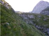 53
53 54
54 55
55 56
56 57
57 58
58 59
59 60
60 61
61 62
62