Ravne - Planina Zgornji Kozjek
Starting point: Ravne (1177 m)
| Latitude/Longitude: | 46,42880°N 14,00550°E |
| |
Walking time: 20 min
Difficulty: easy unmarked way
Elevation gain: 53 m
Elevation difference along the route: 55 m
Map: TNP 1:50.000
Recommended equipment (summer):
Recommended equipment (winter): ice axe, crampons
Views: 464
 | 2 people like this post |
Access to starting point:
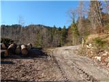
A) We leave the Gorenjska highway at the Jesenice east (Lipce) exit, then follow the signs for Spodnje Gorje and Pokljuka. Further on, we drive through the settlement Kočna, then we already arrive in Spodnje Gorje, where we first cross the stream Rečica, a little after the stream we go right in the direction of the settlement Zgornje Laze. Further on, we drive on a narrower road which leads us through the settlement; when the settlement Zgornje Laze ends, in a smaller valley where the road turns semicircularly to the left and where there are several crossroads, we choose the second turn-off to the right. Further on, we start ascending towards the Mežakla plateau; when the road flattens, we go past the mountain pasture Strmole and mountain pasture Ravne. At the end of the mountain pasture Ravne we continue straight (left: University of Ljubljana cottage) and we again start visibly ascending. When we already pass onto the northwestern slopes of the peak Oblek, a cart track branches off to the left, which leads to the nearby mountain pasture Spodnji Kozjek; we continue on a wider macadam road which a little further brings us to a crossroad, by which there is a marked parking lot (sign P on TNP pole), and we continue on the wider road which gradually transitions into more plateau-like terrain. A few more crossroads follow, where we follow the wider road, then at the next marked parking lot we park in an appropriate place.
B) We drive to Bled, then continue driving towards Pokljuka. Towards the end of the settlement Krnica we leave the main road towards Pokljuka and continue driving right downwards in the direction of Radovna, Krma and Mojstrana. Some descent follows, then over the bridge we cross the Radovna river, after the bridge we go right in the direction of Perniki and Zgornje Laze. Further on, we drive through Spodnje Laze; when the mentioned settlement ends, in a smaller valley the road turns semicircularly to the right and where there are several crossroads, we choose the second turn-off to the left. Further on, we start ascending towards the Mežakla plateau; when the road flattens, we go past the mountain pasture Strmole and mountain pasture Ravne. At the end of the mountain pasture Ravne we continue straight (left: University of Ljubljana cottage) and we again start visibly ascending. When we already pass onto the northwestern slopes of the peak Oblek, a cart track branches off to the left, which leads to the nearby mountain pasture Spodnji Kozjek; we continue on a wider macadam road which a little further brings us to a crossroad, by which there is a marked parking lot (sign P on TNP pole), and we continue on the wider road which gradually transitions into more plateau-like terrain. A few more crossroads follow, where we follow the wider road, then at the next marked parking lot we park in an appropriate place.
Route description:
From the starting point, where the cart track branches off to the left, we continue on an ascending asphalt road which quickly brings us to a green barrier and TNP pole with prohibitions and a notification that we are entering the bear area. A few minutes higher we arrive at a crossroad, where we continue left (the road straight semicircularly bypasses the mountain pasture Zgornji Kozjek and above it joins the road which goes left, the road to the right eventually ends in the forest).
The path ahead leads us on a macadam road, from which soon a cart track branches off to the right towards the lower part of the mountain pasture Zgornji Kozjek. We continue right (if we continue straight we arrive directly at the upper part of the mountain pasture), where the cart track quickly brings us to the lower part of the mountain pasture Zgornji Kozjek. When we step onto the mountain pasture the cart track ends, and we continue along the edge of the mountain pasture, walking across it all the way to the upper part of the mountain pasture, where another cottage stands and where there are some ruins.
Description and pictures refer to the condition in the year 2019 (December).

Photos:
 1
1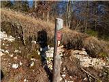 2
2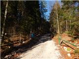 3
3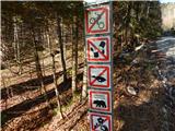 4
4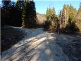 5
5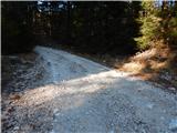 6
6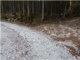 7
7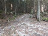 8
8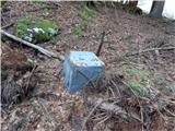 9
9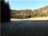 10
10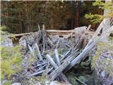 11
11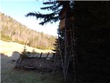 12
12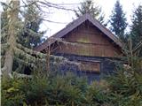 13
13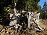 14
14
Discussion about the trip Ravne - Planina Zgornji Kozjek
To post a comment you must log in:
If you do not yet have a username, you must first
register.