Repnje - Sveti Tilen above Repnje
Starting point: Repnje (346 m)
Starting point Lat/Lon: 46.1708°N 14.4808°E 
Time of walking: 10 min
Difficulty: easy marked way
Difficulty of skiing: no data
Altitude difference: 73 m
Altitude difference (by path): 73 m
Map:
Access to starting point:
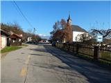
A) From the highway Ljubljana - Jesenice, we take the exit Ljubljana (Šmartno), then at the first intersection we continue left across the highway towards Šmartno and Tacen. After the bridge, a road branches off to the right to the nearby cemetery, to the left the highway leads towards Ljubljana, but we continue straight on the main road and drive another about 100 meters, then at the next intersection we continue right (straight to Tacen). We then drive through Šmartno, after which Ljubljana ends and we continue on the road, which soon returns to the eastern side of the highway. The route further leads us through Povodje and later also Skaručna. When the road after the settlement Skaručna enters a strip of forest, first a road to the village Polje branches off to the right, a little further also to the left a road to the settlement Repnje. We continue towards the settlement Repnje on the road that leads us across the highway, then quickly takes us into the settlement, where we notice signs for the church of St. Tilen. The start of the path is located near the Repnje monastery.
B) From the highway Jesenice - Ljubljana, we take the exit Vodice, then continue driving towards Medvode and Smlednik. On the main road towards Medvode we drive only some 10 meters, then turn left towards the village Dobruša and Repnje. A somewhat narrower road quickly brings us to Dobruša and a little further to Repnje, where at the first intersection we continue slightly right towards the nearby monastery. The start of the path is located a little ahead of the Repnje monastery.
C) First we drive to Medvode, from there we continue driving towards Zbilje, Smlednik and Vodice. Before we arrive in Vodice or to the junction onto the highway, we continue right towards the village Dobruša and Repnje. A somewhat narrower road quickly brings us to Dobruša and a little further to Repnje, where at the first intersection we continue slightly right towards the nearby monastery. The start of the path is located a little ahead of the Repnje monastery.
D) From Kamnik or Mengeš we drive to Vodice, from there at the traffic light where the road to the airport branches off to the right, we continue left. A little further, at the intersection behind a smaller strip of forest, we turn right towards the settlement Repnje. The road then leads us through the underpass under the highway, then at the intersection we continue left towards the nearby monastery. The start of the path is located a little ahead of the Repnje monastery.
Path description:
In Repnje near the monastery we notice signs for the church of St. Tilen, which direct us onto a narrower asphalt road that first leads us past a few more houses, then the asphalt ends and turns into a poor macadam road that leads through the forest. After a left turn the forest thins, so a nice view opens towards the surrounding hills and villages. After approximately 10 minutes the path levels out completely and brings us to the church of St. Tilen, from which a nice view opens towards Velika planina and part of Gorenjska.
Description and pictures refer to the condition in the year 2014 (December).
Pictures:
 1
1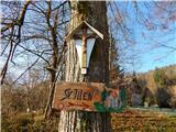 2
2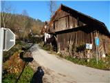 3
3 4
4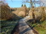 5
5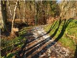 6
6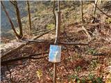 7
7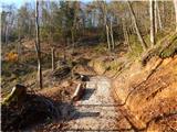 8
8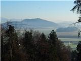 9
9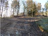 10
10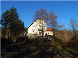 11
11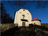 12
12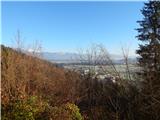 13
13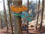 14
14