Starting point: Sebenje (500 m)
Starting point Lat/Lon: 46.3304°N 14.2993°E 
Time of walking: 10 min
Difficulty: easy unmarked way
Difficulty of skiing: no data
Altitude difference: 5 m
Altitude difference (by path): 20 m
Map: Karavanke - osrednji del 1:50.000
Access to starting point:
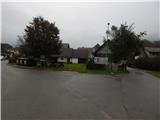
A) From the Ljubljana - Jesenice highway, we take the Naklo exit, then continue left towards the Trnovc camp. Further on, we drive through Žeje, Spodnje and Zgornje Duplje and past two road turn-offs to Žiganja vas. A little further along the main road, we notice signs for Sebenje, which direct us to the right. A somewhat narrower road then takes us into the village, and from the crossroads at the chapel, we continue right and after a good 100 m of further driving arrive at the next crossroads, where the described path begins. We park in a suitable place nearby.
B) From the Jesenice - Ljubljana highway, at the Podtabor junction, we take the Tržič exit, then drive along the main road towards Ljubelj. Before the Petrol filling station in Bistrica pri Tržiču, we turn right, descend to the traffic-light crossroads, where we turn sharply right towards Golnik. Further on, we drive along the main road towards Kranj, and after the settlement of Retnje, we soon turn left towards the settlement of Sebenje. A somewhat narrower road then takes us into the village, and from the crossroads at the chapel, we continue right and after a good 100 m of further driving arrive at the next crossroads, where the described path begins. We park in a suitable place nearby.
Path description:
At the starting point there is an information board for the Pot treh zvonov trail and directional arrows that direct us onto a side road. The path initially leads between houses, where at the first crossroads we go right, then after the larger house chapel the houses gradually thin out. We continue straight ahead on the road that loses its asphalt surface and a little further on enters the forest. At the entrance to the forest, next to the trim course, there is the first bell of the Pot treh zvonov trail.
At the bell we leave the Pot treh zvonov trail and continue left along the path that crosses the slopes to the left, and a few minutes further descends to the Blata wetland, where after the small bridge we arrive at the information boards.
Once we reach the wetland, we can continue along the circular educational trail, which takes about another 10 minutes.
The description refers to the conditions in October 2017, and the photos are from September and October 2017.
Pictures:
 1
1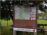 2
2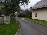 3
3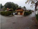 4
4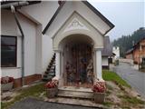 5
5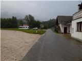 6
6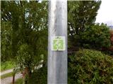 7
7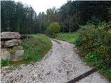 8
8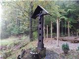 9
9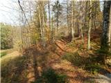 10
10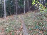 11
11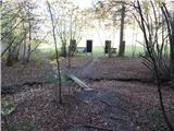 12
12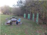 13
13