Slovenske Konjice - Konjice Castle (easier path)
Starting point: Slovenske Konjice (333 m)
Route name: easier path
Walking time: 30 min
Difficulty: easy marked way
Elevation gain: 182 m
Elevation difference along the route: 190 m
Map:
Recommended equipment (summer):
Recommended equipment (winter):
Views: 3.264
 | 3 people like this post |
Access to starting point:
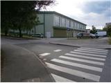
From the highway Ljubljana - Maribor we take the exit Slovenske Konjice and follow the road to the mentioned town. In the center of Slovenske Konjice, we leave the main road (we continue left) and head somewhere towards the church, or also towards the sports hall near which we park on a large marked parking lot.
Route description:
From the parking lot at the church, we continue in the direction west to the school or sports hall. Here somewhere we notice the first trail blazes pointing uphill and we continue in the direction of Konjice Castle (grad Konjice) or Konjiška gora/Stolpnik on a sidewalk, which is on the right side of the road. By the architecturally rich building of Gimnazija Slovenske Konjice (right by the path) we soon reach the crossroad at the cemetery. We continue left along the cemetery and soon reach the junction of mountain paths. We continue left on the easier path, right is the harder path, which has a description on this portal for a long time. Next follows about a hundred meters of asphalt surface and finally we continue straight on a forest path, partly road. Left by the path there is a smaller former quarry, also a point of Zmajčkove themed path. We continue on a somewhat narrower path and somewhat left into the steeper part. Soon from the right the harder variant of the path joins and further on the path is of course common. A few dozen more meters in the embrace of the forest (deciduous trees mainly beech) and passage onto a meadow cart track. We reach the forest road and continue right slightly downhill, straight is Skala and Žička kartuzija. The goal of the path is already visible, again a junction at a smaller wooden object, we continue uphill along a smaller ramp/vehicle barrier, left is the path higher to Stolpnik. Above the ramp we follow the road and soon reach the goal of the path.

Photos:
 1
1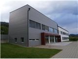 2
2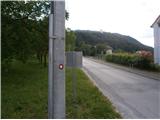 3
3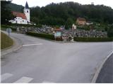 4
4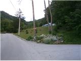 5
5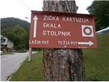 6
6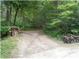 7
7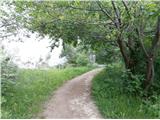 8
8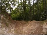 9
9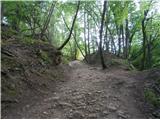 10
10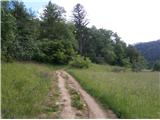 11
11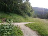 12
12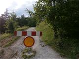 13
13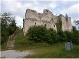 14
14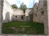 15
15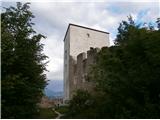 16
16
Discussion about the trip Slovenske Konjice - Konjice Castle (easier path)
To post a comment you must log in:
If you do not yet have a username, you must first
register.