Slovenske Konjice (pokopališče) - Stolpnik (Zmajčkova pot)
Starting point: Slovenske Konjice (pokopališče) (365 m)
| Latitude/Longitude: | 46,33618°N 15,41561°E |
| |
Route name: Zmajčkova pot
Walking time: 1 h 45 min
Difficulty: easy marked way
Elevation gain: 647 m
Elevation difference along the route: 660 m
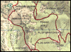
Map:
Recommended equipment (summer):
Recommended equipment (winter):
Views: 17.377
 | 3 people like this post |
Access to starting point:
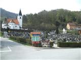
From the highway Ljubljana - Maribor, we take the exit Slovenske Konjice and follow the road to the mentioned town. In the center of Slovenske Konjice, we leave the main road (we continue left) and head towards the church, near which we park on a large marked parking lot.
Route description:
From the spot where we have parked, we first have to reach the cemetery, which is located a little above the town (we can also park by the cemetery). From the cemetery we go right (straight leads the path past the old castle) and we initially walk along the cemetery. When we reach the forest, "our" path branches off slightly right downwards (if we continued straight we would also reach a marked path). When the descent ends we arrive at an interesting waterfall, and the path via the footbridge takes us to the other side of the stream. Slightly above the footbridge we return to the road which we left before, which we follow to the right. At the nearby bend we continue left, then the path returns to the forest, where it becomes quite steep and already almost demanding. For some time wooden stairs help us, then the path turns right and temporarily flattens. Higher we cross the forest road, and the path further acquires a more rocky base, while the forest thins out for a short time. When the path returns to the dense mixed forest, it becomes very steep again and at one spot wooden stairs help us again and this time also a wooden railing. Higher the path flattens and takes us to a well-maintained and wide macadam road.
Follows a somewhat less interesting part of the path, as we will walk for about 20 minutes on the macadam road, from which we occasionally get some views of Zreče and Pohorje. Further the road takes us to the junction Grofov štant, where other paths from Slovenske Konjice also join us, as well as the path from Kamne gore and Stranic.
We continue towards Stolpnik on a rutted cart track, which occasionally rises quite steeply. When the path flattens higher up, only about 15 minutes of gentle ascent and a short steep section right below the summit separate us from the top.
From the top we can also climb to the lookout tower, from which a nice view opens up on all sides.
The trip can be extended to the following destinations: Stolpnik
Photos:
 1
1 2
2 3
3 4
4 5
5 6
6 7
7 8
8 9
9 10
10 11
11 12
12 13
13 14
14 15
15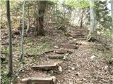 16
16 17
17 18
18 19
19 20
20 21
21 22
22 23
23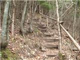 24
24 25
25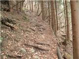 26
26 27
27 28
28 29
29 30
30 31
31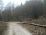 32
32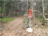 33
33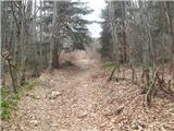 34
34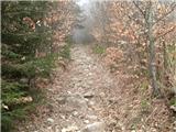 35
35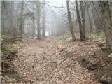 36
36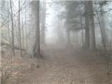 37
37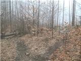 38
38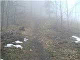 39
39 40
40 41
41 42
42 43
43 44
44 45
45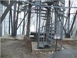 46
46
Discussion about the trip Slovenske Konjice (pokopališče) - Stolpnik (Zmajčkova pot)
|
| pohodnik3815. 02. 2015 |
On Saturday, February 14th, hike to the top of Konjiška gora - Stolpnik....the path is nice, a bit muddy and icy in places but still nice even without views this time.
PICTURES
Best regards! Tone
|
|
|
|
| Marx14. 06. 2015 |
The trail route is slightly changed! Now at Grofov štant (picture 33) we no longer go through the rocky gully. The cairns lead us to a path a bit more to the right (west) and this one runs parallel to the gully. We are back on the trail around picture 37. Of course, it's also possible through the gully, but on this new variant the ground is much less demanding.
The fallen tree from picture 38 has finally disappeared...
|
|
|
|
| anazala24. 03. 2020 |
The Zmajčkova path is interesting. That stream especially and the steps. Nicely made. Easy path for everyone. Go to the mountains now, but with caution ---2m distance between people. And take a mask with you. Prevention is important. People meet and you don't know who will blow or sneeze on you.
|
|
|
|
| Sandi in Tanja15. 03. 2026 20:20:22 |
Addition to the last picture: the stamp is located on the first floor of the observation tower.
|
|
|
To post a comment you must log in:
If you do not yet have a username, you must first
register.