Starting point: Šmihel (310 m)
Starting point Lat/Lon: 45.9508°N 13.7393°E 
Time of walking: 1 h
Difficulty: easy marked way
Difficulty of skiing: no data
Altitude difference: 361 m
Altitude difference (by path): 375 m
Map: Goriška - izletniška karta 1:50.000
Access to starting point:
A) From the Vipava highway we go to the Vogrsko exit, then continue driving in the direction of Tolmin and Ozeljan. When we reach the old road Ajdovščina - Nova Gorica, at the traffic-light crossroad we continue left, then after a few meters, in the hamlet Tri Hiše, right onto the road, by which we quickly arrive in Ozeljan. Through Ozeljan we follow the signs for pizzeria Grad, from the pizzeria onwards the main road or right turn-offs, which higher bring us to the settlement Šmihel. When we arrive in the upper part of the settlement, we notice the first signs for Skozno, which direct us right, then we quickly arrive at the cemetery, beside which we park.
B) From Nova Gorica on the old road we drive towards Ajdovščina, then at the hamlet Tri Hiše (the hamlet is located at the traffic-light crossroad, where the road towards the settlement Vogrsko branches off to the right) we continue left in the direction of pizzeria Grad. On the mentioned road we quickly arrive in Ozeljan. Through Ozeljan we follow the signs for pizzeria Grad, from the pizzeria onwards the main road or right turn-offs, which higher bring us to the settlement Šmihel. When we arrive in the upper part of the settlement, we notice the first signs for Skozno, which direct us right, then we quickly arrive at the cemetery, beside which we park.
Path description:
From the starting point we continue along the left upper side of the cemetery, where we walk on a poorer road that turns left and quickly brings us to a water supply structure. Behind the mentioned structure the path changes into a cart track, turns right and quickly brings us to a marked junction.
From the junction we continue on the left cart track in the direction of the natural window Skozno (straight Trpinovšče), which at a few smaller junctions we follow in the direction of the blazes. At the next directional sign for Skozno we leave the cart track and continue the ascent on a steeper mountain path, which mainly ascends transversely towards the left. A little higher, at the hunting observatory, at the smaller junction, we continue straight, cross a short clearing, then views towards the Vipava valley and Trstelj in the background occasionally begin to open up. A little further the path levels out and we arrive at a pleasant bench, from which a beautiful view opens up towards the valley, Sveta Gora and the Alps in the background.
Behind the bench the path turns semicircularly towards the right, where the path from the settlement Ravnica joins from the left.
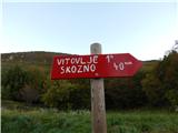
We continue right in the direction of Vitovelj and Skozno, then a few minutes further right downwards towards the natural window Skozno, where we quickly descend to the logbook box.
From the logbook box we can also continue into the natural cave Skozno, through which a steep and quite slippery, unsecured circular path leads.
Technically undemanding is the ascent to the natural bridge above the window, from which a beautiful view opens up over the lower part of the Vipava valley.
Description and pictures refer to the condition in 2016 (October).
Pictures:
 1
1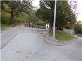 2
2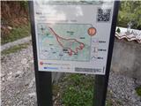 3
3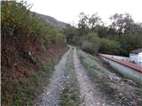 4
4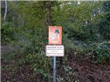 5
5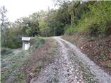 6
6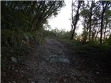 7
7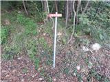 8
8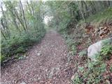 9
9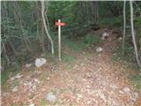 10
10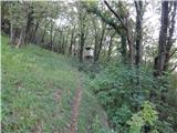 11
11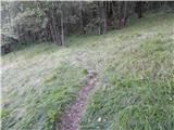 12
12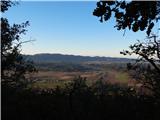 13
13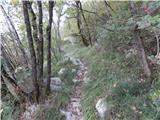 14
14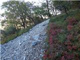 15
15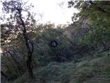 16
16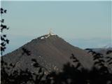 17
17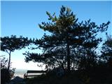 18
18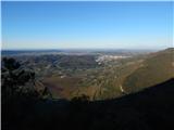 19
19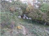 20
20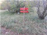 21
21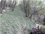 22
22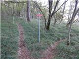 23
23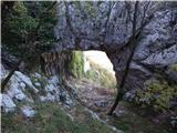 24
24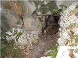 25
25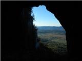 26
26 27
27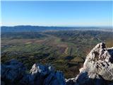 28
28