Source of Ljubija - Dom na Smrekovcu (via Leskovškova pustota)
Starting point: Source of Ljubija (658 m)
Starting point Lat/Lon: 46.4032°N 14.9405°E 
Path name: via Leskovškova pustota
Time of walking: 1 h 50 min
Difficulty: easy unmarked way
Difficulty of skiing: no data
Altitude difference: 717 m
Altitude difference (by path): 717 m
Map: Kamniške in Savinjske Alpe 1:50.000
Access to starting point:
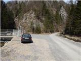
A) From the Ljubljana–Maribor highway, take the Šentrupert exit, then continue driving in the direction of Mozirje and Logarska dolina. At the beginning of Mozirje, from the roundabout turn right in the direction of the settlement Bele Vode, then further follow the signs for Ljubijski graben. Higher up, the asphalt ends and after a shorter quite steep part the road flattens and past the homestead Rožman brings us to a water catchment, which is situated near the confluence of the streams Ljubija and Kramarica. We park at an appropriate place by the water catchment.
B) From Ljubno ob Savinji or Gornji Grad drive to Mozirje, from there from the roundabout near the Hofer store continue in the direction of Bele Vode, then further follow the signs for Ljubijski graben. Higher up, the asphalt ends and after a shorter quite steep part the road flattens and past the homestead Rožman brings us to a water catchment, which is situated near the confluence of the streams Ljubija and Kramarica. We park at an appropriate place by the water catchment.
C) Drive to Šoštanj, where from the roundabout by TEŠ continue in the direction of Bele Vode. After the bridge over the river Paka and behind the railway track at the crossroads continue straight in the direction of Bele Vode and also in the following crossroads follow the mentioned direction. Further, drive past the church in Bele Vode, then arrive at a saddle north of Sv. Križ. After the saddle, the road starts descending, then in a transverse descent brings us into the valley of the stream Kramarica, where continue left. Further, descend along the stream Kramarica, then when arriving at the confluence of Kramarica and Ljubija park at an appropriate place by the water catchment.
Path description:
From the starting point by the water catchment we continue left along the stream Ljubija, where a green ramp is placed over a poor road. After the ramp we continue on the poor road, which leads us through a scenic gorge. In a few minutes we arrive at a relatively strong karst spring, where the stream Ljubija originates. From the spring we continue on a poorer and, due to frequent rains, quite eroded road, which continues through Ljubijski graben. Higher up the gorge splits into two parts, and we continue through the left gorge, along which the poor road still continues. Further, the slopes by the path become less steep, and then suddenly we step onto an ample meadow. The path continues along the left edge of the meadow, then joins a wider macadam road, which we follow to the right (straight Dom na Smrekovcu - on the road).
On the road in a few minutes we arrive at the farm Leskovšek, where we continue left on a cart track, which ascends more steeply across a panoramic hay meadow. From the hay meadow a nice view opens towards Sv. Križ, the cart track a little higher enters the forest, through which it then ascends. The cart track for most of the time ascends transversely towards the left, then on a larger clearing (Leskovškova pustota) at the hunting observatory turns right and ascends across the clearing. On the upper part of the clearing, just before the path goes into the forest, we will notice to the left of the path a wooden cottage. When the path returns into the forest, it soon turns sharply to the left, then ascends transversely all the way to the place where we join a wider macadam road, which we follow to the right.
On the road we walk a few minutes, then when we reach the marked path we continue left upwards on the marked path (right Bele Vode, straight on the road saddle Kramarica). Higher, we cross another road, where to the left continues the path towards Golte, and a little above the road we step out of the forest, where we continue right in the direction of Dom na Smrekovcu. From the spot when we step out of the forest there follow a few minutes of a somewhat more panoramic path and we already reach Dom na Smrekovcu.
Description and pictures refer to the condition in the year 2016 (March).
On the way: Leskovšek (950m), Leskovškova pustota (1101m)
Pictures:
 1
1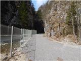 2
2 3
3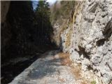 4
4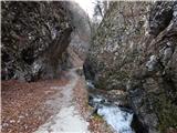 5
5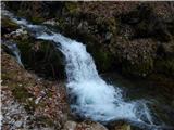 6
6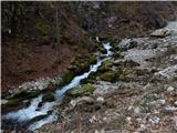 7
7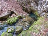 8
8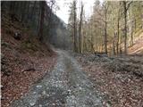 9
9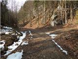 10
10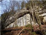 11
11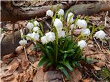 12
12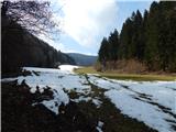 13
13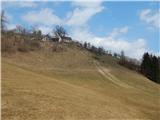 14
14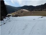 15
15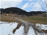 16
16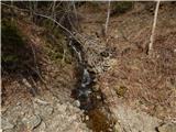 17
17 18
18 19
19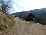 20
20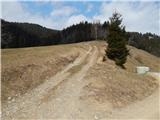 21
21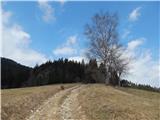 22
22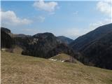 23
23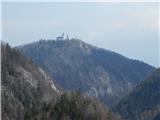 24
24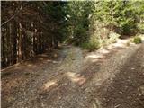 25
25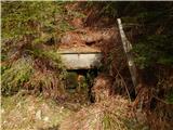 26
26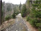 27
27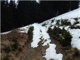 28
28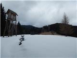 29
29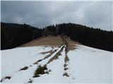 30
30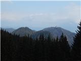 31
31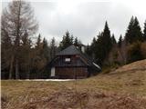 32
32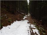 33
33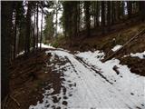 34
34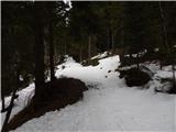 35
35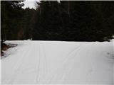 36
36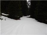 37
37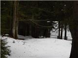 38
38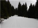 39
39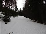 40
40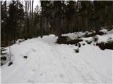 41
41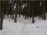 42
42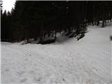 43
43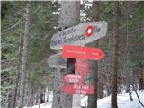 44
44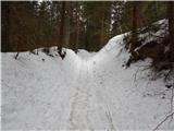 45
45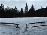 46
46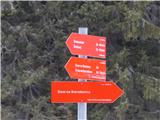 47
47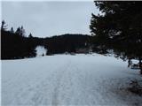 48
48 49
49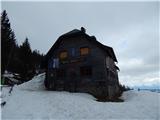 50
50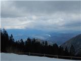 51
51