Spodnja Kokra - Dom na Kališču (via Baba)
Starting point: Spodnja Kokra (530 m)
Starting point Lat/Lon: 46.302°N 14.4754°E 
Path name: via Baba
Time of walking: 4 h 25 min
Difficulty: easy unmarked way, easy marked way
Difficulty of skiing: no data
Altitude difference: 1004 m
Altitude difference (by path): 1110 m
Map: Karavanke - osrednji del 1:50.000
Access to starting point:
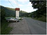
From the highway Ljubljana - Jesenice we take the exit Kranj - East and follow the road ahead in the direction of Jezersko. Only a few kilometers after the turn-off for Preddvor we will notice a transformer on the right side of the road and a parking lot by it, where we park. Here there are also signposts for the mountain hut Dom Čemšenik.
Path description:
From the parking lot we first carefully cross the road, then we head onto the footpath in the direction of the mountain hut Dom Čemšenik. The wide path barely noticeably ascends to the homestead Polajnar, where we step onto the road, which we follow to the right.
The road steeply ascends just after the house, but a little higher it loses the asphalt covering. Further the road flattens and turns somewhat to the left, where it comes completely close to the Čemšeniški potok stream. A little further we cross the mentioned stream and immediately after it we arrive at a marked junction, where we continue on the left road in the direction of the mountain hut Dom Čemšenik. The road then starts ascending more steeply again and after less than 30 minutes of further walking brings us to the mountain hut Dom Čemšenik.
From the mountain hut Dom Čemšenik we continue behind the hut on a well-visible but unmarked path that goes into the forest and starts first gently then ever more steeply ascending. The path soon brings us to a modest vantage point, where it turns slightly to the right and then ascends transversely. Higher the path brings us to the main ridge (view of the Gorenjska plain), where it ascends even more steeply and after a few minutes of further walking brings us to a more level area where a wooden hut (weekend hut) stands.
A little before the hut the path turns right and after a few further steps brings us to the stamping box on Baba.
From the stamping box we continue on a nicely traceable little path that continues along the occasionally panoramic ridge, from which we first get a nice view towards Cjanovca, Kočna, Grintovec, Kalški greben and other surrounding hills. The path ahead first continues along the left side of the ridge, then after an indistinct saddle passes to the right (eastern) slopes of Potoška gora. A few minutes of transverse ascent follows, then we join the marked path that leads from Dom Čemšenik.
We continue upwards and relatively quickly arrive at the saddle between Potoška gora on the left and the secondary summit of Javorov vrh on the right.
On the saddle there is a marked junction where we continue right (left Potoška gora, slightly left Planinska koča Iskra na Jakobu (we can descend via one of the mentioned paths)) in the direction of Javorjev vrh. The path continues along the forested ridge, avoiding only the indistinct secondary summit to the right. A gentle ascent follows, from which some view opens up again, then the path returns to the forest and forks.
Here we continue left in the direction of Srednji vrh, Kališče and Storžič (straight Javorov vrh 15 minutes) on the path that after a few further steps brings us to a pleasant spring. A half-hour crossing of the slopes below Javorov vrh follows, which ends on the saddle between the mentioned summit and Cjanovca.
Here at the marked junction we continue left in the direction of Hudičev boršt (straight Srednji vrh and Cjanovca, sharply right Javorov vrh) on the path which further crosses the slopes to the left, meanwhile slightly ascending and descending a few times. After approximately 15 minutes of walking from the last junction we step out of the forest onto the grassy slopes of Zaplata, across which we continue the crossing. The technically undemanding path leads us across occasionally steeper slopes, where especially when wet it is slippery in a few places. In the last part before entering the forest a steel cable assists us, and after it the path completely flattens. When we enter the forest we have only a short walk to the shelter.
From the shelter we continue towards the west, where we quickly arrive at the spring in Hudičev boršt, immediately after it at the marked junction where we continue straight (left downhill Mačenska pot to Mače). A shorter crossing of the grassy slope follows, then the path enters the forest and brings us to a junction where the path to Dolga njiva, Cjanovci, Srednji vrh and Mali Grintovec branches off to the right, and we continue straight. The path ahead crosses the slopes to the left for a short time more, then after crossing the gully brings us to a junction where we continue right towards Kališče (the lower path leads to Mače).
The path ahead still crosses the slopes to the left. During the crossing we will come to a smaller scree slope, from which the first view towards the valley opens up. A short crossing follows and the path brings us into the valley of Suha, where an unmarked path from Mače joins from the left.
We continue in the direction of Kališče and continue the ascent on a gradually steeper path. The path ahead ascends through dense forest for a while longer, then brings us to the foot of rocky cliffs and a little higher to the ridge, where just a few meters off the path we notice a small hut. Here the path turns right and steeply ascends over a short rocky step. The path flattens here and a few meters further joins the usual path leading to Kališče.
We continue in the direction of Kališče and continue the ascent on a moderately steep path, along which in 5 minutes of further walking we arrive at the Planinski dom na Kališču.
Spodnja Kokra - Čemšenik 50 minutes, Čemšenik - Baba 45 minutes, Baba - Hudičev boršt 1:30, Hudičev boršt - Kališče 1:20.
Pictures:
 1
1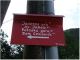 2
2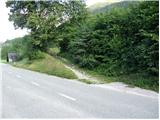 3
3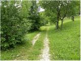 4
4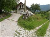 5
5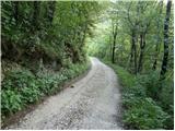 6
6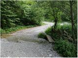 7
7 8
8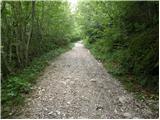 9
9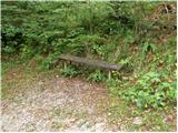 10
10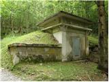 11
11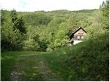 12
12 13
13 14
14 15
15 16
16 17
17 18
18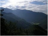 19
19 20
20 21
21 22
22 23
23 24
24 25
25 26
26 27
27 28
28 29
29 30
30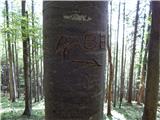 31
31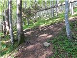 32
32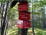 33
33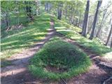 34
34 35
35 36
36 37
37 38
38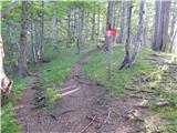 39
39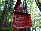 40
40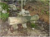 41
41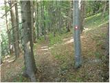 42
42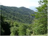 43
43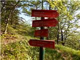 44
44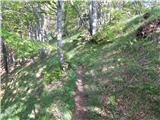 45
45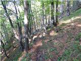 46
46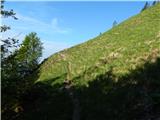 47
47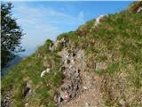 48
48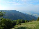 49
49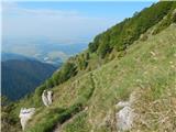 50
50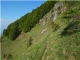 51
51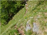 52
52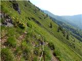 53
53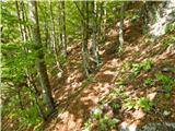 54
54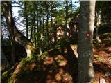 55
55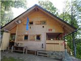 56
56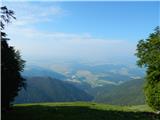 57
57 58
58 59
59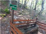 60
60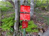 61
61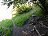 62
62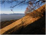 63
63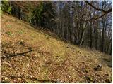 64
64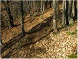 65
65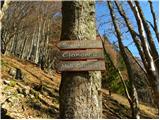 66
66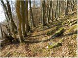 67
67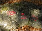 68
68 69
69 70
70 71
71 72
72 73
73 74
74 75
75 76
76 77
77 78
78 79
79 80
80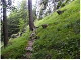 81
81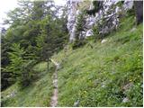 82
82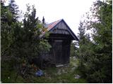 83
83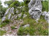 84
84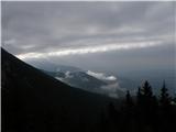 85
85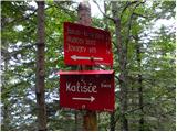 86
86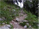 87
87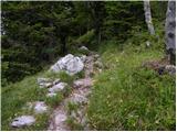 88
88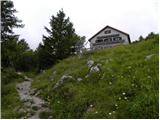 89
89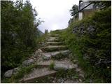 90
90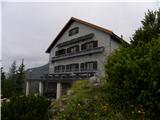 91
91