Spodnja Kokra - Srednji vrh
Starting point: Spodnja Kokra (530 m)
| Latitude/Longitude: | 46,30270°N 14,47540°E |
| |
Walking time: 4 h 5 min
Difficulty: easy marked way
Elevation gain: 1323 m
Elevation difference along the route: 1350 m
Map: Karavanke - osrednji del 1:50.000
Recommended equipment (summer):
Recommended equipment (winter): ice axe, crampons
Views: 10.295
 | 2 people like this post |
Access to starting point:
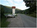
From the Ljubljana-Jesenice motorway, take the Kranj-east exit and continue following the road towards Jezersko. Just a few kilometres after the turn-off for Preddvor, we will spot a transformer on the right side of the road and a parking lot next to it, where we park. There are also signposts for the Čemšenik hut here.
Route description:
From the parking lot, first carefully cross the road, then head to the footpath towards the Čemšenik hut. The wide path barely ascends noticeably to the Polajnar farmstead, where we step onto the road, which we follow to the right.
The road steeply ascends immediately after the house, but a bit higher it loses the asphalt surface. Further on, the road levels out and turns slightly to the left, where it approaches the Čemšeniški stream very closely. A little further ahead, we cross the mentioned stream and immediately after it reach a marked junction, where we continue on the left road towards the Čemšenik hut. The road then begins to ascend more steeply again and after less than 30 minutes of further walking brings us to the Čemšenik hut.
From the Čemšenik hut, continue towards Javorov vrh (signposted Javorjev vrh) on the path that enters the forest after just a few metres. The initially moderately steep path soon brings us to a torrent gully, along which it ascends for a while. Higher up, the path turns right and ascends even more steeply. We follow this relatively steep path, which runs through dense forest the whole time, all the way to the junction at the saddle between Potoška gora on the left and Javorov vrh on the right.
Continue right (left to Potoška gora and Sveti Jakob) on the moderately steep path, which after a short ascent brings us to the south-western ridge of Javorov vrh, from where we get some views towards Cjanovci. The path goes just a little further back into the dense forest, where we reach the next well-marked junction.
Here, continue left towards Srednji vrh, Kališča and Storžič (straight to Javorov vrh 15 minutes) on the path that after a few more steps brings us to a pleasant spring. This is followed by a half-hour traverse of the slopes below Javorov vrh, ending at the saddle between the mentioned peak and Cjanovca.
Continue straight towards Cjanovca and Srednji vrh (left to Hudičev boršt, sharply right to Javorov vrh) on the path that begins to ascend more steeply along and on the eastern ridge of Cjanovca. Higher up, the path takes us out of the forest onto slopes covered with dwarf pines, and we continue on the increasingly steep and in places very scenic path. The path, from which we have beautiful views of Kočna, Grintovec, Kalški greben and Gorenjska, slowly turns slightly to the left. We follow this increasingly scenic and relatively steep path all the way to the summit of Cjanovca, where there is a bench and a small cairn.
From Cjanovca, continue north on the path that descends through a belt of dwarf pines to the col between Cjanovca and Srednji vrh. Here we step onto the ridge, which we then follow to Srednji vrh, reaching it after a few minutes of further walking.
Starting point - Čemšenik hut 0:50, Čemšenik hut - Baba 0:45, Baba - Volčje jame 0:25, Volčje jame - junction below Javorov vrh 0:10, junction below Javorov vrh - Saddle above Skodovnjek 0:15, Saddle above Skodovnjek - Skodovnjek junction 0:10, Skodovnjek junction - Cjanovca 1:15, Cjanovca - Cjanovca saddle 0:05, Cjanovca saddle - Srednji vrh 0:10.

Photos:
 1
1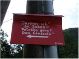 2
2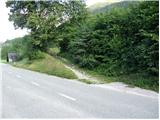 3
3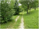 4
4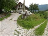 5
5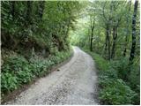 6
6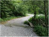 7
7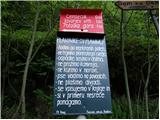 8
8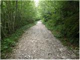 9
9 10
10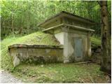 11
11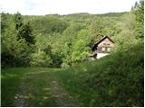 12
12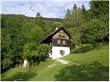 13
13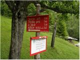 14
14 15
15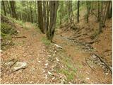 16
16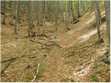 17
17 18
18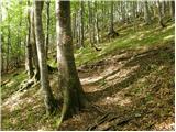 19
19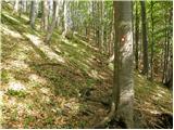 20
20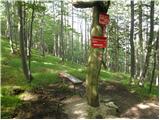 21
21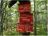 22
22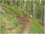 23
23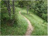 24
24 25
25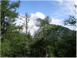 26
26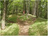 27
27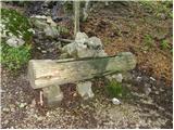 28
28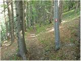 29
29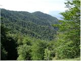 30
30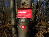 31
31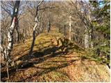 32
32 33
33 34
34 35
35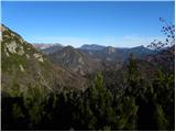 36
36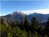 37
37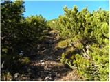 38
38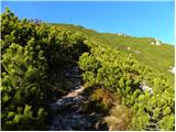 39
39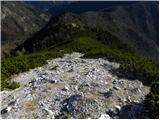 40
40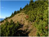 41
41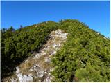 42
42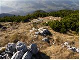 43
43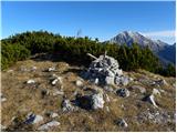 44
44 45
45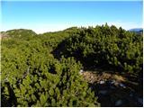 46
46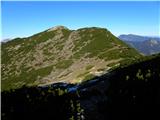 47
47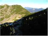 48
48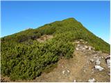 49
49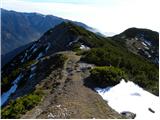 50
50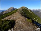 51
51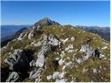 52
52 53
53
Discussion about the trip Spodnja Kokra - Srednji vrh
|
| Micky14. 11. 2011 |
With PD Cerknica we spent a wonderful Sunday, warm, sunny and without the slightest breeze. We climbed to Srednji vrh, where we had a really nice view of Storžič, Grintavec, Kočna, Tolsti vrh, Košuta and of course our father peak. Well, the other side was a bit foggy below us. But the view magnificent nonetheless. Descent to Mač and we happily ended the day after a 7-hour hike. Recommend.
|
|
|
|
| lepenatka18. 09. 2023 13:56:23 |
Yesterday's day was ideal for this tour. Finally it was its turn. Including Javorov vrh.
From Srednji vrh descent to Dolgo njivo and to Hudičev boršt and return to Kokra.
Before that, a stop at the Čemšenik hut.
Great food and team that takes care of our wishes
|
|
|
|
| ppegan19. 09. 2023 09:11:21 |
Lepenatka, it was really nice to meet you again. Come again, we'll be glad to see you
|
|
|
|
| lepenatka19. 09. 2023 09:40:34 |
We were also happy to meet.
We'll surely visit these beautiful parts again sometime
|
|
|
To post a comment you must log in:
If you do not yet have a username, you must first
register.