Türlwandhütte - Hoher Dachstein (Super Ferrata)
Starting point: Türlwandhütte (1695 m)
Starting point Lat/Lon: 47.4501°N 13.61762°E 
Path name: Super Ferrata
Time of walking: 8 h 30 min
Difficulty: extremely difficult marked way
Ferrata: E
Difficulty of skiing: no data
Altitude difference: 1300 m
Altitude difference (by path): 1600 m
Map:
Access to starting point:
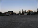
Through the Karawanks Tunnel we drive into Austria, then we continue driving on the Tauern motorway. Further, we drive through the Katschberg Tunnel and later also the Tauern Tunnel / Tauerntunnel, but we follow the motorway towards Salzburg (also Solnograd) only to the exit for Radstadt, Schladming. We continue on the road to the town of Schladming where we then continue left onto the ascending road following the signs for Ramsau. In the town of Ramsau we continue a good 2 km further on the mentioned road, then we turn right onto the toll road, where the signs for the gondola cable car direct us. We follow this road all the way to the large parking lot in front of the lower station of the gondola cable car.
Path description:
From the parking lot, we continue past the lower cable car station following the signs to Südwandhütte. The path first leads along the right side of the cable car through a sparse larch forest, later turns left and crosses the slopes to the west. Soon a path branches off to the right towards the climbing garden (Klettergarten). We continue crossing the slopes to the west and from the left the path from a lower starting point joins us. From the junction there then follows about 10 minutes of walking on a scenic slope to the Südwandhütte hut.
From the hut, we continue following the signs »Klettersteig Anna« and in a gentle descent cross the slope to the north. The path quickly brings us to a junction, where we continue left downhill, straight ahead the path leads to the climbing route Johann. From the junction, the path begins to descend somewhat more steeply past sparse dwarf pines and brings us back to a junction. This time we continue right following the signs »Klettersteig Anna«, left the path leads downhill to the alpine pastures Glösalm and Bachalm. The path soon brings us to scree slopes which we cross for some time, then a signpost directs us slightly right, straight ahead the path leads to the Adamek Hütte hut. Further on, the path is marked with red dots and after a short ascent brings us to the start of the climbing section.
The climbing path already at the start ascends almost vertically up a pillar, aided by numerous bolts (difficulty C/D). The path then becomes slightly less demanding and soon turns right where we ascend along the steel cable on a steep rocky slope. A more demanding ascent with bolt assistance follows, bringing us to the point called Mittersteinköpfl (C). The path then turns left and a short traverse to smooth slabs follows (B). The path then ascends the smooth slabs upwards (B/C) and then steeply ascends with bolt assistance (C). An ascent of a very steep gully follows (C/D). Further on, the path becomes a shade less demanding (up to B/C), but remains very exposed. In the final section, the path becomes more demanding again and ascends a vertical smooth wall with the aid of numerous bolts (D). The path then gradually becomes less demanding and an ascent along the steel cable on a less demanding ridge to the summit follows.
From the summit, we continue along the ridge and after a short descent join the direct path from the Südwandhütte hut.
The path, marked with red dots, continues crossing slopes to the west. In early summer, snowfields may still be present on this section. The path then turns right and ascends the scree to the start of the climbing path Johann Klettersteig.
The climbing path first ascends along the steel cable towards the wall (difficulty C), then a short traverse left follows, bringing us to the entry overhang, the most difficult point on the entire route (difficulty E). Bolts assist over the overhang, but considerable arm strength is still required for the ascent. From the overhang, which is not overly long, a steep ascent with bolt assistance follows (difficulty D). For a short time the path becomes a shade easier (difficulty B), then it ascends steeply again along the steel cable (difficulty C/D). Further on, the path ascends a steep slope for some time (difficulty up to B/C) and brings us to a short level section where a rest is possible.
The path becomes more demanding again and first ascends along the steel cable (C), bringing us to an even steeper section. Further on, we ascend mostly vertical wall for some time, aided by numerous bolts (C/D). Higher up at the point called Adlerhorst (2470 m), the path becomes even more exposed and ascends a vertical smooth wall (D). The vertical ascent is relatively long, but numerous bolts also assist on this section, easing the climb. The path then brings us to a somewhat wider ledge where there is a lot of loose rock, so we must take great care not to dislodge stones.
On the ledge the path turns slightly right and after a short steep ascent (C/D) brings us to the logbook box at 2500 m altitude. Further on, the path becomes somewhat less demanding and only occasionally ascends more steeply. In the final section towards the hut, the more demanding parts become increasingly frequent (difficulty up to D). Right at the end of the Johann climbing path, an exposed exit traverse follows, bringing us to the Seethalerhütte hut. At the hut, located right next to the glacier, a fine view opens to the north and the mountains above the glacier.
From the hut, we continue on a wide groomed path across the glacier, which begins to descend gently. Soon we reach a bend where the path turns right downhill. At this point we leave this path and head decisively left towards the east ridge of Hoher Dachstein summit. During the glacier ascent we will also cross a crevasse, marked by a warning sign. On this section the glacier is still relatively flat and soon we arrive below the rocky slopes of the east ridge where we leave the glacier.
To the start of the secured path we must first climb about 20 metres from the glacier up a fairly steep unsecured slope. Rope belaying is recommended on this section. The initial steep part can be avoided by continuing briefly on the glacier then sharply left up a narrow gully to the secured path. In this section the glacier is slightly steeper and we cross another small crevasse.
Once at the secured path, we continue ascending fairly steeply along the east ridge (difficulty up to B). The path then becomes a shade less steep and runs along the right side of the ridge. Later the path turns right from the ridge and after traversing a ledge joins the path running across the glacier.
At the junction we continue left and begin ascending somewhat more steeply again (B). Further on, the path ascends steeply several times with bolt and bracket assistance, then we soon reach the summit.
The described path is extremely demanding and rated difficulty level E. The path is also very long, so it is suitable only for experienced mountaineers with sufficient fitness and a lot of arm strength.
From the summit we descend the ascent path to the glacier then along the groomed path across the glacier to the upper station of the gondola cable car. Instead of the cable car, descent is also possible on foot via the Hunerscharte col (difficulty B).
Pictures:
 1
1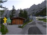 2
2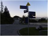 3
3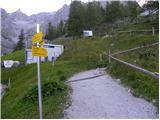 4
4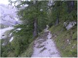 5
5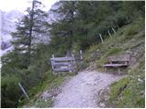 6
6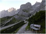 7
7 8
8 9
9 10
10 11
11 12
12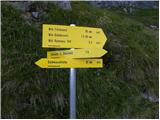 13
13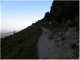 14
14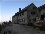 15
15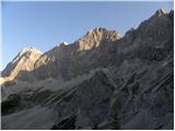 16
16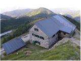 17
17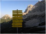 18
18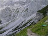 19
19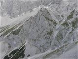 20
20 21
21 22
22 23
23 24
24 25
25 26
26 27
27 28
28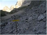 29
29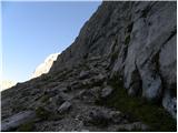 30
30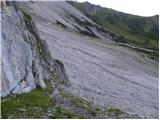 31
31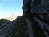 32
32 33
33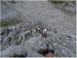 34
34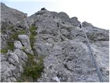 35
35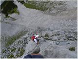 36
36 37
37 38
38 39
39 40
40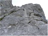 41
41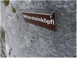 42
42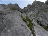 43
43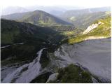 44
44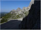 45
45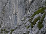 46
46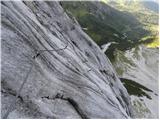 47
47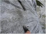 48
48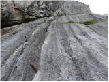 49
49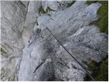 50
50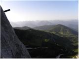 51
51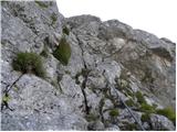 52
52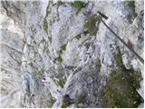 53
53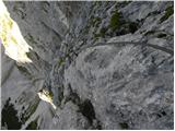 54
54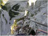 55
55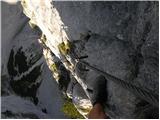 56
56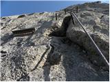 57
57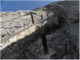 58
58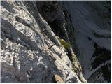 59
59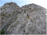 60
60 61
61 62
62 63
63 64
64 65
65 66
66 67
67 68
68 69
69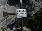 70
70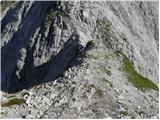 71
71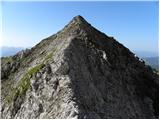 72
72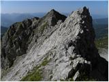 73
73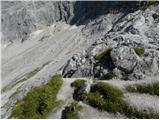 74
74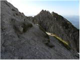 75
75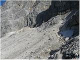 76
76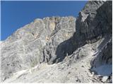 77
77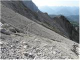 78
78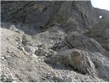 79
79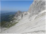 80
80 81
81 82
82 83
83 84
84 85
85 86
86 87
87 88
88 89
89 90
90 91
91 92
92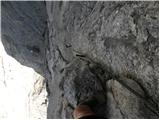 93
93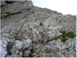 94
94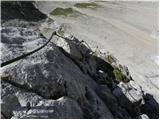 95
95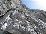 96
96 97
97 98
98 99
99 100
100 101
101 102
102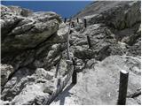 103
103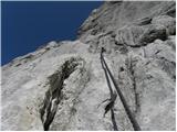 104
104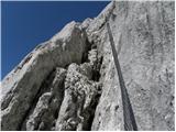 105
105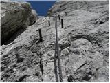 106
106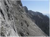 107
107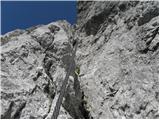 108
108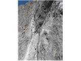 109
109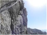 110
110 111
111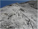 112
112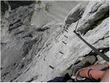 113
113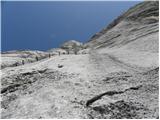 114
114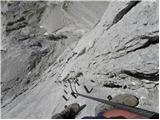 115
115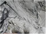 116
116 117
117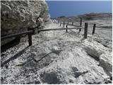 118
118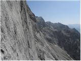 119
119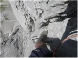 120
120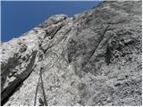 121
121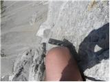 122
122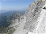 123
123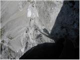 124
124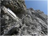 125
125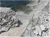 126
126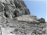 127
127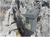 128
128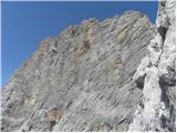 129
129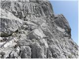 130
130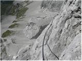 131
131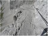 132
132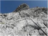 133
133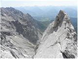 134
134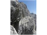 135
135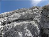 136
136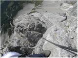 137
137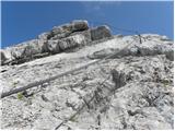 138
138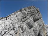 139
139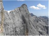 140
140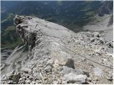 141
141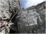 142
142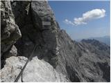 143
143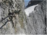 144
144 145
145 146
146 147
147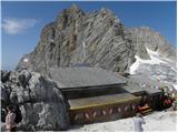 148
148 149
149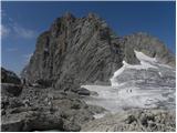 150
150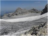 151
151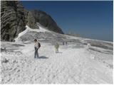 152
152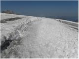 153
153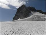 154
154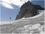 155
155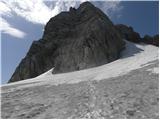 156
156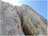 157
157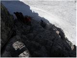 158
158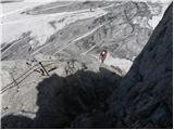 159
159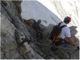 160
160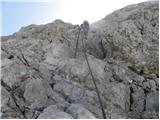 161
161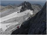 162
162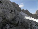 163
163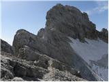 164
164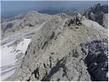 165
165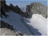 166
166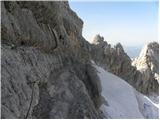 167
167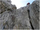 168
168 169
169 170
170 171
171 172
172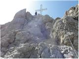 173
173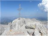 174
174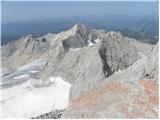 175
175 176
176