Starting point: V Koncu (900 m)
| Latitude/Longitude: | 46,34200°N 14,56820°E |
| |
Walking time: 3 h 15 min
Difficulty: difficult marked way
Elevation gain: 1147 m
Elevation difference along the route: 1147 m
Map: Kamniške in Savinjske Alpe 1:50.000
Recommended equipment (summer): helmet
Recommended equipment (winter): helmet, ice axe, crampons
Views: 52.007
 | 6 people like this post |
Access to starting point:
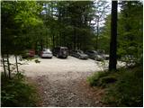
Drive to Kamnik and continue along the road towards the Kamniška Bistrica valley. From Dom v Kamniški Bistrici continue driving along the forest road, which higher up leads to a junction where we continue straight (right Jermanca, starting point for Kamniško sedlo). The road then leads past Žagana peč to the parking lot at the lower station of the freight cable car to Kokrsko sedlo.
In winter, driving from Koča v Kamniški Bistrici to the parking lot V Koncu is prohibited (traffic sign), which extends the walk by almost an hour.
Route description:
From the parking lot at the freight cable car we head onto the initially gentle footpath towards Kokrsko sedlo. The path first crosses a belt of shrubs, then enters dense forest where it starts to ascend more steeply. Higher up the forest becomes somewhat thinner, opening up some views of the surrounding peaks. The path, which continues to ascend steeply, higher up leads us to two consecutive steel cables (completely undemanding when dry), after which we reach a pleasant resting place with a bench.
The path ahead returns to dense forest, then begins to turn right, where the steepness of the path also eases for a short time. A little further the path leaves the forest, crosses an indistinct gully and then leads us onto avalanche slopes below Kokrsko sedlo. Here the path turns slightly left and begins to ascend steeply over a mostly rocky slope. The rather strenuous path (due to scree), which runs below the walls of Kalška gora on the left and the lesser-known Mali vrh on the right, eventually leads us, with increasingly beautiful views, to Cojzova koča na Kokrskem sedlu.
From the saddle we continue left on the marked path towards Kalški greben and Krvavec. The path ahead initially continues along and beside the ridge, then leads us to a crumbly gully, which we ascend via a slightly exposed passage. The path ahead ascends more steeply, then passes onto the scree slopes of Kalška gora (here at the beginning of the scree we will notice an old climbing route to Kalška gora, which has been abandoned for many years). Crossing the scree follows (possible snow patches in early summer), then the path turns left into the wall, where it ascends very steeply. During the ascent over the relatively crumbly wall we are helped by protections (mostly pitons) and numerous holds. Higher up the wall flattens somewhat and after a few more minutes of walking the path leads us to a small saddle where there is a junction.
From the saddle, from which we have a beautiful view of Kalce, we continue left towards Kalška gora (slightly right Krvavec, right Kalški greben). The path ahead passes onto steep and especially when wet slippery grassy slopes. We then follow this relatively gentle path all the way to Kalška gora, which we reach after a good 5 minutes of further walking.
V Koncu - Kokrsko sedlo 2:15, Kokrsko sedlo - Kalška gora 1:00.

Photos:
 1
1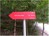 2
2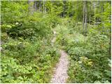 3
3 4
4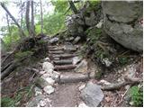 5
5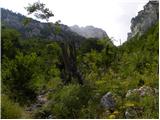 6
6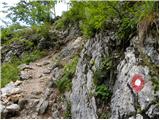 7
7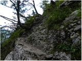 8
8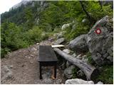 9
9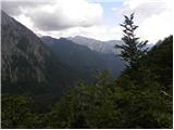 10
10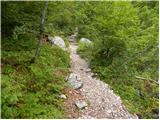 11
11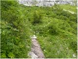 12
12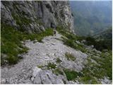 13
13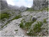 14
14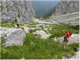 15
15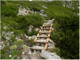 16
16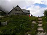 17
17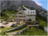 18
18 19
19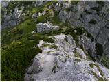 20
20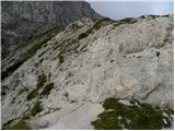 21
21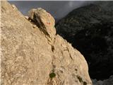 22
22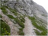 23
23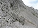 24
24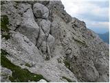 25
25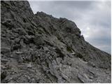 26
26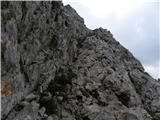 27
27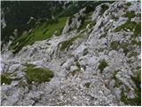 28
28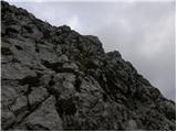 29
29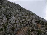 30
30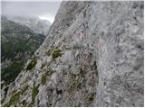 31
31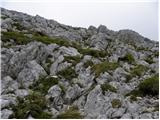 32
32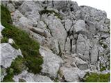 33
33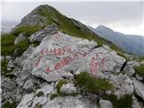 34
34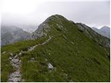 35
35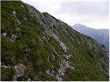 36
36 37
37 38
38 39
39 40
40 41
41
Discussion about the trip V Koncu - Kalška gora
|
| Gost3. 07. 2007 |
Nice hike and nice goal - nice views above Kokrsko sedlo. Even on Sundays the path is not crowded (above the hut). Caution is not superfluous, because the path is quite crumbly and there is quite a bit of material on it.
|
|
|
|
| Gost15. 09. 2007 |
Wonderful mountain tour. From Kokrsko Sedlo to Kalška Gora we ascend also on pegs and cables. Especially on descent great caution is required. Otherwise from the peak splendid view of surrounding summits and Velika Planina.
Marjetka Rot
|
|
|
|
| fpetel15. 09. 2008 |
There is a nicer and more direct access via an easy unmarked path from Žagane peči. Last week I climbed up. Maybe I'll post pictures, which despite the fog are still quite good.
|
|
|
|
| viharnik5. 09. 2008 |
A little before the Žagane peči rock, there is a small parking on the left side. From there in the forest, not far away, a hunting path leads steeply uphill, crosses some steep forest gullies, finally enters a clearing with a hunting hut at approx. 1350m. Further on, easily through a natural gully. Here at the end of the gully to the right, an unmarked path branches off to the panoramic but crumbly Čmaževski turn-viewpoint (bivouac under Skuta, large part of the ridge). Straight ahead, and in one hour we reach Kalška gora. LP-ROK. LP-ROK.
|
|
|
|
| fpetel15. 09. 2008 |
The path branches off about 20 meters behind the rock in the direction towards Konca at the first small parking on the left side. So there's no mistake.
|
|
|
|
| srfar13. 10. 2009 |
I'm wondering what the path from Kamniška Bistrica to the parking lot at the end is like. And if anyone knows if Cojzova koča is still open this weekend-17.10.
LP and thanks in advance for the answers
|
|
|
|
| EUGEN13. 10. 2009 |
According to the latest information I got from Mr. Vida, the koča closes on 12.10.2009
|
|
|
|
| frenk6521. 08. 2010 |
I'm concerned about picture 31. I'm interested if anyone has already walked this path. I would go from Cojzova koča to Krvavec. What is the difficulty and duration.
|
|
|
|
| jprim22. 08. 2010 |
I've walked this path twice, always for descent, which is harder than going up, don't let this photo worry you, maybe it looks like that from the photographer's position.
How to continue over the ridge to Kalški greben, I can't advise you, it was already planned to cross it, but the weather didn't allow.
LP!
|
|
|
|
| AnzeKozjek24. 07. 2013 |
I'm interested in what the exposed passage on picture 22 really looks like? Is it very exposed? If I compare it to the Slovenska pot to Ledine, could this be a more demanding, exposed path? Thanks for the answer! Best regards
|
|
|
|
| Daaam24. 07. 2013 |
I dare say it's easier than the Slovenska pot to Ledine. The passage isn't that exposed either. I'd say the photo might mislead a bit. All this is my subjective opinion ..so no one scolds me for misleading people ..so no one scolds me for misleading people 
|
|
|
|
| CarpeDiem24724. 07. 2013 |
With some caution you won't have problems. E.g. Žrelo to Ledine is certainly more demanding than this section (my opinion of course).
|
|
|
|
| Bandzo4. 08. 2013 |
Yesterday I walked this path from the hut at the source of Kamniška Bistrica. Wonderful tour, the summit is completely deserted, very panoramic and intended for resting and finding some peace. The only thing that can tire you a bit is the path to Kokrško sedlo. I have to admit, it dragged on a bit for me =)Regarding pictures 22 and 31, I have to tell future visitors of this mountain that the pictures look much worse than the sections actually are. On the path you have to be careful due to the friability, especially when going downhill, as you can easily trigger a stone that can fall on someone in front of you. Otherwise, I warmly recommend visiting Kalška gora!
Good luck!
|
|
|
|
| mojcika12. 10. 2017 |
I visited Kalška gora on 8.10.2017...not the first time, but it's always interesting. It was wonderful....the mountain, as well as the path itself. Burning larches and herds of chamois grazing under Kokrško sedlo, which we few hikers observed from the path from Kokrško sedlo to the summit. Unfortunately, the hut at the saddle was already closed and there was no hot tea. On the descent, I twisted my ankle after falling on the rocky path. With the help of two male hikers and a female hiker, I descended to the car. Since I don't know their names, I want to thank them here for their patience. Climbing the mountain means a lot to me, as my illness no longer allows me to visit higher mountains. With great effort, I thus visited five two-thousanders this year. Dear hikers who overtake in the mountains and like to tell how fast you are and how much you've already walked that day, there are also those among you who may invest more effort but walk slower. Thanks to those for whom help and friendship in the mountains also mean a lot. It's nicer in the mountains because of them too.
|
|
|
|
| trdi6. 07. 2019 |
Great path from Cojzova koča to the summit. Climbing section short, looks worse in photos than reality. Path not that exposed, most exposed bit on ridge from Kalški greben junction further towards Kalci. Careful on descent at pinned section, otherwise no issues.
|
|
|
To post a comment you must log in:
If you do not yet have a username, you must first
register.