Za koridorjem - Sabotin (direct way)
Starting point: Za koridorjem (200 m)
Starting point Lat/Lon: 45.9847°N 13.6229°E 
Path name: direct way
Time of walking: 1 h
Difficulty: easy marked way
Difficulty of skiing: no data
Altitude difference: 409 m
Altitude difference (by path): 409 m
Map: Goriška - izletniška karta 1:50.000
Access to starting point:
From the direction of Bovec-Tolmin we drive along the Soška cesta towards Nova Gorica to the traffic-light intersection above the cemetery in Solkan. Here we turn right and drive across the bridge over the river Soča into Goriška Brda.
From other directions we drive to Nova Gorica and follow the signs Bovec-Tolmin. If we drive through Nova Gorica and Solkan, then at the end of Solkan we drive left across the bridge over the river Soča into Goriška Brda. If we drive past Nova Gorica, we follow the signs for Bovec-Tolmin and via the Solkan bypass reach the traffic-light intersection above the cemetery in Solkan.
Here we turn left and then immediately drive right across the bridge over the river Soča into Goriška Brda.
The road starts ascending right behind the bridge. After two large turns we drive past the parking lot on our left and 500 m higher on our right we notice stairs that lead to Sabotin via the south path.
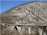
Soon after the stairs we arrive in Italy, where the road flattens. After approximately 1 km of driving through the "corridor" in Italy, the road under the overpass starts descending. At the turn we slow down, because immediately when we drive under the next overpass we arrive in Slovenia. Here we must immediately turn left into a smaller parking lot. On our right we see stairs that lead to Sabotin via the path Za koridorjem.
Path description:
Sabotin is a hill of special energies that will enchant you in all seasons. It is most beautiful in spring when it fully blooms and in late autumn when its slopes turn red with sumac. In winter the sun will nicely warm us on its southern slopes, in summer it is too hot even for horned vipers. The most suitable time to visit Sabotin is from September to May. Later only very early in the morning or by car. An asphalt road from Goriška Brda leads to the mountain hut and refreshment hut, which are in the premises of the former guardhouse right below the summit. There is a mini museum in the refreshment hut, and you can arrange a guided tour of the caverns, which are illuminated and arranged.
The path Za koridorjem is less visited than the south path, which is more popular with most people. However, it is more suitable for ascending Sabotin from spring onwards, when temperatures on the southern slopes quickly rise to stifling heat.
The path from the start is not as scenic as the south path, but it is somewhat steeper than it.
On this path too we will need good footwear and on warmer days plenty of fluids, since Sabotin is not challenging due to its elevation but due to the heat.
From the parking lot we cross the road and ascend the stairs. The path already from the start moderately ascends through a sparse forest, which provides some shade on warmer days.
When the path after a few turns flattens for the first time, we will notice a pathlet on our right. It leads to the asphalt road on the Italian side, which runs from the village Šentmaver/San Mauro to the Italian guardhouse on Sabotin. We can approach the mentioned path higher up several more times and use it on the return.
We continue the ascent on the usual path, which ascends the slope supported by stumps and brings us after a few minutes to a cavern with an interesting arched entrance, where we turn left. If we followed the pathlet to the right, we would reach the road from the village Šentmaver in a couple of steps.
The path from the cavern continues ascending and after five minutes brings us to a rocky bend, from where a nice view opens onto the Soča River, which winds towards the sea, and onto the ossuary at Oslavje/Oslavia (white round building in the Italian Brda/Collio). After a further 15 minutes we arrive at a gravel path, where there is also a bench for a short rest. The gravel path leads from the nearby bend of the asphalt road that goes to Sabotin from Goriška Brda and after a few meters joins the road that runs on the Italian side from Šentmaver. If from the hut or refreshment hut on Sabotin we no longer feel like going along the ridge, we descend along the road to this bend, where we join the path Za koridorjem.
From the junction at the bench we continue straight uphill. After a 10-minute steep ascent we arrive at the edge of a meadow that extends to the right towards the Italian guardhouse. The meadow from spring to the beginning of summer is a real botanical garden, which unfortunately is increasingly overgrown. If we want to admire the flowers, we can follow the pathlet that gently ascends to the right across the meadow towards the Italian guardhouse, and from there to the summit; otherwise, we continue the ascent towards the summit along the usual path on the Slovenian side. Also on this section of the path, which higher up rises among black oaks, we will see pasque flowers in spring, and later irises, lilies, orchids and other wonderful flowers. Just below the summit we cross a shooting trench, where in early spring we can also see beautiful cowslips or auriculas. Sabotin is one of the lowest sites of this alpine flower in Slovenia.
At the top of the ridge we head right and after a couple of minutes reach the summit of Sabotin, from where beautiful views open in all directions.
If we chose the path to the left, we reach the refreshment hut and mountain hut in 10 minutes, which are in the premises of the former guardhouse.
We can descend to the valley along the ridge or below the ridge to the church of St. Valentin.
From here we have two options:
Option 1:
If we go along the ridge to the church of St. Valentin, then we continue along the south path past the former inscription Naš Tito. We follow the path for a few more turns until we pass the newly plowed path. We continue along the old path to the next junction, where it turns left, but we go straight past a larger rock, where we are soon on the Italian side of the hill. The path gently rises and descends until it brings us to the log cabin. From here we gently descend along the cart track to the junction at the larger rock, where we continue right uphill. Left downhill we join the south path.
The path along the cart track gently rises to the road that comes from Šentmaver. We continue downhill along the road to the 3rd bend/tornante, where via a pathlet we join the path Za koridorjem right below the cavern with the arched entrance.
Option 2:
If from the summit we go along the path below the ridge, we continue to the cart track that comes from the church of St. Valentin. Here instead of right towards the road and bench at bend no. 5, we turn a couple of steps left (in the direction of the church) and continue along the marked path that descends from the cart track to the right. The path flattens in the lower part and later splits into two parts. If we turn left, we join the south path below the former inscription Naš Tito. From here we continue as described under option 1.
If we go right, our path will soon start to descend very steeply over rocky terrain to the path that comes from the south path, as described under option 1. We continue right and soon arrive at the log cabin. From here we gently descend along the cart track to the junction at the large rock, where we continue right uphill. Left downhill we join the south path. The path along the cart track moderately rises to the road that comes from Šentmaver. We continue downhill along the road to the 3rd bend/tornante, where via a pathlet we join the path Za koridorjem right below the cavern with the arched entrance.
No problem if we forgot where to turn and arrived almost at the end of the south path. Instead of turning left onto the path that leads to the stairs on the south path, we continue straight along the marked path that comes from the village Šentmaver. After a few minutes' descent we arrive at a narrower road that leads above the corridor of the road to Goriška Brda. We continue right and walk the road to the end of the corridor. Here we join the road that leads to Sabotin from the village Šentmaver. We continue along the road right uphill for just a few meters and then along the cart track that we see on the left side. After a few minutes crossing the slope, we arrive on the Slovenian side at the path Za koridorjem. From here only a short descent to the parking lot remains.
Higher above the road corridor (behind the second wire fence) there is also a pathlet, but it is very overgrown in places, so it is easier and faster to walk the corridor along the road.
Pictures:
 1
1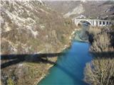 2
2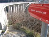 3
3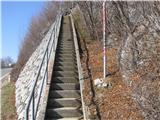 4
4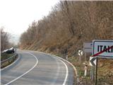 5
5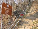 6
6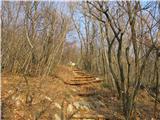 7
7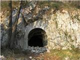 8
8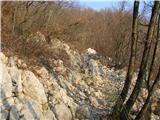 9
9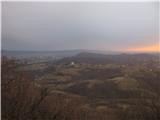 10
10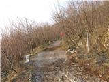 11
11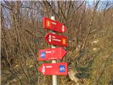 12
12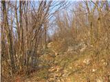 13
13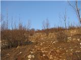 14
14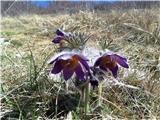 15
15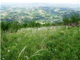 16
16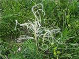 17
17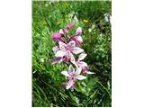 18
18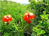 19
19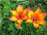 20
20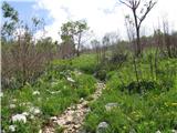 21
21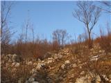 22
22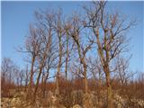 23
23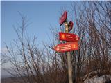 24
24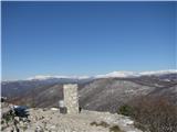 25
25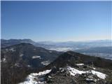 26
26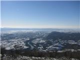 27
27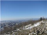 28
28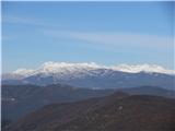 29
29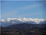 30
30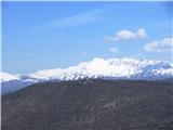 31
31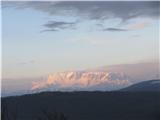 32
32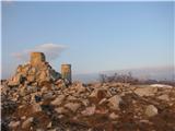 33
33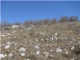 34
34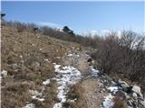 35
35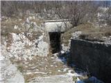 36
36 37
37 38
38 39
39 40
40 41
41 42
42 43
43 44
44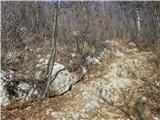 45
45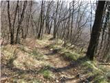 46
46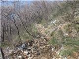 47
47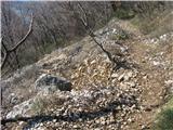 48
48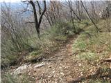 49
49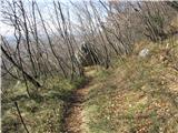 50
50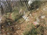 51
51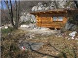 52
52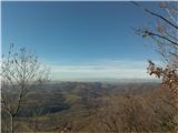 53
53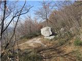 54
54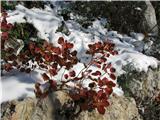 55
55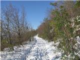 56
56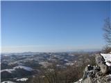 57
57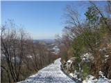 58
58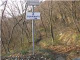 59
59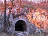 60
60 61
61