Zaboršt (Poljšica pri Bledu) - Planina Rčitno
Starting point: Zaboršt (Poljšica pri Bledu) (600 m)
Time of walking: 1 h
Difficulty: easy marked way
Difficulty of skiing: no data
Altitude difference: 300 m
Altitude difference (by path): 300 m
Map: Julijske Alpe - vzhodni del 1:50.000
Access to starting point:
From the Ljubljana - Jesenice highway, take the Lesce exit, from where we continue driving towards Bled, Pokljuka and Zgornje Gorje. When we have passed through the villages of Rečica and Spodnje Gorje and arrived there, at the church in the middle of the village we notice a signpost for the village Poljšica (left). We descend through the street among the houses, along the road and turn first right, then also left (sign). Soon we find ourselves in the middle of the field, where the winding road after less than a kilometer brings us to the crossroads of four narrow roads, in front of which stands the place sign "Poljšica". We look for a suitable place for parking.
Path description:
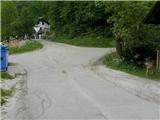
At the crossroads where we start the trail, we first turn onto the right road (Zaboršt), where on the left we encounter a fork in the roads with signs Zatrata and Zaboršt. We turn left towards Zatrata and continue uphill on the asphalt road. Soon on the left side we notice the equipped climbing wall, and continue ahead on the road. When the asphalt ends (bench on the right), at the junction we continue slightly left on the macadam road, which soon brings us to the next junction (straight ahead meadow), where we choose right into the forest. The slightly worse forest road turns somewhat left and descends over a smaller saddle to the forest road that comes from the left from the direction of Bled. We continue right on the road, which steadily ascends moderately. A bit further on the right we notice the pasture fence with inscription, and continue straight on the road. When on the left side of the road we again encounter a bench, the marked trail Camp Bled - Planina Rčitno joins from the left. From here on we follow the blazes, which actually lead us along the main forest road. Then, when we miss the left branch-off, the road ascends somewhat more steeply and soon after almost levels out. Here beside the road we encounter the stone trough below Križi - with info board. When thereafter we miss another left branch-off, the trail (forest road) ascends somewhat more steeply again. Higher, where it levels out somewhat, it turns left, and beside the road we encounter the already seen signs - Riklijeva pot, Bled, Rčitno - (smaller hay shed on the right). The trail from here almost levels out for a while and thereafter ascends again somewhat more to the west. Soon a view towards Babji zob and Galetovec begins to open on the left, the road becomes somewhat gravelly for a while and ascends twice more somewhat more steeply. When it levels out, only a few minutes of easy walking remain to the place where on a tree we notice a small sign with inscription Rčitno, straight ahead the forest opens into a fairly large and picturesque Planina Rčitno, on which there are quite a few nice weekend cottages, some already antique. The trail, which branches off left somewhere in the middle of the pasture, leads to Slamniki above Bohinjska Bela, and from there further to Galetovec.
Pictures:
 1
1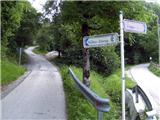 2
2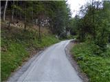 3
3 4
4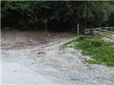 5
5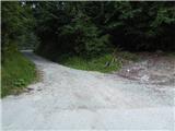 6
6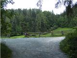 7
7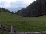 8
8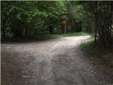 9
9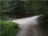 10
10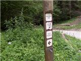 11
11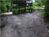 12
12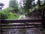 13
13 14
14 15
15 16
16 17
17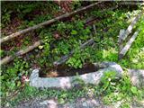 18
18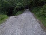 19
19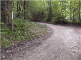 20
20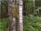 21
21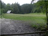 22
22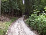 23
23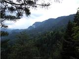 24
24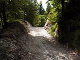 25
25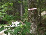 26
26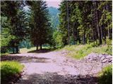 27
27 28
28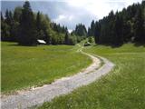 29
29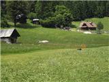 30
30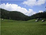 31
31