Rudno polje - Koča na Uskovnici
Starting point: Rudno polje (1347 m)
Starting point Lat/Lon: 46.3458°N 13.9236°E 
Time of walking: 50 min
Difficulty: easy marked way
Difficulty of skiing: no data
Altitude difference: -193 m
Altitude difference (by path): 10 m
Map: TNP 1:50.000
Access to starting point:
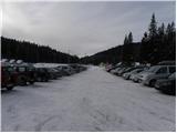
From the Ljubljana-Jesenice highway, take the Lesce exit and follow the road ahead towards Bled. In Bled, at the traffic lights, the signs for Pokljuka direct us to the right. We then drive through Gorje and past the abandoned ski area Zatrnik to Rudno polje on Pokljuka (large parking lot, barracks and shooting range).
Path description:
From the parking lot, we continue along the road (in winter a cross-country ski trail) in the direction of the Koča na Uskovnici mountain hut. The road first leads past the shooting range, then transitions into a spruce forest through which it continues to a smaller but marked crossroad. From the crossroad, we continue on the left lower road (slightly to the right, the road leading to the starting point for Planina Konjščica and car access to Uskovnica), which is closed to public traffic by a traffic sign. Along the road, in a few minutes we descend into the grassy valley of Španove jame, where after a few minutes the road splits into two parts.
We continue straight ahead (left upper part of Planina Praprotnica and footpath to Planina Zajamniki) and proceed along the road, which with nice views on Spodnje Bohinjske gore descends barely noticeably. A little lower we arrive at the area named Razpotje, where there are several successive crossroads. Here we carefully follow the signs and stick to the direction for Uskovnica or Koča na Uskovnici. After the last crossroad we begin to descend more steeply along the road, along which we quickly reach the bridge over the Ribnica stream (Ribnica is the stream that separates Uskovnica from Pokljuka). On the other side of the bridge the road turns sharply to the left and levels out, or even rises slightly for a short time. The road then quickly takes us out of the forest, where we reach a marked crossroad.
We continue left in the direction of the Koča na Uskovnici mountain hut (right road to Planina Konjščica, straight ahead to Vodnikov dom and Triglav), along the road that bypasses the nearby chapel on the left side. After a short descent we leave the road and head slightly left onto the path, which continues between some shepherd huts or holiday cottages, then along the marked path that leads us across hummocky meadows, and in a few minutes we reach the Koča na Uskovnici mountain hut.
Trip can be extended to: Planina Zajamniki
,
Planina Konjščica
,
Planina pod Mišelj vrhom
,
Velo polje
,
Vodnikov dom
,
Ablanca
,
Jezerski Stog
,
Viševnik
,
Mali Draški vrh
,
Vernar
,
Veliki Draški vrh
,
Tosc
,
Dom Valentina Staniča
,
Dom Planika
,
Triglavski dom na Kredarici
,
Triglav
Pictures:
 1
1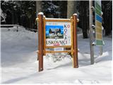 2
2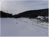 3
3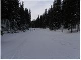 4
4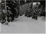 5
5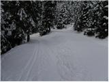 6
6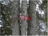 7
7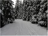 8
8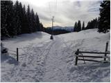 9
9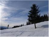 10
10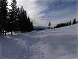 11
11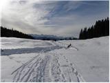 12
12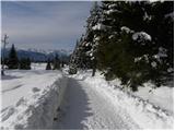 13
13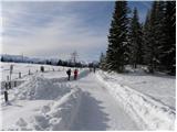 14
14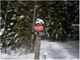 15
15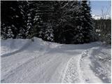 16
16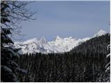 17
17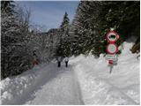 18
18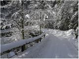 19
19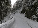 20
20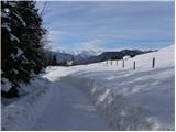 21
21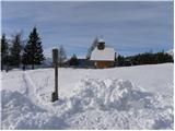 22
22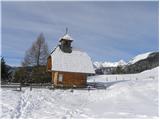 23
23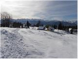 24
24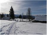 25
25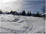 26
26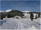 27
27 28
28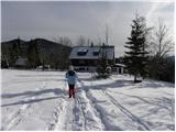 29
29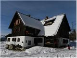 30
30