|
|
|
|
 Mojčin dom on Vitranc Mojčin dom on VitrancNina, 328 m ascent in a kilometer is steep, but its not extreme steepness. There are quite a few easy marked paths where you ascend more than 400...  Martinj Trail Martinj TrailA hike across Martinj trail a few days ago opened a philosophical question: 80kg and 65kg person fin...  Kanjavec KanjavecToday from Zadnjica over Komar to Dolič, then past Kanjavecs tooth to the eastern and western summit...  Ratitovec RatitovecTo me the most beautiful path, walked many times, and a nice circular can be made, extend towards So...
|
|
|
|
|
|
|
 Slovenian two-thousanders Slovenian two-thousandersNice, you told them, Vinko! Those who refer to prominence are looking for an excuse in them and some...  Found/Lost Found/Lost30.7.26 on the path across Škarjev rob (Storžič- Dom pod storžičem) lost pink sports sunglasses (bra...
|
|
|
New trips
 Stari trg (Pilštanj) - Veliki Javornik (Bohor) Stari trg (Pilštanj) - Veliki Javornik (Bohor)Veliki Javornik, at 1023 meters, is the highest peak of Bohor. Although the summit is unvegetated and there are no higher hills nearby, there is no view from the top as it is surrounded by dense fores... 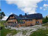 Jassing - Sonnschienhütte Jassing - SonnschienhütteThe Sonnschienhütte mountain hut stands on the extensive and picturesque Sonnschienalm alpine pastur...
|
|
|
|
|
|
|
|
|
|
|
Random trip
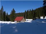 Planina Pečana Planina PečanaThe Planina Pečana mountain pasture is located on the northern (Bohinj) side of Ratitovec. There are a few cottages and, shortly before them, a cross. Due to the nearby forest, there is no view. A stamp is also available on the pasture, attached to a metal pole....
|
|
|
|
|
|
|