Podkraj / Unterort - Končnikov vrh (Walter Mory Klettersteig)
Starting point: Podkraj / Unterort (650 m)
Starting point Lat/Lon: 46.5426°N 14.7744°E 
Path name: Walter Mory Klettersteig
Time of walking: 4 h 5 min
Difficulty: very difficult marked way
Ferrata: C
Difficulty of skiing: no data
Altitude difference: 1459 m
Altitude difference (by path): 1480 m
Map: Koroška 1:50.000
Access to starting point:
A) Over the border crossing Jezerski vrh we drive to Austria, and after approximately 6 km after Železna Kapla / Bad Eisenkappel we turn right towards Velikovec / Völkermarkt. We follow the main road towards Velikovec for 2 km, and then we again turn right, this time in the direction of the settlement Pliberk / Bleiburg. Further, we drive through the valley of Podjuna, and then at the next larger crossroad we turn right towards Pliberk. The road ahead leads through some roundabout, and we follow it further in the direction of the ski slope Peca / Petzen. Further, we drive through Bistrica pri Pliberku / Feistritz ob Bleiburg to a large parking lot at the bottom station of the cableway on Peca. From the border crossing Jezerski vrh to the starting point, there is approximately 40 km.
B) From Dravograd or Slovenj Gradec we drive to Ravne na Koroškem, and then we continue driving in the direction of border crossing Holmec. When we drive into Austria we at first drive towards Pliberk / Bleiburg, and then we follow the signs for ski slope Peca / Petzen. Further, we drive through few villages, and we follow the road to a large parking lot at the bottom station of the cableway on Peca. From the border crossing Holmec to the starting point, there is approximately 8 km.
Path description:
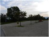
From the parking lot, we at first walk to the bottom station of the cable car, which runs on Peca, and then we go on the path marked with number 3, 7 and 8. The path at first leads on a wide cart track, on which we quickly get to a ski track. We continue by the left edge of the ski slope, and then the path turns a little to the right and brings us into a dense forest. Here it flattens and joins the cart track, on which we slightly descend to the nearby marked crossing. From the crossing, we continue on the left ascending road, where also signs for path number 3 and 7 point us to. Only few minutes higher, the road splits into two parts, where we continue left on the path number 3 (right at first slightly downwards path number 7, which leads towards the mountain pasture Veška planina). Good 100 meters higher, we join also the marked path which leads from the village Rute / Ruttach, so further we several times cross a bad forest road. Higher, the road, on which we occasionally for some time also continue, finally ends, and we continue between two rocks in the forest. The path ahead is steeply ascending through the forest, which in hot days offers a pleasant shade. Higher forest gradually starts to get thinner, and nice views start opening up on Podjuna and mountain chain of Golica. And even a little further footpath turns quite to the left and it brings us below the steep slopes of Mala Peca, where soon climbing path named Walter Mory Klettersteig branches off to the left.
At the crossing, we continue left in the direction of the climbing path and then we start ascending in zig-zags towards a wall where there is the beginning of the climbing path.
In front of the entry into a climbing part of the path, we equip ourselves with a helmet and self-belay set. Climbing path at the beginning ascends diagonally over a rocky slope, and we get help from a steel cable and few stemples. The path then turns to the right and it ascends on slippery slope, on which there is quite a lot of sand and dirt. Next follows a little less steep crossing to the left and then steep ascent right upwards by a short gully. On the top of the gully, the path becomes for a short time less demanding and it brings us to a crossing.
In case if the path was too hard we continue left on an easier path, otherwise we can continue right on harder path. Harder path then after a shorter crossing and ascent on a crumbly slopes brings us to the inscription box, which is situated before the most difficult part of the path. The path here almost vertically ascends, and we get help from numerous stemples. Next follows a steep ascent by the steel cable on an indistinct rocky outside corner. Climbing path then ends and after a short ascent, we come to the vantage point where there is quite a few benches.
We continue on a wide gentle path, which brings us to a macadam road where there is a marked crossing. We continue straight on a steep road to the upper station of the cableway, which we already see in front of us.
At the upper station of the cable car where there is a crossing, we continue straight following the signs »P12 Kordeschkopf«. We at first walk on a gentle cart track, and then the path turns to the right and starts ascending by the ski slope upwards. For a short time, the path from the ski slope turns left in the forest and then it is again ascending by the edge of the ski slope. When we come to the top of the ski slope we continue left and we are then for some time ascending by dwarf pines upwards. Later dwarf pines become a little rarer and then a short ascent follows on a grassy slope to a crossing on the border ridge (Knipsovo sedlo).
At the crossing, we continue right (left Kordeževa glava) and we quickly ascend on Končnikov vrh.
Pictures:
 1
1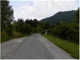 2
2 3
3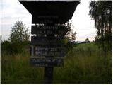 4
4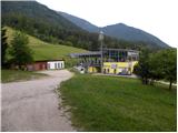 5
5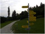 6
6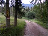 7
7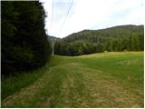 8
8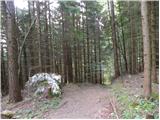 9
9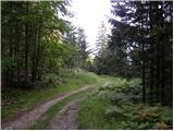 10
10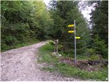 11
11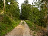 12
12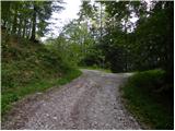 13
13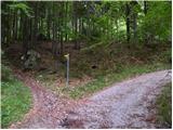 14
14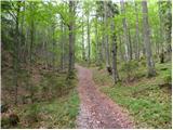 15
15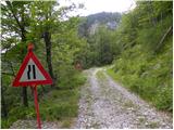 16
16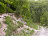 17
17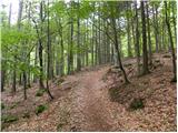 18
18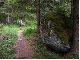 19
19 20
20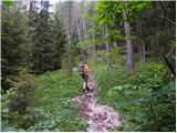 21
21 22
22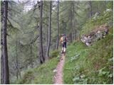 23
23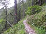 24
24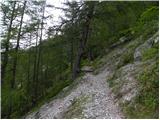 25
25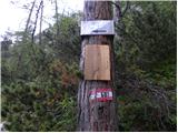 26
26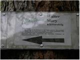 27
27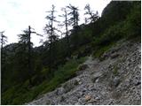 28
28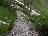 29
29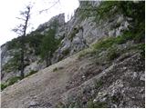 30
30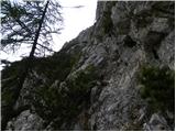 31
31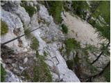 32
32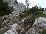 33
33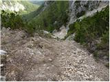 34
34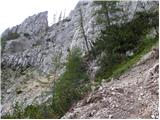 35
35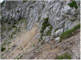 36
36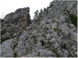 37
37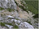 38
38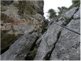 39
39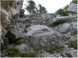 40
40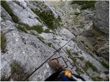 41
41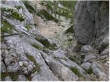 42
42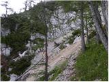 43
43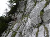 44
44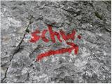 45
45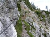 46
46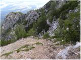 47
47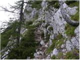 48
48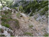 49
49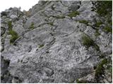 50
50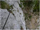 51
51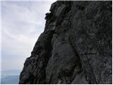 52
52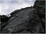 53
53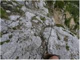 54
54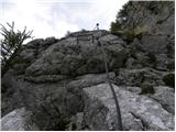 55
55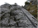 56
56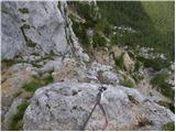 57
57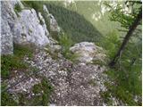 58
58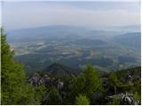 59
59 60
60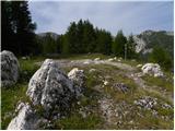 61
61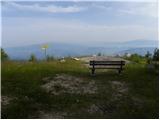 62
62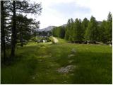 63
63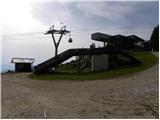 64
64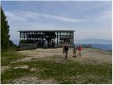 65
65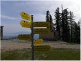 66
66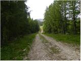 67
67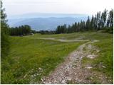 68
68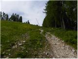 69
69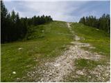 70
70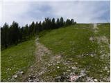 71
71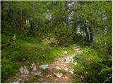 72
72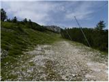 73
73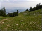 74
74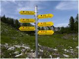 75
75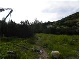 76
76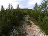 77
77 78
78 79
79 80
80 81
81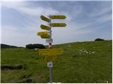 82
82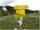 83
83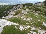 84
84 85
85