Aljažev dom v Vratih - Visoka Vrbanova špica (via Prag)
Starting point: Aljažev dom v Vratih (987 m)
Starting point Lat/Lon: 46.4128°N 13.8466°E 
Path name: via Prag
Time of walking: 4 h 50 min
Difficulty: very difficult marked way
Difficulty of skiing: very demanding
Altitude difference: 1421 m
Altitude difference (by path): 1425 m
Map: Triglav 1:25.000
Access to starting point:
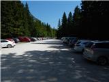
We drive to Mojstrana, then follow the signs for Vrata valley. We continue on the toll road, which is closed to public traffic in winter time, following it to the large parking lot located a few minutes before Aljažev dom v Vratih.
Path description:
From the parking lot we continue along the gravel road closed to public traffic, passing Šlajmerjev dom and quickly reaching Aljažev dom v Vratih.
We bypass Aljažev dom on the right and continue straight towards Triglav, Sovatna, Luknja... (right Škrlatica, bivak na Rušju...). We proceed along the rougher gravel road past the winter shelter to a marked junction by the famous peg (monument to fallen partisan mountaineers).
We continue straight (left Tominškova pot) along an easy path with fine views of Triglav and the Triglav north face. After a few minutes' walk we reach a beech forest where the path over Sovatna branches right; we go straight towards Luknja and Triglav - the path over Prag. A short ascent on a track follows, then markers lead left to a path approaching the bed of Triglavska Bistrica. Here the path passes a memorial to mountain victims and soon reaches the next marked junction.
Straight ahead the path goes to Luknja, we turn left towards the path over Prag, first crossing Triglavska Bistrica stream (the source of Bistrica is a bit higher).
On the other side we soon reach the first steep section aided by initial pegs; after a few minutes the difficulty eases but we continue steeply ascending with ever better views across the valley.
This section is partly overgrown with brush; higher up fixed protection reappears and soon we reach probably the crux of the Prag path: a nearly vertical 15m chimney climbed with brackets and cables. The path eases gradually, Tominškova pot joins from left, and shortly after we reach Begunjski studenec.
We continue steeply but technically easy to a junction near Kotla after about 15 minutes.
Go left to Staničev dom pod Triglavom (slightly right Triglav and Triglavski dom na Kredarici), skirting Kotel valley on the left through high karst terrain past fissures and dolines requiring extra care in fog or snow though technically easy. Higher we cross a short scree, reach plateau terrain, and ascend past fine views of Triglav and surroundings to Dom Valentina Staniča.
From the hut left towards Begunjski vrh, Visoka Vrbanova špica and Cmira (straight Kot valley, right Krma valley and Rjavina, sharply right Triglavski dom na Kredarici and Triglav).
An easy path soon reaches Begunjski preval where the path to Vrbanove špice goes right. A scenic easy path leads to the summit of Visoka Vrbanova špica in minutes.
Starting point - Aljažev dom 0:05, Aljažev dom - source of Bistrica 0:55, source of Bistrica - Begunjski studenec 2:45, Begunjski studenec - Kotel 0:15, Kotel - Dom Valentina Staniča 0:30, Dom Valentina Staniča - Visoka Vrbanova špica 0:20.
On the way: Aljažev dom v Vratih (1001m), Spomenik padlim partizanom gornikom (1020m), V Plazičih (1040m), Izvir Bistrice (1160m), Begunjski studenec (2091m), Kotel (2166m),
Dom Valentina Staniča (2332m), Begunjska vratca (2342m)
Pictures:
 1
1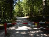 2
2 3
3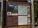 4
4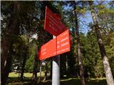 5
5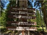 6
6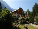 7
7 8
8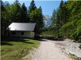 9
9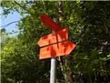 10
10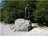 11
11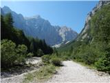 12
12 13
13 14
14 15
15 16
16 17
17 18
18 19
19 20
20 21
21 22
22 23
23 24
24 25
25 26
26 27
27 28
28 29
29 30
30 31
31 32
32 33
33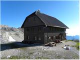 34
34 35
35 36
36 37
37 38
38 39
39 40
40 41
41 42
42 43
43 44
44 45
45 46
46