border crossing Matjaševci - Wegkapelle Kölbereck
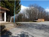
Starting point: border crossing Matjaševci (350 m)
Starting point Lat/Lon: 46.85746°N 16.0861°E 
Time of walking: 25 min
Difficulty: easy marked way
Difficulty of skiing: no data
Altitude difference: 5 m
Altitude difference (by path): 55 m
Map: Pomurje 1:40.000
Access to starting point:
a) From the road Gorenji Petrovci - Kuzma, after the settlement Dolič we turn right towards Matjaševci. In Matjaševci we turn left in the direction of Austria and Tromejnik - Vinska turistična cesta Tromejnik (straight Trdkova and Tromejnik - Gozdna učna pot Tromejnik) and we drive to the border crossing Matjaševci, where we park.
b) We drive into the center of Kuzma, where from the roundabout we take the exit in the direction of Tromejnik. At the following crossroads we follow the signs for Tromejnik; when we arrive at the border crossing Matjaševci, we park in a suitable place.
Path description:
From the starting point, we head to the road along which there are signs for Tromejnik. At first we still walk on asphalt, soon we go straight onto a macadam road, which continues along the state border. The poorer road, or marked cycling path, has several intersections further on, and we follow Slovenian or Austrian blazes and border stones. After some time a somewhat steeper descent follows, where after border stone no. 36 we leave the wider path and continue slightly left on a traceable but less trodden path, which continues directly along the state border. After three minutes of descent at the intersection we reach an asphalt road, and we continue straight (left Toka / Tauka, right Tromejnik) and after a few minutes of moderate ascent, passing a few more houses, we arrive at the chapel Wegkapelle Kölbereck, which we notice a few meters above the road, and we reach it via a grassy cart track.
Pictures:
 1
1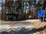 2
2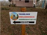 3
3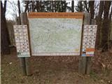 4
4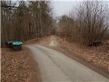 5
5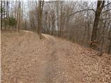 6
6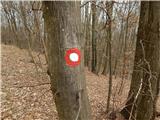 7
7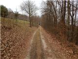 8
8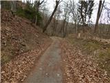 9
9 10
10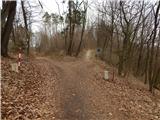 11
11 12
12 13
13 14
14 15
15 16
16 17
17 18
18 19
19 20
20 21
21