Ciganija - Dom na Uršlji gori (winter path)
Starting point: Ciganija (1115 m)
| Latitude/Longitude: | 46,4532°N 14,9571°E |
| |
Route name: winter path
Walking time: 2 h 20 min
Difficulty: easy marked way
Elevation gain: 565 m
Elevation difference along the route: 665 m
Map: Koroška 1:50.000
Recommended equipment (summer):
Recommended equipment (winter): ice axe, crampons
Views: 1.340
 | 1 person like this post |
Access to starting point:
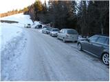
A) First, we drive to Šoštanj (from here from Velenje or the Savinja Valley), then we continue driving towards Črna na Koroškem. Further on, the road starts ascending towards the pass Spodnje Sleme (1081 m), which after a few kilometers of winding road we also reach. Here, the road branches off to the left to Andrejev dom na Slemenu, while we continue driving towards Črna na Koroškem. From the pass, we drive a few hundred meters more, then the signs for Uršlja gora direct us right onto an ascending road, which a little higher loses its asphalt surface. We continue on a wider macadam road (the road is usually plowed and gritted in winter), which we follow for approximately 1500 meters, or to the intersection, where a poorer macadam road branches off to the right towards Križan and Uršlja gora (numerous mountaineering signposts and a cross are at the intersection). We park in a suitable place by the road.
B) First, we drive to Črna na Koroškem, from there we continue driving towards Šoštanj and Velenje. Before reaching the pass Spodnje Sleme, the signs for Uršlja gora direct us sharply left onto an ascending and subsequently wider macadam road (the turn-off from the main road is a few hundred meters before the mentioned pass, and above the intersection we also notice a larger chapel). We continue on a wider macadam road (the road is usually plowed and gritted in winter), which we follow for approximately 1500 meters, or to the intersection, where a poorer macadam road branches off to the right towards Križan and Uršlja gora (numerous mountaineering signposts and a cross are at the intersection). We park in a suitable place by the road.
Route description:
From the parking lot, we continue on the right road in the direction of Uršlja gora and Naravske ledine. The road goes immediately into the forest, where it then continues without major changes in elevation to the saddle between Kotnikov vrh and Kavnikov vrh. We continue further in the direction of Uršlja gora along the road, which from here starts to descend more steeply. The road then levels out and after approximately 45 minutes of walking from the starting point brings us to a somewhat larger intersection at the farm Križan.
We continue straight uphill on the footpath in the direction of Uršlja gora (left continues the road to Naravske ledine). The path ahead ascends through a belt of forest, after which we arrive at expansive and scenic grassy slopes along which, past the chapel, we climb to the road that leads to Uršlja gora.
We only cross the mentioned road as the marked path leads us into the forest. The path ahead starts to ascend more steeply and after a few minutes of further walking brings us to a junction, where we continue right in the direction of the winter path (slightly left the normal path). The path then quickly brings us to a cart track along which we ascend diagonally to the road that leads to Uršlja gora. We reach the road exactly at the place where the summer parking lot is located. We continue the ascent past the barrier along the road, which ascends relatively steeply at first through the forest. We follow this road, from which increasingly beautiful views open up, to the hut on Uršlja gora.

Along the route: Križan (1040m), Šišernik (1259m)
Photos:
 1
1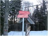 2
2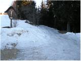 3
3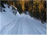 4
4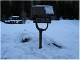 5
5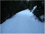 6
6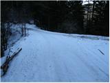 7
7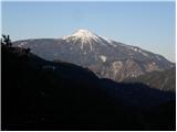 8
8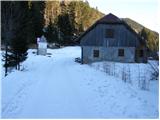 9
9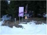 10
10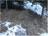 11
11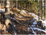 12
12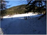 13
13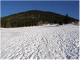 14
14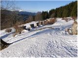 15
15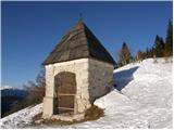 16
16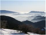 17
17 18
18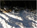 19
19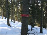 20
20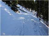 21
21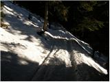 22
22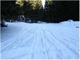 23
23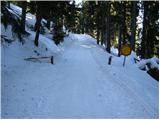 24
24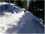 25
25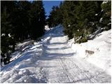 26
26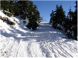 27
27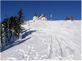 28
28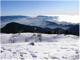 29
29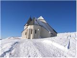 30
30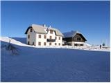 31
31
Discussion about the trip Ciganija - Dom na Uršlji gori (winter path)
To post a comment you must log in:
If you do not yet have a username, you must first
register.