Starting point: Črnivec (902 m)
Starting point Lat/Lon: 46.2608°N 14.7024°E 
Time of walking: 3 h 15 min
Difficulty: easy marked way
Difficulty of skiing: no data
Altitude difference: 523 m
Altitude difference (by path): 845 m
Map: Kamniške in Savinjske Alpe 1:50.000
Access to starting point:
From Kamnik we drive towards Gornji Grad or vice versa. When we reach the mountain pass Črnivec we park on the parking lot by the information boards. Parking in front of the nearby inn is only for guests.
Path description:
Across from the inn Gostišče GTC 902 Črnivec, at the water fountain 902, we notice the mountain signposts, but we head onto the path in the direction of Veliki Rogatec, Lepenatka and the top of Kašna planina (Kranjska reber). It is best to start on a macadam road which branches off from the main road towards the north, and from there we go left already after a few steps, onto the path which starts to ascend through swampy terrain. Initially the swampy path continues through the area where years ago (13 July 2008) there was a strong gale, and today after artificial planting the slope is growing over again. Because the trees are still low, in summer the undergrowth and bushes grow strongly, therefore the path on this part in summer is quite overgrown. On the quite overgrown path we walk to the place where we cross the road, then on the other side we continue on a cart track which is also still quite overgrown. When we cross the road a second time, we arrive at the upper part of the slope where the gale raged, so the path further on is less overgrown. On this part the path also levels somewhat and turns somewhat to the right, where it first crosses a stream, then continues through mostly spruce forest. A little further we cross another road, then ascend diagonally through the forest, the path brings us past a smaller spring to the saddle Na križu, where an unmarked path from Kališ joins from the left.
We continue straight on the marked path, which ascends somewhat more steeply, then crosses a grazing fence and brings us out of the forest, where an unmarked path from the pass Volovljek joins almost unnoticeably from the left.
Here we continue straight and with nice views walk a few minutes on an indistinct cart track, from which we soon go right onto the mountain path, on which we quickly ascend to a smaller watering place for animals. From the watering place follows a few minutes of moderate ascent and the increasingly scenic path brings us to the top of Kranjska reber, where there is a logbook box.
After we rest and enjoy the views, we continue on the path in the direction of Lepenatka. The path ahead starts to descend moderately along the indistinct northeastern ridge of Kranjska reber, then brings us past some watering places to the hut on Kašna planina.
From the hut we continue the descent on the nearby road or on a marked shortcut, on which in 5 minutes we arrive at the junction with a wider macadam road. Here we first continue right (left pass Volovljek), then already after a few steps left (straight we return on the macadam road to the starting point at the pass Črnivec), both times in the direction of Lepenatka. From the junction we walk on the road which descends gently, while on the eastern side it crosses the slopes of Kašni vrh. After a few minutes we reach the ridge, where the road ends at the turning area Leška gmajna, and we continue straight on the marked footpath which enters the forest, through which it first descends moderately, then more steeply. Lower we reach a forest road, which we follow straight ahead, then, when the road from the ridge turns slightly to the right, we continue straight onto an ascending cart track, along which there are also blazes. The cart track first ascends steeply along the ridge, then from it slightly to the left and downward branches an unmarked cart track, which after a short diagonal descent joins a forest road, on which it is possible to continue towards Bivak na Kalu, but we continue straight, first briefly still on the cart track, then slightly right onto the marked footpath. The path immediately starts to ascend steeply, soon turning somewhat more to the right, where it ascends diagonally across steeper slopes. Further on the path ascends steeply, occasionally leading us also over some shorter exposed section, where especially in wet conditions and snow greater caution is needed. Higher up the slope gradually flattens, the path turns right and brings us to the ridge east of Kunšperski vrh (also Brezovec).
When we reach the ridge we continue right (left Kunšperski vrh, 5 minutes of easy pathless terrain) on the marked path which continues along the occasionally panoramic ridge. Further we ascend gently to moderately along or somewhat left of the ridge. Higher the path leads over a grazing fence, behind which we step onto the summit grassy slopes of Lepenatka. Follows a few minutes of moderate ascent along the path, from which beautiful views open up, reaching from the nearby Veliki Rogatec, across Raduha and Olševa, to the highest peaks of the Kamniško Savinjske Alpe, and we already reach the grassy summit of Lepenatka.
Črnivec - Kranjska reber 1:30, Kranjska reber - Kašna planina 15 minutes, Kašna planina - Lepenatka 1:45.
Pictures:
 1
1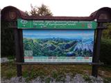 2
2 3
3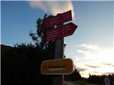 4
4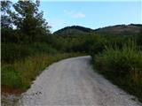 5
5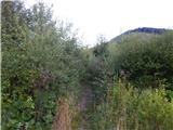 6
6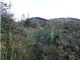 7
7 8
8 9
9 10
10 11
11 12
12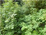 13
13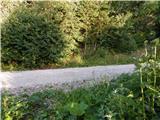 14
14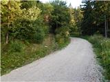 15
15 16
16 17
17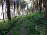 18
18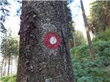 19
19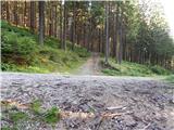 20
20 21
21 22
22 23
23 24
24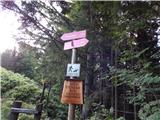 25
25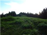 26
26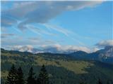 27
27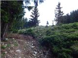 28
28 29
29 30
30 31
31 32
32 33
33 34
34 35
35 36
36 37
37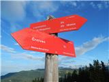 38
38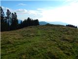 39
39 40
40 41
41 42
42 43
43 44
44 45
45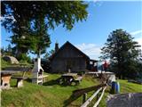 46
46 47
47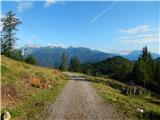 48
48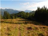 49
49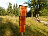 50
50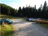 51
51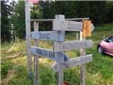 52
52 53
53 54
54 55
55 56
56 57
57 58
58 59
59 60
60 61
61 62
62 63
63 64
64 65
65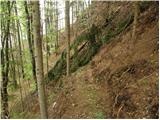 66
66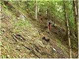 67
67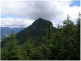 68
68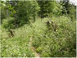 69
69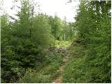 70
70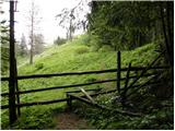 71
71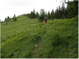 72
72 73
73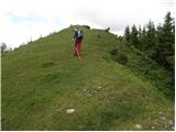 74
74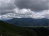 75
75 76
76