Dobeno - Rašica (Vrh Staneta Kosca)
Starting point: Dobeno (511 m)
Time of walking: 30 min
Difficulty: easy marked way
Difficulty of skiing: no data
Altitude difference: 130 m
Altitude difference (by path): 145 m
Map: Ljubljana - okolica 1:50.000
Access to starting point:
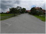
From the Trzin–Kamnik road, at the settlement Loka we turn onto a local road in the direction of Loka and Dobeno. Further, we drive through Loka, where at the crossroads we follow the signs for Dobeno. Further, we cross a few fields, and then the road enters the forest, where it starts to ascend more steeply. We soon arrive in Dobeno, but we follow the road for some time and drive past the inn Ručigaj and Dobenski hram to a large asphalted parking lot, beside which there is a chapel and next to it a bench.
Path description:
From the parking lot, we continue on an ascending asphalt road, which we follow at the crossroads in the direction of the mountain hut Dom na Rašici. With nice views on Posavsko hribovje and partly also on Kamnik Savinja Alps, we quickly get to a hamlet, where mountain signposts for the mountain hut Dom na Rašici point us to the right onto an initially wide cart track. Here the path passes into the forest, and at the crossings we carefully follow the blazes so that in the labyrinth of cart tracks and footpaths we don't miss the right path. Higher up the wide footpath slightly descends, and then it starts moderately ascending towards the mountain hut Dom na Rašici, which we reach after a few minutes of additional walking.
From the hut, we continue on a gently sloping path in the direction of the lookout tower, which we reach after a minute of additional walking. For a nice view it is worth ascending also onto the 17 m high lookout tower.
Pictures:
 1
1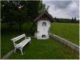 2
2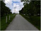 3
3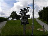 4
4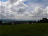 5
5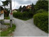 6
6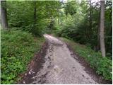 7
7 8
8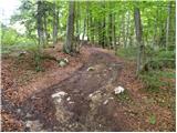 9
9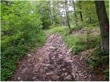 10
10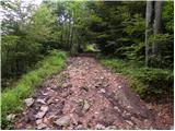 11
11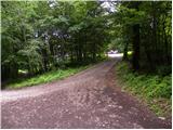 12
12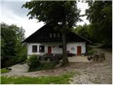 13
13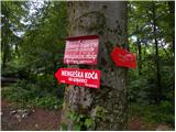 14
14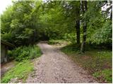 15
15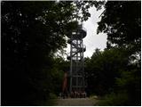 16
16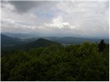 17
17 18
18