Dolina potoka Žep - Veliki Travnik (Turnovka) (via partisan hospital)
Starting point: Dolina potoka Žep (887 m)
| Latitude/Longitude: | 46,39840°N 14,82730°E |
| |
Route name: via partisan hospital
Walking time: 2 h 25 min
Difficulty: easy unmarked way
Elevation gain: 750 m
Elevation difference along the route: 800 m
Map: Kamniške in Savinjske Alpe 1:50.000
Recommended equipment (summer):
Recommended equipment (winter):
Views: 7.530
 | 2 people like this post |
Access to starting point:
From the Ljubljana–Maribor motorway, take the Šentrupert exit and follow the road ahead towards Logarska dolina valley. In the village of Ljubno ob Savinji, the signpost for Smrekovec directs us right. The road then takes us through the centre of the village, where we turn left again following the signs for Smrekovec. The road then brings us to Ljubenske Rastke, where at the junction near the church we continue left. We then follow this road to the sharp right bend, in the middle of which a macadam road branches off straight ahead, which we follow to a smaller parking lot at its end.
Route description:
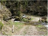
From the parking lot at the old mill, over a small bridge we cross the tributary of the stream Žep and then ascend on a cart track rising along the stream Žep. After a few minutes of walking we will notice a footpath that turns sharply right and steeply ascends for a short time. After a short ascent the path brings us out of the forest onto a smaller clearing where the log cabin Planinc stands.
We continue slightly left on a worse cart track that starts to ascend gently parallel to the torrent gully that we notice right below. The cart track then crosses the mentioned torrent after a while and immediately after it brings us to a junction. We continue on the right cart track, which first crosses the slopes to the right, then in numerous zigzags starts to ascend more steeply. Higher we reach a forest road, which we follow left; it quickly brings us to a junction.
We continue left in the direction of the partisan hospital and the hut on Travnik, on the further marked cart track that mostly just crosses the slopes. The cart track later turns into a macadam road, which we follow only to the point where it crosses the torrent stream.
Immediately after the stream we notice a steep marked cart track that ascends along the stream and then enters the forest. We continue the ascent on the cart track, which after a few more minutes of walking through the forest brings us to the partisan hospital Mrzle vode.
From the hospital we continue towards Travnik on an increasingly steep and increasingly poorly visible path. Higher the path crosses two successive forest roads and then returns to the forest, where it continues to ascend relatively steeply. Higher the steepness eases and from the right the path from the saddle Hlipovec joins us.
We continue left on a pleasant forest path that further only gently ascends. A little further ahead the path brings us to the next junction, where we continue right in the direction of Veliki Travnik or. Turnovka (left hut Koča na Travniku) on the path that continues to ascend through the spruce forest. After a further 10 minutes we step out of the forest, from where a view towards the summit opens up. We continue right (left hut Koča na Travniku) and with a few dozen steps of further walking we reach the summit of Veliki Travnik.

Photos:
 1
1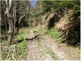 2
2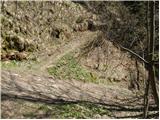 3
3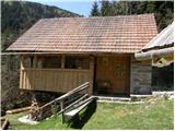 4
4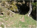 5
5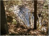 6
6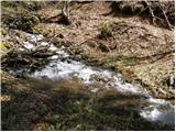 7
7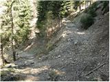 8
8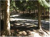 9
9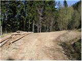 10
10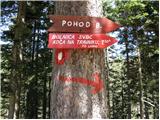 11
11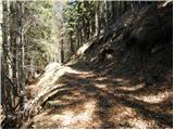 12
12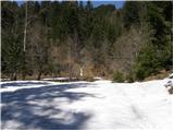 13
13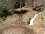 14
14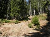 15
15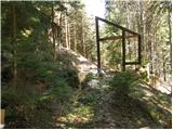 16
16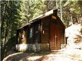 17
17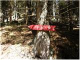 18
18 19
19 20
20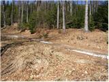 21
21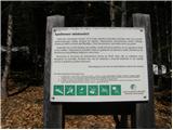 22
22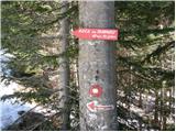 23
23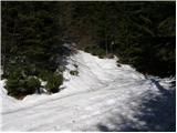 24
24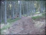 25
25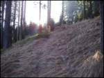 26
26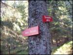 27
27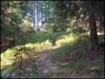 28
28 29
29 30
30
Discussion about the trip Dolina potoka Žep - Veliki Travnik (Turnovka) (via partisan hospital)
To post a comment you must log in:
If you do not yet have a username, you must first
register.