Dom pod Storžičem - Bela peč
Starting point: Dom pod Storžičem (1123 m)
Starting point Lat/Lon: 46.3586°N 14.3906°E 
Time of walking: 2 h
Difficulty: easy marked way
Difficulty of skiing: no data
Altitude difference: 470 m
Altitude difference (by path): 500 m
Map: Karavanke - osrednji del 1:50.000
Access to starting point:
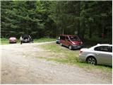
From the Ljubljana-Jesenice motorway, take the Ljubelj (Tržič) exit, then continue driving towards Ljubelj. Just before the petrol station in Bistrica pri Tržiču, leave the main road and continue right towards Tržič. Then drive through Tržič towards Dolžanova soteska, and at the end of the town continue right towards Lom pod Storžičem and Grahovše. At the end of Grahovše village, the asphalt ends, and we continue following the gravel road towards Dom pod Storžičem. We follow this steeper gravel road in the upper section to the parking lot near Dom pod Storžičem.
Path description:
From the parking lot near Dom pod Storžičem, continue left onto the road towards Javorniško sedlo, Planina Javornik, Jezersko, Pavšel, Tič, Tržič and the NOB monument. After just a few meters of walking, the road splits into two, and we take the lower left road leading towards the nearby NOB monument and Tržič (slightly right Javorniško sedlo). From the road we are following, a short path soon branches left to the nearby monument, but we continue along the road crossing the slopes to the left. After a few minutes, we reach the next junction, where we again choose the lower left road (slightly right another path to Javorniško sedlo). A little further on, precisely at the old hay shed, the road turns into a cart track, which begins to ascend moderately. After a short ascent, we reach a second hay meadow with a hay shed; from this path, we get a nice view of Storžič, and after a few more meters, it turns right, bringing us to a marked junction. At the junction, continue straight towards Bela peč (left Tič and Lom pod Storžičem); we then ascend to a small pass where the cart track levels out and, just a few dozen meters further, brings us to an overgrown clearing. On the clearing, the marked path leaves the cart track and continues right across a short overgrown slope (the branch-off is not specially marked, but the blazes on the trees are clearly visible). After a few steps, we step back onto a nice traceable path, which begins to ascend transversely across steep slopes. This is followed by crossing a short scree slope, where extra caution is needed especially when wet, then we cross a gully and ascend on its other side to the nearby cart track. A relatively steep ascent follows along the cart track, offering nice views, after which we join another cart track and descend along it to a gravel road a few minutes away.
When we reach the road, follow it right; we ascend it to the nearby Gaberčev rovt (Gabrčov rot), which is just a short distance from the road. From here, we walk along the road for only a few minutes, then leave it at a left bend and continue straight into the forest on a marked cart track. The cart track, initially following a small stream, soon turns into a trail, which begins to ascend more steeply through the forest. Higher up, the path enters a torrent gully, and we ascend through and beside it to the gravel road.
Upon reaching the mentioned road at Sedlo Dol, continue left (right Planina Javornik), then past the memorial plaque, walk a few dozen steps to Koča Pr Zdravc.
From the hut, continue briefly along the road, then at a small pass turn right onto the marked hiking trail towards Bela peč. The path ahead ascends moderately along the edge of steep slopes, then leads us transversely to a cart track, which we follow left. The cart track ends quickly, and the path moves onto steeper slopes, which we cross to the right. A short slightly exposed section follows, after which the slope levels out. Then we cross a pasture fence, and a gentle path brings us to the next marked junction.
At the junction, continue left (straight Planina Zgornja and Planina Spodnja Konjščica) towards the viewpoint Bela peč. Here, pass through a narrow gap between two trees, then quickly ascend to the panoramic summit.
Starting point - Srpice 0:20, Srpice - junction below Gaberčev rovt 0:25, junction below Gaberčev rovt - Gaberčev rovt 0:15, Gaberčev rovt - Koča Pr Zdravc 0:30, Koča Pr Zdravc - Bela peč 0:30.
On the way: Srpice (1124m), Razpotje pod Gaberčevim rovtom (1227m), Gaberčev rovt (1287m), Sedlo Dol (1450m), Koča Pr Zdravc (1460m), Razpotje pri Beli peči (1586m)
Pictures:
 1
1 2
2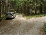 3
3 4
4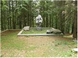 5
5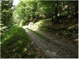 6
6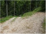 7
7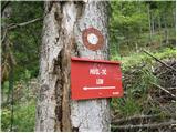 8
8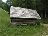 9
9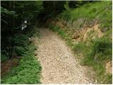 10
10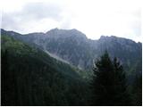 11
11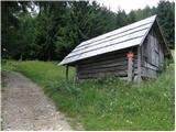 12
12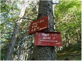 13
13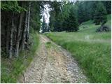 14
14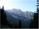 15
15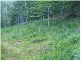 16
16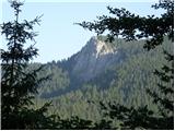 17
17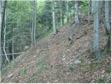 18
18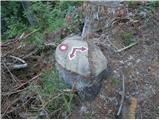 19
19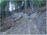 20
20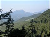 21
21 22
22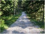 23
23 24
24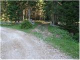 25
25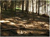 26
26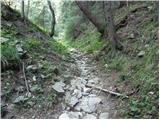 27
27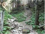 28
28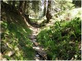 29
29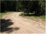 30
30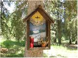 31
31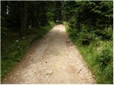 32
32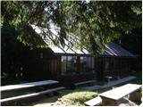 33
33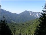 34
34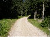 35
35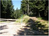 36
36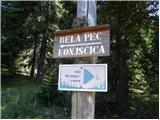 37
37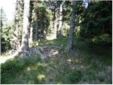 38
38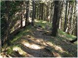 39
39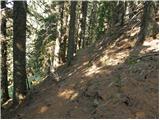 40
40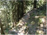 41
41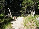 42
42 43
43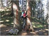 44
44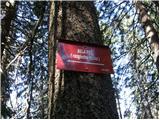 45
45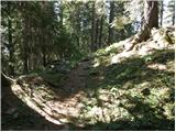 46
46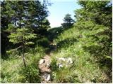 47
47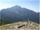 48
48 49
49