NC Planica - Mala Mojstrovka (via Grlo)
Starting point: NC Planica (931 m)
Starting point Lat/Lon: 46.476°N 13.7241°E 
Path name: via Grlo
Time of walking: 4 h 35 min
Difficulty: very difficult marked way
Difficulty of skiing: no data
Altitude difference: 1401 m
Altitude difference (by path): 1500 m
Map: Kranjska Gora 1:30.000
Access to starting point:
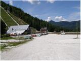
a) First we drive to Kranjska Gora, then we continue driving towards Rateče. When we arrive at the roundabout near Rateče, we take the exit in the direction of Planica. This is followed by some ascent and we arrive at the large parking lot next to the Nordic Center Planica, where we park at the paid parking lot. The price for passenger cars is 2,5 euros / day (March 2019).
b) Through the Rateče border crossing we drive into Slovenia, then soon turn right towards Planica. This is followed by some ascent and we arrive at the large parking lot next to the Nordic Center Planica, where we park at the paid parking lot. The price for passenger cars is 2,5 euros / day (March 2019).
Path description:
From Planica we continue along the macadam road towards the Dom v Tamarju, before the road enters the forest it branches into two parts. We continue along the slightly right road in the direction of the footpath towards Tamar (slightly left is the drivable road, which is closed to public traffic).
The path ahead leads us along the road, which passes the last parking lot of NC Planica and enters the forest and which in winter time is converted into a cross-country ski track. There follows an ascent along a gentle road, which mostly runs through the forest, when the path leaves the forest, there are viewpoints along the path with inscriptions of what can be seen. Higher up, the forest thins out several times or we leave it for a while, so that beautiful views open up to the mountains that rise above Planica and Tamar. When we already get quite close to the Dom v Tamarju, a wonderful view of Jalovec opens up and the path branches.
We continue slightly left (slightly right is the spring of Nadiža) and a few minutes later we join the drivable road, along which we continue left, back towards Planica (right Dom v Tamarju, two minutes).
We do not walk along the road for long and soon arrive at a crossroads, where we turn right in the direction of Vršič and Slemenova špica through Grlo (up to here we can also go by road).
We turn onto the mentioned path, which after just a few steps leads us out of the forest onto vast gravel fields. The path ahead gently ascends slightly to the left to the end of the mighty gorge we see in front of us. The path then leads us right into the gorge along which the path continues. Next we ascend up the gorge and in doing so search for passages, which after every heavier rainfall are elsewhere. The path through the gorge is marked but many markings are upside down and where the marking is, the passage is often almost impossible. The entire approximately 45-minute passage through the gorge is also exposed to falling rocks. The ascent through the gorge is difficult but nowhere exposed. We exit the gorge at the Grlo saddle, where a barely noticeable unmarked path from the Mala Pišnica valley joins us.
We continue right in the direction of Slemenova špica and Vršič. The path ahead crosses a short stretch of forest and somewhat higher leads us to scree slopes, which the path crosses in a gentle ascent to steep slopes. Here the path steeply ascends, and we are helped by some pitons and a steel cable. Next we ascend along a moderately overgrown slope quite steeply upwards to the place where we join the Vršič - Slemenova špica path.
Here we continue left in the direction of Vršič (right Slemenova špica) and continue along a pleasant path that runs through a sparse larch forest. Next the path gently ascends for a short time, then in a few minutes of further walking it takes us to the Vratca pass, where there is a junction of marked and unmarked paths.
We continue right in the direction of Mojstrovka (left unmarked path to Prednje Robičje, straight down Vršič) along the path that runs under the walls of Šitna glava. After a few tens of steps of further walking, the Hanzova pot to Mala Mojstrovka branches off left upwards (straight Slemenova špica along unmarked path). The path ahead steeply ascends with the help of numerous pitons and higher up brings us to the first steel cables, which then are our "constant" companion. The still excellently secured path continues to lead us along exposed ledges and gullies steeply upwards. The path, which is exposed to falling rocks, gradually levels, and an unmarked path from Šitna glava joins us from the left. After a further few minutes the steepness eases even more and the path takes us to flatter terrain, which we bypass on the right side. Next the path approaches the ridge, and we see Mangart and Jalovec in front of us. Here the path turns slightly left and takes us to the next steep section. With the help of a few pitons, mainly without protection, we climb the steep summit slope of Mala Mojstrovka to its panoramic summit.
Planica - turnoff for Grlo 0:45, turnoff for Grlo - Grlo 0:55, Grlo - Čez Sleme 0:50, Čez Sleme - Vratca 0:25, Vratca - Rob severne stene Male Mojstrovke 1:05, Rob severne stene Male Mojstrovke - Mala Mojstrovka 0:35.
On the way: Dom v Tamarju (1108m), Odcep za Grlo (1090m), Grlo (1451m), Odcep v Pišnico (1489m), Čez Sleme (1773m), Vratca (1800m), Severna stena Male Mojstrovke (1865m), Rob severne stene Male Mojstrovke (2116m)
Pictures:
 1
1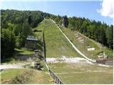 2
2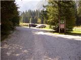 3
3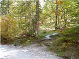 4
4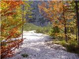 5
5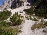 6
6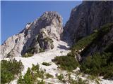 7
7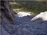 8
8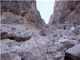 9
9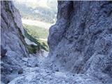 10
10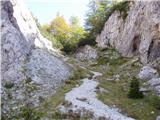 11
11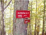 12
12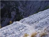 13
13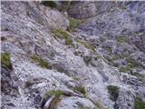 14
14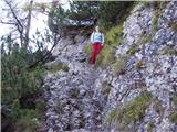 15
15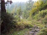 16
16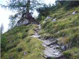 17
17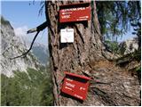 18
18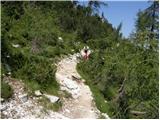 19
19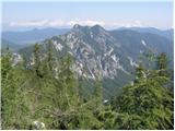 20
20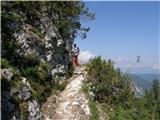 21
21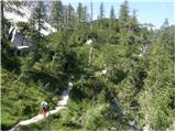 22
22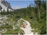 23
23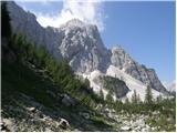 24
24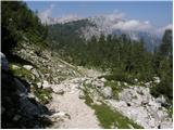 25
25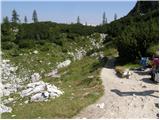 26
26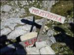 27
27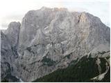 28
28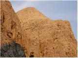 29
29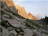 30
30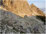 31
31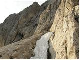 32
32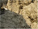 33
33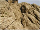 34
34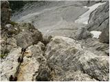 35
35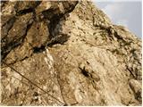 36
36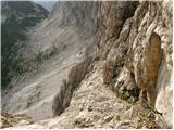 37
37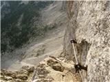 38
38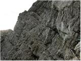 39
39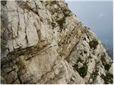 40
40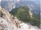 41
41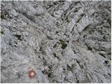 42
42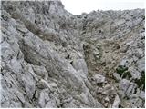 43
43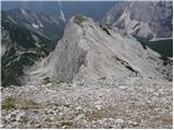 44
44 45
45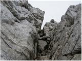 46
46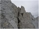 47
47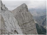 48
48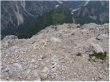 49
49 50
50 51
51