Franz-Josefs-Höhe - Fuscherkarkopf
Starting point: Franz-Josefs-Höhe (2369 m)
Starting point Lat/Lon: 47.0752°N 12.7516°E 
Time of walking: 3 h 45 min
Difficulty: difficult pathless terrain, difficult marked way
Difficulty of skiing: no data
Altitude difference: 962 m
Altitude difference (by path): 980 m
Map:
Access to starting point:
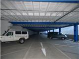
From the Karawanks Tunnel, we follow the highway towards Salzburg to a highway junction where we turn left towards Spittal. From Spittal we drive towards Lienz. A little after the highway ends, at the settlement Möllbrücke, we turn right towards the settlement Mallnitz and then we follow the signs for the alpine road Großglockner. When we drive into the mountain village Heiligenblut 1336m high we have only 17 km of Grossglockner Hochalpenstrasse, the best-known Alpine panoramic road. The toll for this road is 35.50 euros per car (August 2017). At the roundabout at an altitude of approximately 1900m we turn left towards Kaiser-Franz-Josefs-Höhe and glacier Pasterze. We follow this road to the end and then we park in the garage building.
Path description:
From the large panoramic platform by the garage building, we head into the tunnel where the signs for the path Gamsgrubenweg direct us. The path then leads us through a relatively wide tunnel, which is illuminated so we do not need a lamp. The tunnel consists of six sections, in which various things related to the nearby surroundings are presented. When we come out of the tunnels, we continue on the wide and fairly level path towards the northwest. From the path, we have a very nice view all the time towards Grossglockner and glacier Pasterze, the largest and longest glacier in the Eastern Alps. To the left downwards, the path towards the mentioned glacier soon branches off. Near the junction, the hut Hofmannshütte stood for many years. It was built in 1869, and in 2016 it was demolished.
We continue on the panoramic path along which quite a few benches and information boards are placed. The path then soon brings us to a marked junction. At the junction, we leave the wide path leading towards glacier Wasserfallwinkel and hut Oberwalderhütte and head right upwards towards summit Fuscherkarkopf.
From the junction, the path starts to ascend more steeply and soon brings us to a rocky slope secured with a steel cable. A few times we ascend in zigzags along the steel cable on the smooth rocky slope, which is otherwise not too steep and in dry conditions does not cause major problems. The slope then becomes slightly less steep and further on we walk along the wide south ridge towards the north. Somewhat higher, the ridge becomes narrower and the ascent becomes somewhat more demanding. First, with the aid of some fixed protections, we cross fairly steep slopes, then a steep but well-secured descent into a small notch follows.
It is possible to reach the mentioned notch also via easy pathless terrain, but due to nature conservation, walking off-path is not desirable, as a sign along the path warns us. From the notch, a short ascent along the steel cable follows, then the path leads us for a while along the left side of the ridge. Here we ascend a fairly steep slope that is not secured, so some caution is required. Later, the path turns right back onto the ridge and the slope becomes somewhat less steep. In the continuation, we then ascend along the relatively undemanding and wide south ridge. Such a path continues all the way to the main ridge where we reach the western summit of Fuscherkarkopf.
From the western summit, we continue right along the ridge. The ascent here becomes slightly more demanding again and runs along the ridge the whole time. At some points, we can bypass the ridge on the right side as well, but this is not necessary as there is no essential difference in difficulty. We then follow the partly slightly exposed ridge all the way to the panoramic summit.
We descend along the ascent path.
Pictures:
 1
1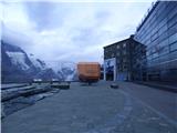 2
2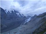 3
3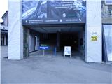 4
4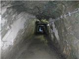 5
5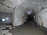 6
6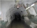 7
7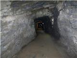 8
8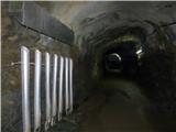 9
9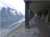 10
10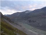 11
11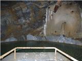 12
12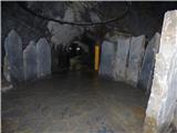 13
13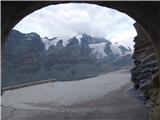 14
14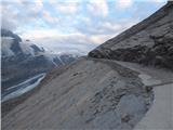 15
15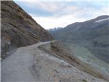 16
16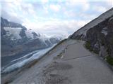 17
17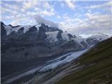 18
18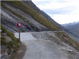 19
19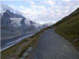 20
20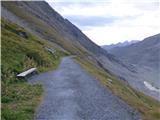 21
21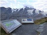 22
22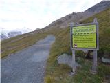 23
23 24
24 25
25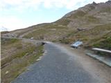 26
26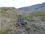 27
27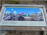 28
28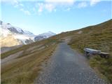 29
29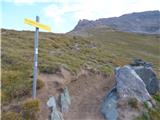 30
30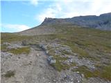 31
31 32
32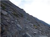 33
33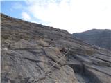 34
34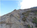 35
35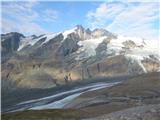 36
36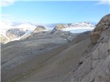 37
37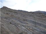 38
38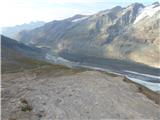 39
39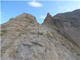 40
40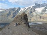 41
41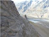 42
42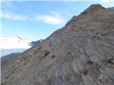 43
43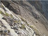 44
44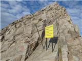 45
45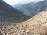 46
46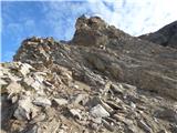 47
47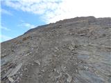 48
48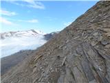 49
49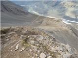 50
50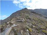 51
51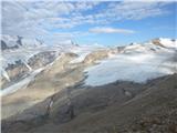 52
52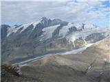 53
53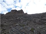 54
54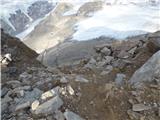 55
55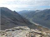 56
56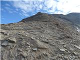 57
57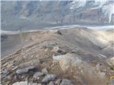 58
58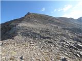 59
59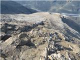 60
60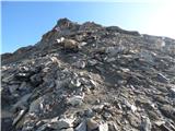 61
61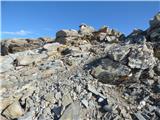 62
62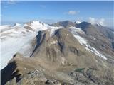 63
63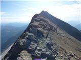 64
64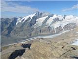 65
65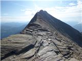 66
66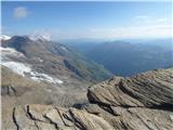 67
67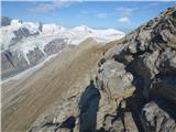 68
68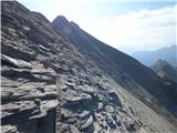 69
69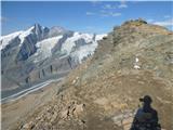 70
70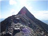 71
71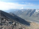 72
72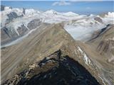 73
73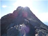 74
74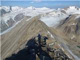 75
75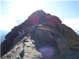 76
76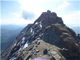 77
77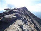 78
78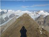 79
79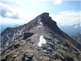 80
80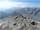 81
81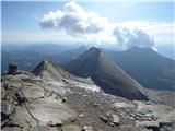 82
82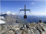 83
83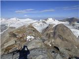 84
84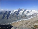 85
85