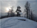
Gosteče - Osolnik (via Vidmovec)
Starting point: Gosteče (350 m)
Starting point Lat/Lon: 46.1517°N 14.3432°E 
Path name: via Vidmovec
Time of walking: 1 h 30 min
Difficulty: easy unmarked way
Difficulty of skiing: no data
Altitude difference: 508 m
Altitude difference (by path): 508 m
Map: Ljubljana - okolica 1:50.000
Access to starting point:
A) First, we drive to Medvode, after that at Spar store we leave the main road and we continue towards the railway station and settlement Sora. In Sora at first road towards Katarina branches off to the left, and a little ahead also towards Osolnik. In both cases we continue straight and we drive to the settlement Gosteče, where we turn left towards company Avto Lušina, and we drive good 100 more meters ahead to Darja bar, where at the end of the parking lot, we park.
B) From Kranj we drive towards Škofja Loka, from periphery of Škofja Loka then we follow the signs for Gorenja vas. Before the tunnel Sten from a roundabout we drive on exit in the direction of the settlement Sora. Further, we drive through settlements Hosta and Pungert, to the settlement Gosteče, where we turn right towards company Avto Lušina, and we drive good 100 more meters ahead to Darja bar, where at the end of the parking lot, we park.
C) From the valley Poljanska dolina we drive towards Škofja Loka and then on bypass road and through the tunnel Sten. After the tunnel we turn right and we follow the signs for settlement Sora. Further, we drive through settlements Hosta and Pungert, to the settlement Gosteče, where we turn right towards company Avto Lušina, and we drive good 100 more meters ahead to Darja bar, where at the end of the parking lot, we park.
Path description:
At the end of the parking lot, we continue left over a small bridge, then on the right side of hayrack and ahead on a beaten footpath which goes into the forest. Through the forest, we at first steeply ascend, and then the path flattens a little and continues on and by the ridge. Higher, the footpath splits on gentle and steep, a little ahead they cross eachother, and on the ridge of Močerad they join again.
Further moderately steep path then from the ridge Močerad passes on the ridge of Vidmovec, where it also brings us out of the forest. Here on the right side, on a cart track we bypass the nearby house, and when we step on the road, we follow it to the right. Few minutes we walk on the road, and then we go left on a footpath which only a little further crosses also a little wider road. Next again follows a little steeper an ascent through the forest and then we join the marked path Sora - Osolnik.
We follow the mentioned path to the right, and there in few minutes of relatively steep ascent we ascend to the summit of Osolnik, where there stands the church of St. Mohor and Fortunat.
Description and pictures refer to a condition in the year 2018 (February).
On the way: Močerad (592m), Vidmovec (681m)
Pictures:
 1
1 2
2 3
3 4
4 5
5 6
6 7
7 8
8 9
9 10
10 11
11 12
12 13
13 14
14 15
15 16
16 17
17 18
18 19
19 20
20 21
21 22
22 23
23 24
24 25
25 26
26 27
27 28
28 29
29 30
30 31
31