Gozd Martuljek - Hvadnik (Ferata Hvadnik)
Starting point: Gozd Martuljek (747 m)
| Latitude/Longitude: | 46,48494°N 13,84357°E |
| |
Route name: Ferata Hvadnik
Walking time: 2 h
Difficulty: very difficult marked way
Via ferrata: B/C
Elevation gain: 173 m
Elevation difference along the route: 250 m
Map:
Recommended equipment (summer): helmet, self belay set
Recommended equipment (winter): helmet, self belay set
Views: 68.555
 | 6 people like this post |
Access to starting point:
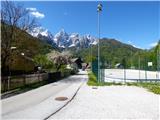
We leave the Gorenjska highway at the exit Hrušica and follow the road ahead in the direction of Kranjska Gora. We follow this road all the way to the village Gozd Martuljek, where before the bridge, which crosses the stream Hladnik, we turn right onto a narrow road past the sports field. Immediately after the mentioned sports field on the left side of the road there is a smaller parking lot where we park. By the parking lot there are also signs with data about the secured paths Ferata Hvadnik and Ferata Jerm'n.
Route description:
From the parking lot, we continue on the asphalt road and already after a few meters left over a small bridge the path towards the secured path Ferata Jerm'n branches off, and we still continue on the road through the village. A little later at the crossroad of multiple roads, the signs point us to the left on a dead-end street. We follow the road to the bridge over the stream Hladnik, where there is again a sign with data about the secured path.
Before the bridge a signpost points us to the right on a narrow footpath which runs by the stream. The path is then ascending by the stream, at first on the right and then also on the left side of the stream. A little higher, then a relatively poorly beaten footpath turns right downwards towards the stream where there is the beginning of the secured path.
In front of the entry into the secured part of the path, we equip ourselves with a helmet and a self-belay set. It is also recommended to use climbing gloves. At the beginning, the secured path steeply ascends over a few boulders in the riverbed of the stream Hladnik. On harder spots besides the steel cable we also get help from some pegs and smaller brackets. Next follows an interesting crossing of the stream on the steel cable (bridge) to the left side. Further, the path for quite some time runs on a wall on the left side of the gorge where shorter ascents and traverses alternate (difficulty up to B/C). At more difficult traverses and ascents we also get help from a few brackets. A little higher, then with the help of the steel cable and two larger brackets we cross to the right side of the riverbed. The path then soon returns to the left side and ascends steeper with the help of brackets. In the last part of the path through the gorge, the path runs above smaller pools and crosses the stream two more times on steel cables.
After that, the path leaves the gorge and turns decisively to the left. Further follows a diagonal ascent through the forest where we still get help from the steel cable. Such a path then soon brings us to the vantage point where the secured path ends. At the vantage point where a view opens up on the Martuljek group, there is also a bench and a logbook box.
From the vantage point, we first slightly ascend past the logbook box and then we quickly reach a better-trodden footpath where there is a signpost. We descend left downwards towards Gozd Martuljek. Lower the path from the secured climbing path Ferata Jerm'n also joins us, and we all the time follow the signs for Gozd Martuljek.
When we come to an asphalt road, we continue left and then through the village we follow the signs for the parking lot Ferata Hvadnik.
The secured path is closed in winter from 31 October to 1 April. Description and pictures refer to the condition in May 2020. During the epidemic it is mandatory to use full-finger gloves (without holes for fingers).

Photos:
 1
1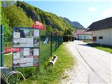 2
2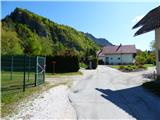 3
3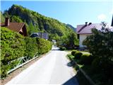 4
4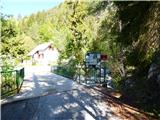 5
5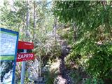 6
6 7
7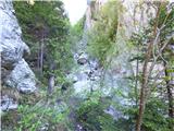 8
8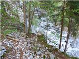 9
9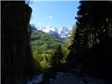 10
10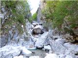 11
11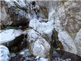 12
12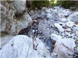 13
13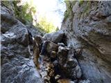 14
14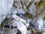 15
15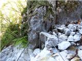 16
16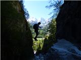 17
17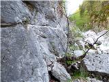 18
18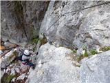 19
19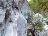 20
20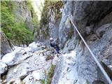 21
21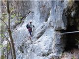 22
22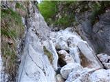 23
23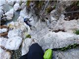 24
24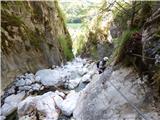 25
25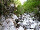 26
26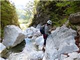 27
27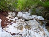 28
28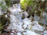 29
29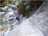 30
30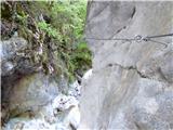 31
31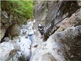 32
32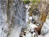 33
33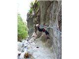 34
34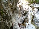 35
35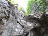 36
36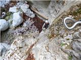 37
37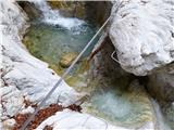 38
38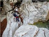 39
39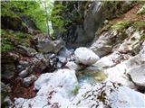 40
40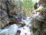 41
41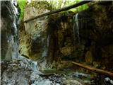 42
42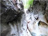 43
43 44
44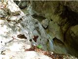 45
45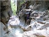 46
46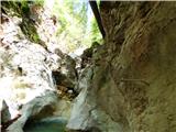 47
47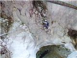 48
48 49
49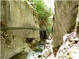 50
50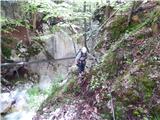 51
51 52
52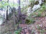 53
53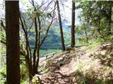 54
54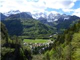 55
55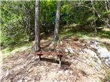 56
56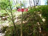 57
57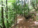 58
58 59
59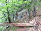 60
60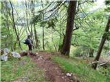 61
61 62
62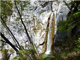 63
63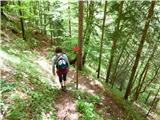 64
64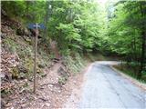 65
65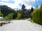 66
66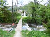 67
67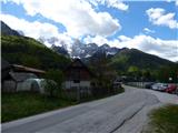 68
68
Discussion about the trip Gozd Martuljek - Hvadnik (Ferata Hvadnik)
|
| squirrel28. 07. 2020 |
This week second time on Hvadnik via ferrata. Super via ferrata, like in Narnia. Due to wet rocks it's harder than the blue Ferrata in Mojstrana, plus here on some sections you need quite some strength in your arms to pull yourself over the rock, especially at the beginning. For beginners I recommend not heading to the via ferrata after heavy rain, because the amount of water is much greater than in dry periods and the via ferrata is a bit harder because of that.
|
|
|
|
| Berstuk23. 10. 2020 |
My 11-year-old said after visiting Hvadnik that it was her best active day. The via ferrata is wonderful, especially on summer days, water in many places provides pleasant refreshment.
It is true though that caution is needed, as some parts can be quite slippery, especially if rain catches you, as it did my wife and me during a summer scouting trip 
Anyway, nothing serious, but it's good if at least one experienced person goes with beginners to advise and warn on certain sections 
|
|
|
|
| mk661312. 06. 2021 13:05:49 |
Today I lost my sports watch Xiaomi Band 5 on the ferrata, if anyone finds it, please let me know at mk6614@student.uni-lj.si
|
|
|
|
| balon16. 08. 2022 09:36:37 |
Hello,
I'm interested if access to the summit is possible also via some easy marked path. Part of the family is not into via ferrata and a circular path would suit us.
Thanks for the answer.
Alen&Kim
|
|
|
|
| natasacraine16. 08. 2022 09:52:09 |
Yes. You can go by road to Srednji vrh or through the forest - there is a marked path. After that via ferrata then down back to Martuljek. See pictures from 57 onwards 
Best regards,
NAtaša
|
|
|
|
| balon16. 08. 2022 10:09:09 |
oh NAtaša super, many thanks for the answer.
A&K& other part of family.
|
|
|
|
| balon16. 08. 2022 10:57:42 |
NAtaša, I'm looking for the starting point for the mentioned path to Srednji vrh to the junction where the via ferrata joins on the return for descent... but I can't find it at all. Maybe some advice, where to start the ascent to Srednji vrh so that we meet at picture no. 57 at the end?
Thanks,
Alen
|
|
|
|
| bongo16. 08. 2022 18:11:50 |
You start the ascent on the descent from the Hvadnik ferrata and close to or right before the entrance to the more difficult part, Jerm'n. Walk along the main road towards Srednja vas, about 200m from the parking lot on the right there are signs and the path. When you meet at the top, I recommend a 1-minute ascent to the Krniše hut (it's marked). Nice views of the Martuljek group and friendly service.
|
|
|
|
| balon17. 08. 2022 09:39:59 |
bongo, many thanks for the reply.
Alen
|
|
|
|
| balon5. 09. 2022 09:16:38 |
Bongo thanks once again. It was magical, the path found just as per the instructions.
Wonderful via ferrata.
|
|
|
|
| MinasTirith13. 05. 2023 21:25:05 |
Info if anyone is interested.
Today 13.5.2023 I was on the ferrata…although it was rainy, lots of water and slippery, the ferrata can be climbed without problems…100% concentration is needed and you use a bit more energy than in dry weather…the ferrata is excellently secured, I didn't notice any damage. Bravo to the managers.
|
|
|
|
| plaNinaPirsMajcen27. 06. 2025 21:24:17 |
Hi,
fixed protections are in good condition.
Video experience:
https://youtu.be/jyT6PUsUaJY?si=uQl46Rdz17UtnI1C
On this via ferrata, there's definitely no boredom. It offers the scenic beauty of the gorge, pleasant temperatures and wire bridges over the stream.
What makes it even harder in my opinion than it would technically be (grade B/C) is the slipperiness due to proximity to water and heavy traffic, meaning polished rocks and consequently less reliable and safe footholds.
Best, Nina
|
|
|
To post a comment you must log in:
If you do not yet have a username, you must first
register.