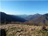
Grahovo ob Bači (Brelih) - Bukovski vrh (via Žrelo)
Starting point: Grahovo ob Bači (Brelih) (452 m)
Starting point Lat/Lon: 46.1557°N 13.8808°E 
Path name: via Žrelo
Time of walking: 1 h 40 min
Difficulty: easy unmarked way
Difficulty of skiing: no data
Altitude difference: 466 m
Altitude difference (by path): 475 m
Map:
Access to starting point:
We drive into Baška grapa or to the settlement Grahovo ob Bači, where we turn on a side road in the direction of Zakojca, Bukovo and a railway station. Next follows some descent, and after crossing the railway track, we go left towards Bukovo (right railway station Grahovo) and we start ascending. Next follows an ascent in few hairpin turns, when we get to a crossroad, where the road branches off sharply to the right to the near and from the road visible homestead Brelih, there is the beginning of the described path. We park on an appropriate place by the road about 200 meters ahead in the direction towards Bukovo, or already lower by the road.
To the starting point, we can get to also on foot from the railway station Grahovo, for that we need approximately 30 minutes.
Path description:
From the crossroad near the homestead Brelih, we continue on the road towards Bukovo (sharply right Bukovski vrh and Črvov vrh past the homestead Pušnik) and we are ascending diagonally. Further, we on the right side bypass few houses (few of them are a little below the road), and when on the right we notice few houses we are at homestead Pšeničnik, where we leave the road and we continue slightly right through the yard (possible also after the homestead right on a cart track). Above the houses we continue on a cart track which is ascending diagonally towards the left and at first leads on a panoramic slope, and before it passes into the forest it splits.
We continue on a slightly left, lower cart track which becomes steeper and poorly beaten and in parts muddy. After few minutes of a steeper ascent, we step on an asphalt road which we reach on the saddle Žrelo, and we continue right towards Ponikve (left Zakojca and Bukovo) and we start ascending towards the plateau Šentviška planota. After two hairpin turns we already get to the first houses in the settlement Bukovski Vrh, and after a smaller religious symbol we leave the asphalt road and we continue slightly right on steeper macadam road which soon turns right and it brings us to a garage.
At the garage we go left on a cart track which soon changes into a pleasant footpath, and in a gentle ascent it brings us back on an asphalt road. We follow the road to the right, and we walk there to a marked crossroad from which we continue right in the direction of Bukov gaj. Only a little further signs for Bukov gaj point us left, and we continue slightly right, and after few steps, we go once again right. Next follows few minutes of crossing and quite gentle road brings us to homestead Pri Pircu. Buildings at the homestead we bypass on the left side, and then we step on a grassy path which continues between grazing fences. When we reach an indistinct ridge, we continue by the grazing fence, which leads by the ridge and in few minutes of additional ascent, we reach panoramic Bukovski vrh.
Description and pictures refer to a condition in December 2019 and February 2020.
On the way: Žrelo (603m), Bukovski Vrh (830m)
Pictures:
 1
1 2
2 3
3 4
4 5
5 6
6 7
7 8
8 9
9 10
10 11
11 12
12 13
13 14
14 15
15 16
16 17
17 18
18 19
19 20
20 21
21 22
22 23
23 24
24 25
25 26
26 27
27 28
28 29
29 30
30 31
31 32
32 33
33 34
34 35
35 36
36 37
37 38
38 39
39 40
40 41
41