Horjul - Koreno (steep path)
Starting point: Horjul (340 m)
| Latitude/Longitude: | 46,02210°N 14,30110°E |
| |
Route name: steep path
Walking time: 1 h
Difficulty: easy marked way
Elevation gain: 389 m
Elevation difference along the route: 389 m
Map: Ljubljana - okolica 1:50.000
Recommended equipment (summer):
Recommended equipment (winter):
Views: 7.759
 | 1 person like this post |
Access to starting point:
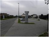
A) From the Ljubljana - Koper highway, take the Brezovica exit, then continue driving towards Dobrova pri Ljubljani. From Dobrova, continue towards Horjul, and drive along the regional road to the mentioned settlement, where you can park on the large parking lot in front of the Metrel factory (on the mentioned parking lot you can park only in the afternoon and at the end of the week, as it is intended for the company's employees). If you set out on the path during the week, find a suitable parking space nearby.
B) From the Koper - Ljubljana highway, take the Vrhnika exit, then continue driving towards Horjul. When you arrive in Horjul, at the intersection turn right towards Dobrova, then after 50 meters turn right into the parking lot in front of the Metrel factory (on the mentioned parking lot you can park only in the afternoon and at the end of the week, as it is intended for the company's employees). If you set out on the path during the week, find a suitable parking space nearby.
Route description:
From the starting point, we continue on the sidewalk (along the main road leading towards Vrzdenec), walking along it to the intersection, where signs for Koreno direct us right. We continue past the NOB monument, church and Center for the Elderly Horjul (DEOS) to the intersection, where the main road towards Koreno and Samotorica turns left, and we continue straight to the nearby chapel.
At the chapel, the road splits into three parts, and we choose the middle road, also indicated by signs for the steep path (the right road leads the gentle path to Koreno). The path ahead leads us past the hayrack, then brings us to the yard of a few nearby houses. We continue through the yard, then behind the houses left onto the cart track. We walk on the wide cart track only briefly, then signs for the old steep path direct us sharply right onto a grassy cart track, which brings us out of the forest onto the nearby pastures. Above the pasture, the path turns left and returns to the forest. There follows a short somewhat steeper ascent, and the path brings us below the power line, and at the power pole we continue left back into the forest. The path ahead ascends relatively steeply through the forest for some time, then we arrive at the hay meadows, where we first reach a wooden bench, and above it a cart track, along which we ascend transversely to the right. Before reaching the asphalt road, the cart track turns sharply left, then after a few more steps of walking brings us to the aforementioned asphalt road. We follow the mentioned road to the right, which quickly brings us to the place where the gentle path joins from the right.
We continue along the road, ascending with ever more beautiful views to the farm pr'Lenart.
From the mentioned farm, we continue left and ascend on the gentle asphalt road in 3 minutes of further walking to the church of St. Mohor on Koreno.

Photos:
 1
1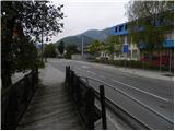 2
2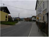 3
3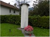 4
4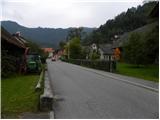 5
5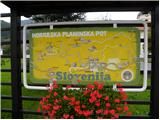 6
6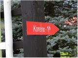 7
7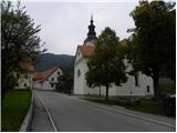 8
8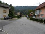 9
9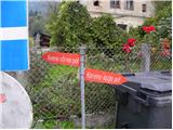 10
10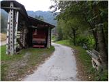 11
11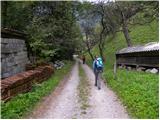 12
12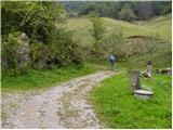 13
13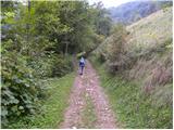 14
14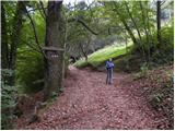 15
15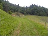 16
16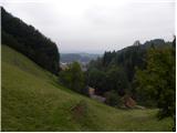 17
17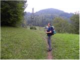 18
18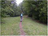 19
19 20
20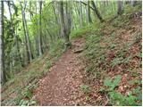 21
21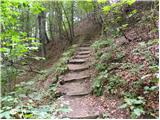 22
22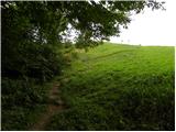 23
23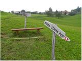 24
24 25
25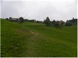 26
26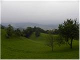 27
27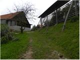 28
28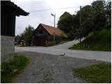 29
29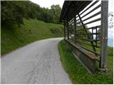 30
30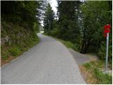 31
31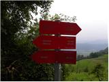 32
32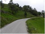 33
33 34
34 35
35 36
36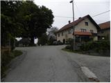 37
37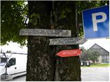 38
38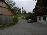 39
39 40
40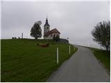 41
41 42
42 43
43 44
44
Discussion about the trip Horjul - Koreno (steep path)
To post a comment you must log in:
If you do not yet have a username, you must first
register.