Iverje - Kamniški vrh (by Potok)
Starting point: Iverje (458 m)
| Latitude/Longitude: | 46,2797°N 14,614°E |
| |
Route name: by Potok
Walking time: 2 h
Difficulty: partly demanding unmarked way
Elevation gain: 801 m
Elevation difference along the route: 801 m
Map: Kamniške in Savinjske Alpe 1:50.000
Recommended equipment (summer):
Recommended equipment (winter): ice axe, crampons
Views: 12.553
 | 2 people like this post |
Access to starting point:
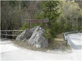
From Kamnik we drive towards Kamniška Bistrica. Soon at the beginning of the valley, immediately after the large quarry, we notice a big wooden sign, which marks the beginning of Koželjeva pot. The sign points left over the bridge. Behind it, by the macadam path, there are some parking spots.
Route description:
Here is described an unmarked path through the valley of Potok. The valley is squeezed between Grohat and Hudi Konci. Except the forest and the forest road there isn't anything in it. Even the stream Potok in dry periods likes to hide among stones. It should be added that on some maps Potok is wrongly marked with the name Grohat, which is otherwise the name of the hill.
Immediately behind the bridge the valley of Potok opens. At this spot there is a crossing of three mountain paths. Koželjeva pot goes on macadam by the right bank of the river towards the mountain hut Dom v Kamniški Bistrici. Left goes a forest path into the valley of Potok. Between them goes a steep uphill less noticeable footpath which leads through Hudi Konci to Kamniški vrh.
This time we turn left onto the forest road which all the time sticks to the riverbed, a few times goes from one bank to the other, several paths or forest cart tracks branch off in both directions but it isn't hard to follow the main road. At the end it is suitable only for tough tractors and worn-out mountain boots. The stream becomes a spring and when even that runs out it is time to turn left onto the cart track which goes along the neighbouring bank almost in the opposite direction. We could otherwise persist in the old direction and follow the small valley right into the head, but there awaits pathless terrain and a fairly steep slope. I have already tried this variant, but I cannot recommend it because it did not prove to be a useful shortcut. Better we go left onto the gentle forest path when Potok runs out.
The path is gentle and when it reaches the ridge it joins another forest road. Here we turn right and we are already on the marked path which goes from Stahovica to Kamniški vrh.
We leave the forest road at an indistinct saddle, just before the path turns downhill, we turn left uphill. The footpath is clearly visible. We must be aware that we are already in the narrower area of Kamniški vrh, where countless paths and tracks are interwoven. Take care to stay on the most trodden and only marked one. Soon we come to a junction marked with metal signposts. The right path is the shortest and the steepest. Unfortunately mountaineers and erosion have already damaged it so much that it is better to avoid it. Better to go straight on the smartly routed footpath across the steep south slope. It brings us right to the top of Roža on the saddle between Planjava and Kamniški vrh. We turn right uphill along the ridge and soon we are on the summit.

Photos:
 1
1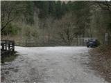 2
2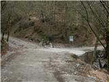 3
3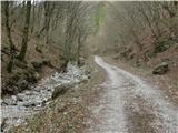 4
4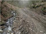 5
5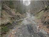 6
6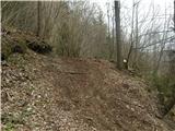 7
7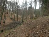 8
8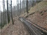 9
9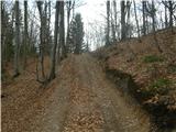 10
10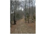 11
11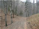 12
12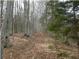 13
13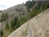 14
14 15
15 16
16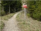 17
17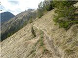 18
18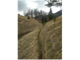 19
19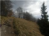 20
20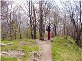 21
21 22
22
Discussion about the trip Iverje - Kamniški vrh (by Potok)
|
| andi223. 11. 2014 |
Used for descent, very nice comfortable variant. Need to watch to hit the junction (pic 10) to the unmarked pathlet - a bit beyond the goat track. And regarding floods - the path by the stream in the upper part is dangerous if raining, as the pathlet runs in a narrow torrent bed. Today instead of the spring a strong stream roared, partly flooding the path.
|
|
|
|
| anak13. 10. 2018 |
Very nice variant, we'll use it several times for descent if we go up via Hude konce...
The water mentioned in the previous comment was also flowing along the path in the upper part today, even though it hasn't rained for a long time.
|
|
|
|
| garmont15. 04. 2024 20:01:22 |
The path in the upper section along the Potok is completely destroyed and therefore very difficult to pass.
|
|
|
To post a comment you must log in:
If you do not yet have a username, you must first
register.