Starting point: Jeršiče (650 m)
Starting point Lat/Lon: 45.7748°N 14.2305°E 
Time of walking: 2 h 40 min
Difficulty: easy marked way
Difficulty of skiing: no data
Altitude difference: 456 m
Altitude difference (by path): 525 m
Map: Snežnik 1:50.000
Access to starting point:
A) From the highway Koper - Ljubljana, we take the exit Postojna, then we drive towards the center of Postojna. In the mentioned settlement, we will notice signs for Pečna reber and the railway station, which direct us to the right, then approximately 200 m before the railway station we turn left (the crossroad is not marked) onto the road that soon takes us over the highway. On the other side of the highway, we arrive at a crossroad, where the road to Stara vas branches off to the right, and we continue in the direction of Javornik and Sveta Trojica. A little further on, by the NOB monument, the road to Pečna reber branches off to the left, and we park here at a suitable spot.
B) From the highway Ljubljana - Koper, we take the exit Unec, then we continue driving towards Unec and Cerknica. In the settlement Unec, we leave the main road towards Cerknica and continue driving to the right in the direction of Postojna. We then drive on a somewhat narrower road that runs parallel to the highway. When, after a few kilometers through the underpass, we arrive on the other side of the highway, at the first crossroad we continue straight. When we return to the original side of the highway, at the crossroad we continue left, i.e., in the direction of Pečna reber and Sveta Trojica. When we soon arrive at the crossroad where the road to Pečna reber branches off to the left and the road to Sveta Trojica continues to the right, we will notice the NOB monument between both roads. We park at a suitable spot near the crossroad.
Path description:
The described path is officially closed until further notice, for safety reasons because it leads through a military polygon (10.4.2018)-
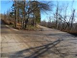
From the crossroad by the NOB monument, we continue on the lower right road in the direction of Javorniki and Sveta Trojica (left Pečna reber). A few steps ahead by the road, we notice a sign that we will continue the path on the forest road; we walk along it for only a minute or two, then we arrive at the next crossroad, where a somewhat ambiguous sign for Sveta Trojica directs us onto the lower right road. That we are on the right road is soon confirmed by the fairly frequent blazes along the path. The path ahead leads us gently downhill, meanwhile bypassing first a smaller abandoned structure, then behind a larger clearing where we continue straight, also a somewhat larger abandoned military structure. After the mentioned structure, the path enters a denser forest, which was severely damaged by ice at the beginning of 2014. The marked path, along which we also notice some signs for Sveta Trojica, gradually begins to ascend gently and takes us into the military area, where passage is forbidden and deadly dangerous during exercises. The road, which in the meantime has turned into a cart track, then leads us past a maintained wooden cottage; a little further, it begins to ascend transversely on a moderately steep slope. On a smaller clearing, the first views open up towards Nanos; a little further, when we step out of the forest onto a larger grassy slope, also towards the surrounding hills, including Sveta Trojica, whose summit we could already see during the ascent.
On the section where we step onto the mentioned grassy slope, we also notice signs that we have entered the target area (deadly dangerous), which is not hard to notice from the heavily damaged ground from grenades or other lethal munitions.
On this section, where a solitary birch stood at the time of the description, we encounter a larger orientation loop, as on a stone under tall grass we notice signs that from a nicely traceable little path direct us right downhill onto an initially barely visible little path that begins to descend towards the foot of the hill Poček (826 m). After some tens of meters of descent, we join a grassy cart track, along which we descend to a second, somewhat more rocky cart track, which we follow left downhill. There follows some more descent across extensive meadows adorned with numerous birches. When lower, by the indistinct pass Vratca, the path levels out completely, then at the crossroad where we reach a wider macadam road, we continue left, as indicated also by the arrow or blaze on the tree. Along the level road, in a few minutes we arrive at the next crossroad, where we continue on the right road in the direction of Sveta Trojica. The road, which begins to ascend moderately again, soon brings us to the hunting cottage Lovska koča Trešnja ravan, which is located a few steps to the left of the road.
We continue along the road to the next crossroad, where we go right; a few minutes further, at the next crossroad straight onto the marked cart track, which ascends somewhat more steeply. Higher up, at the turning area, we cross a second forest road, then along the still marked path we begin to ascend relatively steeply along a rocky cart track. After approximately 15 minutes, the steepness eases and the path brings us to the saddle between Lonica on the left and Sveta Trojica on the right.
Here we reach a poorer forest road, which we follow to the right, and along it with ever better views in a few minutes we ascend to the panoramic summit with the little church and panorama board.
The description and photos refer to the conditions in 2014 (December).
Pictures:
 1
1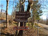 2
2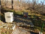 3
3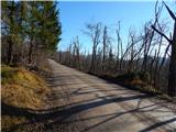 4
4 5
5 6
6 7
7 8
8 9
9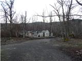 10
10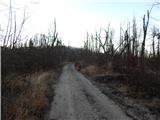 11
11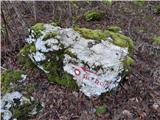 12
12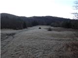 13
13 14
14 15
15 16
16 17
17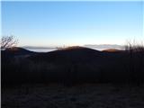 18
18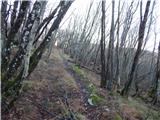 19
19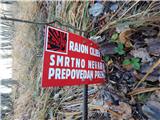 20
20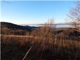 21
21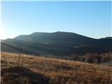 22
22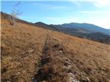 23
23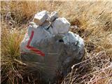 24
24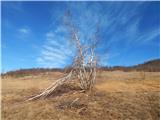 25
25 26
26 27
27 28
28 29
29 30
30 31
31 32
32 33
33 34
34 35
35 36
36 37
37 38
38 39
39 40
40 41
41 42
42 43
43 44
44 45
45 46
46 47
47 48
48 49
49 50
50 51
51 52
52 53
53 54
54 55
55 56
56 57
57 58
58 59
59 60
60 61
61 62
62 63
63 64
64 65
65 66
66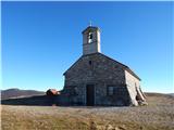 67
67 68
68