Starting point: Katarija (500 m)
| Latitude/Longitude: | 46,11890°N 14,74760°E |
| |
Walking time: 2 h 35 min
Difficulty: easy marked way
Elevation gain: 145 m
Elevation difference along the route: 450 m
Map: Ljubljana - okolica 1:50.000
Recommended equipment (summer):
Recommended equipment (winter):
Views: 13.068
 | 2 people like this post |
Access to starting point:
From the Ljubljana–Celje motorway, take the Krtina and Moravče exit. Follow the road ahead towards Moravče, where we turn right towards the village Ribče. The road towards Ribče first ascends then descends. When it starts ascending again, it brings us into the forest, where after some time a macadam road branches off to the right. We park on the parking lot by the road near the junction. The parking lot is located on the Moravče side.
From Litija we drive towards Ljubljana but only to the village Ribče. Here we turn right and follow the road ahead towards Moravče. The road then takes us over a 580 m saddle (to which we return on foot), after which the road starts descending. After a short descent we come to a junction, where we park on the parking lot by the road.
Route description:
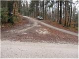
From the parking lot on the Moravče side of the road we continue up the asphalt road to the village Katarija, which we reach after a good five minutes of walking. Here we come to a junction, where we continue left in the direction of Slivna (right Miklavž, straight Ribče). The road soon after the village becomes macadam. We follow the road, which mostly gently ascends, to a larger meadow across which a power line runs. Right at the place where the road crosses the power line we leave it and turn left onto a footpath that gently ascends across the meadow. The path across the meadow brings us to the mountain hut in two minutes with nice views.
From the hut we continue in the direction of Zgornje Slivne (Pivkelj) along the path that soon brings us to a forest road. After a few minutes of walking from the hut the road brings us to a junction, where we continue along the lower road. Just a few dozen meters further we come to the next junction, where we continue right in the direction of GEOSS. The road, which moderately ascends, brings us after some time to Štance Laze (smaller hamlet). Just a little further the signs for Slivna direct us right onto a cart track. Further we walk along the cart track, which goes from the meadow into the forest. The cart track running through the forest has several forks so we carefully follow the blazes. After a few descents and ascents the path brings us to the next fork, where we continue right in the direction of Pivklja (Slivna). The path, which here ascends somewhat more steeply, brings us in five minutes from the fork to a vegetated summit.
From the summit we return back to the fork and continue right (straight in the direction of approach). After a few minutes' walk along the cart track we come to an asphalt road, where we continue right. The road along which we walk brings us to the hut at Slivna in a few minutes.
Just a few meters before the hut a path branches off to the left downwards to GEOSS. The descending path is marked but the start is not signposted. After a short descent we come to a chapel, where the path turns sharply right and then goes into the forest. After a few minutes of descent we come to a road which we immediately leave. We turn right downwards along the path, which brings us to the GEOSS point in a few minutes of descent. From this point to the stamping box and inn we have another 100 m of walking along the road.

Photos:
 1
1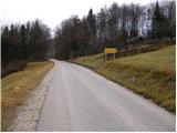 2
2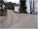 3
3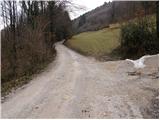 4
4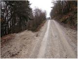 5
5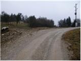 6
6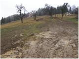 7
7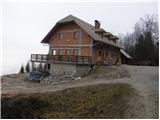 8
8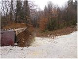 9
9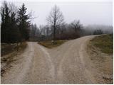 10
10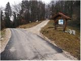 11
11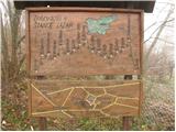 12
12 13
13 14
14 15
15 16
16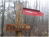 17
17 18
18 19
19 20
20 21
21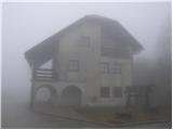 22
22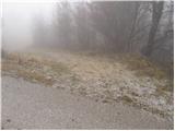 23
23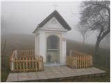 24
24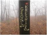 25
25 26
26 27
27 28
28 29
29 30
30
Discussion about the trip Katarija - GEOSS
|
| Kokta8. 01. 2012 |
The logbook in front of Gostilna Vrabec needs replacement, as do the stamps on the logbox, which are illegible. The GEOSS 644m stamp is located in the gostilna.
|
|
|
|
| Janiel744. 03. 2012 |
If I understand correctly, is Geoss 644m the only stamp that's useful here at all?
|
|
|
|
| Kokta4. 03. 2012 |
Yes, last time it was like that.
|
|
|
|
| sblnt19. 08. 2012 |
As for the stamp, it's still the same. We've been asking the mountaineering association in Litija for a stamp for the third year, but nothing. Let me also tell you that you can arrange hot meals at the Vrabec inn. Call 01 89 76 037.
LP!
|
|
|
|
| balon6. 06. 2014 |
Is the stamp located in the inn or in front of the Vrabec inn? We plan to start early on the trail, but the inn opens only at 12 o'clock. That's why I'm asking.
Thanks and best regards,
Balončki
|
|
|
|
| smatjaz7. 06. 2014 |
In front , it's already quite bad.
|
|
|
To post a comment you must log in:
If you do not yet have a username, you must first
register.