Starting point: Koča v Krnici (1113 m)
Time of walking: 6 h 30 min
Difficulty: very difficult marked way
Difficulty of skiing: no data
Altitude difference: 1488 m
Altitude difference (by path): 1488 m
Map: TNP 1:50.000
Access to starting point:
I drove along the road to Vršič and parked at Mihov dom (1085 m). From there I went on foot to Koča v Krnici and slept there (approx. 30 minutes of walking). Then in the morning I went from Koča v Krnici to Razor.
Path description:
Notification from 30.9.2013. The path to Razor is again open, but the route of part of the path from the saddle Planja towards the summit Razor has changed. The new path is technically more demanding and is very demanding (mandatory use of a self-belay set, helmet...).
From Koča v Krnici with a friend I started at 05:50 towards Kriška stena. The path slightly ascends and is interesting for walking, because on some parts it is necessary to jump from stone to stone (recently a part of the wall crumbled there). During the path we also saw a family of chamois, which was grazing on the left (eastern) side. To Kriška stena we needed 2 hours and 10 minutes. Then the "hellish" ascent on Kriška stena begins, where I felt quite a lot of fear, so I decided there that I would not descend back on this path.
We climbed Kriška stena in 50 minutes, after which we came to a completely different "planet". We needed another 25 minutes to the crossroad of paths for Razor, Vrh Kriške stene, Križ, Škrlatica, Krnica, Aljažev dom v Vratih, Bivak IV and Pogačnikov dom. At the crossroad we were lucky to meet a chamois, which stood only 10 meters from us, and did not get disturbed at all, although after a few minutes we started calling it too. It looked at us and continued grazing. We went on the path towards Pogačnikov dom, specifically on the path so that we had both Kriški lakes on the left side. After 1 hour of walking we came to the next crossroad in the immediate vicinity of Pogačnikov dom. Here we went right towards Razor (at the crossroad it was written that we had 2 more hours of walking). To the saddle Planja we needed 1 hour and 10 minutes. On the saddle there is also a crossroad, where on the way back to the starting point we also split. My friend had the courage to go back via Kriška stena, I did not. From the saddle to Razor we needed 35 minutes. So our path lasted 6 hours and 10 minutes, as we arrived at Razor at 12:00. From there we returned to the saddle Planja, where I went in the direction towards Vršič. The descent from Razor went over the saddle Planja in the direction of Vršič and thus reached a junction, where you can choose between two paths to Vršič. One is called "jubilejna pot" and the other "path over Kranjska planina". The jubilejna pot is longer and harder, as it goes over peaks on the way to Vršič (the highest is Prisojnik), but I decided to go via the path over Kranjska planina, which is easier and shorter time-wise. From Razor to this crossroad I needed 1 hour and 30 minutes. From this crossroad the path changes from high mountain to mid-mountain, so walking is mainly through green areas, and part is also secured with steel cables and pegs. Walking is likewise mainly at the same elevation (50 meters up - down). The path then starts to ascend steeply just before the crossroad and after 1 hour and 50 minutes I reached the crossroad of two paths that come from Prisojnik and the path that continues towards Vršič. So to Vršič I needed another 40 minutes. Thus for the path from Razor to Vršič I needed 4 hours.
On the way: Bovška vratica (2375m), Sedlo Planja (2349m), Gladki rob (1870m), Vršič (1611m)
Pictures:
 1
1 2
2 3
3 4
4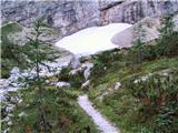 5
5 6
6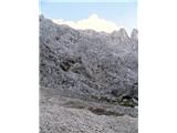 7
7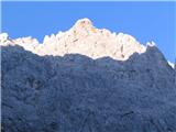 8
8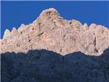 9
9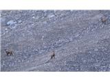 10
10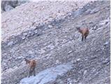 11
11 12
12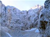 13
13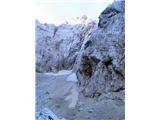 14
14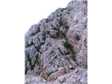 15
15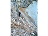 16
16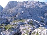 17
17 18
18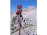 19
19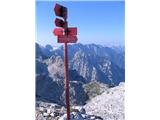 20
20 21
21 22
22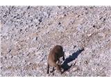 23
23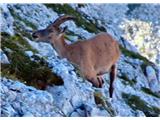 24
24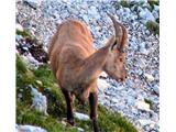 25
25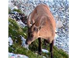 26
26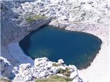 27
27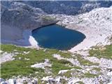 28
28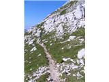 29
29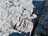 30
30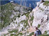 31
31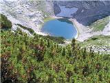 32
32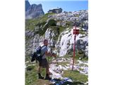 33
33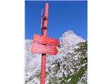 34
34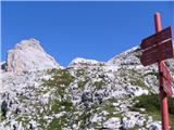 35
35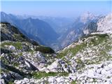 36
36 37
37 38
38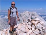 39
39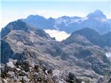 40
40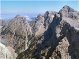 41
41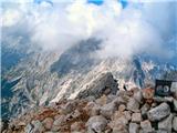 42
42 43
43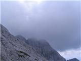 44
44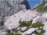 45
45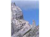 46
46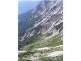 47
47 48
48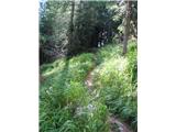 49
49 50
50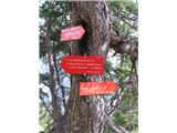 51
51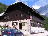 52
52