Starting point: Košnica (232 m)
Walking time: 1 h
Difficulty: easy marked way
Elevation gain: 377 m
Elevation difference along the route: 450 m
Map:
Recommended equipment (summer):
Recommended equipment (winter): crampons
Views: 6.885
 | 3 people like this post |
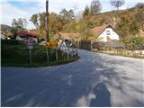
Access to starting point:
A) From Celje, we drive along the river Savinja towards Laško. After a few kilometers the road branches off right for Košnica and we park before the sign with the name of the settlement.
B) From Laško we drive along the river Savinja towards Celje and soon after the settlement Tremerje at the crossroads we go left for Košnica. We park near the sign with the name of the settlement.
Route description:
Practically directly beside the road Celje - Laško, at the crossroads we begin the ascent to Veliki Slomnik. The path runs along the eastern ridge and at the beginning it is quite steep up to the pylon of the power line. In this part there is also a woven wire/steel cable for grip. We continue past the hunting feeding site along a more distinct ridge path, which offers views at several places to the Savinja valley below. Further on, the path from the settlement Tremerje joins from the left side and a little further also from Košnica (another path from Košnica - from a higher starting point) from the right side. Here there is also a table with benches, and further a moderate ascent through diverse terrain to the summit Veliki Slomnik with a table, benches and register box. There are no views.
From Veliki Slomnik we can extend a few minutes to the excellent viewpoint Libojska stena.
The total length of the path is around 2700 meters, 450 positive elevation meters and 80 negative elevation meters.

Photos:
 1
1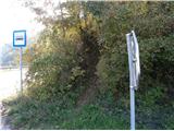 2
2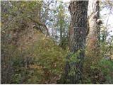 3
3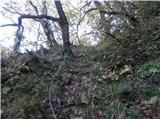 4
4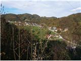 5
5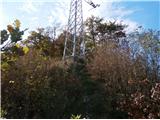 6
6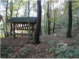 7
7 8
8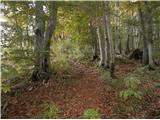 9
9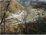 10
10 11
11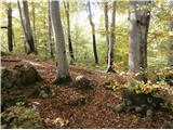 12
12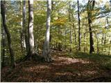 13
13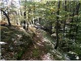 14
14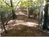 15
15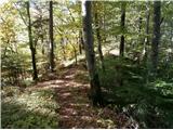 16
16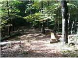 17
17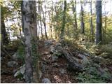 18
18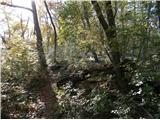 19
19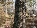 20
20
Discussion about the trip Košnica - Veliki Slomnik
|
| bruny15. 12. 2013 |
Within the framework of a circular hiking activity ascent along the described path although not foreseen in the original plan. It was pleasant and the colleague who joined me today rated the mentioned path as one of the more interesting in the broader range of paths along Sava and Savinja between (below) Celje and Ljubljana and I personally agree with the opinion. It was somewhat a play of sun, mists and falling needles from trees. Today experienced the path in a different light because the path description was created months ago during  descent from Veliki Slomnik and today on ascent ,,feeling,, completely different. descent from Veliki Slomnik and today on ascent ,,feeling,, completely different.
|
|
|
|
| minčamb30. 05. 2014 |
The path to Veliki Slomnik runs through a wonderful forest. On certain sections it is quite steep. Since there aren't many visitors, the path is not well-trodden. At the same time I ate blueberries and collected spruce tips.
|
|
|
|
| plaNinaPirsMajcen6. 03. 2025 19:34:38 |
https://youtu.be/ZxvKBUNNfOc?si=OTozejZA6ivWxrx7
Who is not filled with new vital forces by awakening nature?🌸
It is truly beautiful these days on the slopes of Veliki Slomnik.
We started in Košnica and walked along the forest ridge path, which is well marked with trail markers, to the summit and further to a viewpoint 10 minutes away, from which there is a nice view of Liboje.
Best regards, Nina
|
|
|
To post a comment you must log in:
If you do not yet have a username, you must first
register.