Krn - Mrzli vrh above Planina Pretovč
Starting point: Krn (900 m)
Time of walking: 1 h 30 min
Difficulty: easy marked way
Difficulty of skiing: no data
Altitude difference: 459 m
Altitude difference (by path): 480 m
Map: Julijske Alpe - zahodni del 1:50.000
Access to starting point:
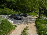
A) From the road Tolmin - Kobarid, a little before Idrsko, a road branches off to the right to the village Kamno. We head onto the mentioned road, then, when we arrive in the village, we follow the signs for Vrsno. From Vrsno, where Simon Gregorčič's birth house stands, we continue on a narrow and steep road to the village Krn, where the road splits into two parts. To the left the road continues towards the mountain pasture Kuhinja, and we continue straight towards Mrzli vrh. We park above the last houses in the village, where there is a nicely arranged small parking lot with space for 4 to 5 cars.
B) We drive to Kobarid, then continue driving towards Drežnica. Immediately after the bridge over the river Soča, we turn right in the direction of the villages Ladra, Smast, Libušnje, Vrsno and Krn. When we get to the village Krn, we continue straight (left to mountain pasture Kuhinja), and we continue following the narrow road to a small arranged parking lot, which is located above the last houses in the village.
Path description:
From the parking lot we continue along the road alongside which we parked, which already after a few steps splits into two parts. We continue straight in the direction of Mrzli vrh and continue the path on an initially still wide cart track, which gradually transitions into dense forest. Higher up, the signs for Pretovč, Mrzli vrh and Puščavnikova jama direct us left onto a wide ascending path, to which a less trodden path from the mountain pasture Kuhinja soon joins. The path soon turns right and then ascends transversely through the forest. A little further on, we arrive at Puščavnikova jama, which is only a few dozen steps' walk from the marked path.
We continue through occasionally somewhat sparser forest, and a moderately steep path leads us to a forest road, which we follow to the right. There follows a short descent along the road to a marked junction on a small saddle, where we continue right in the direction of Mrzli vrh. The path further leads us past an information board, behind which we soon arrive at the shepherd huts on the mountain pasture Pretovč.
From the mountain pasture Pretovč we continue on the marked path in the direction of Mrzli vrh. From the shepherd hut the path ascends along a panoramic grassy ridge, then a little higher it turns left, crossing a short rough slope. Further through low scrub and with nice views of the surroundings we quickly ascend to an old Austrian cavern, where there is today a nicely arranged small memorial park. If we have a flashlight with us, we can also view the interior of two caverns, in one of which there is also a well-preserved altar.
From the memorial park we continue left and ascend transversely through a belt of forest towards the left. When we step out of the forest, we cross a short somewhat steeper grassy slope, then the path turns right and brings us to the main ridge of Mrzli vrh, along which we ascend to the panoramic summit in a few minutes.
Starting point - mountain pasture Pretovč 1:00, mountain pasture Pretovč - Mrzli vrh 0:30.
Description and images refer to the state of May 2011.
Pictures:
 1
1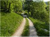 2
2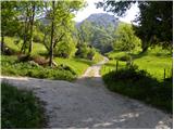 3
3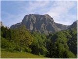 4
4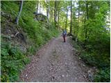 5
5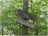 6
6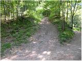 7
7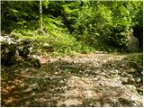 8
8 9
9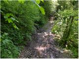 10
10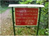 11
11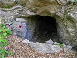 12
12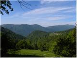 13
13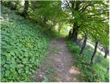 14
14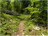 15
15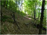 16
16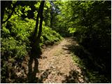 17
17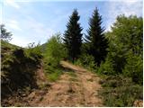 18
18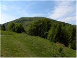 19
19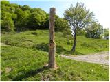 20
20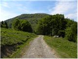 21
21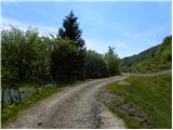 22
22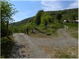 23
23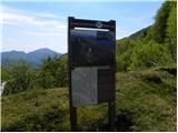 24
24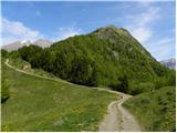 25
25 26
26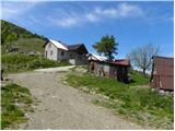 27
27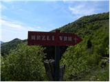 28
28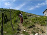 29
29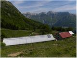 30
30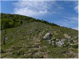 31
31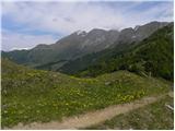 32
32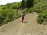 33
33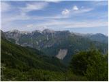 34
34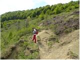 35
35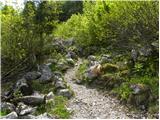 36
36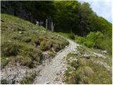 37
37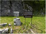 38
38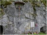 39
39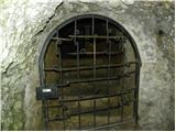 40
40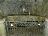 41
41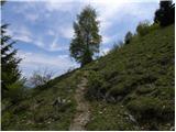 42
42 43
43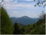 44
44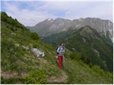 45
45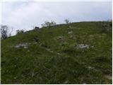 46
46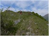 47
47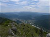 48
48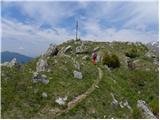 49
49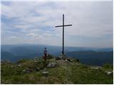 50
50 51
51